

CHILLY NIGHT AHEAD!
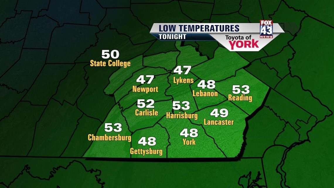
Cool, Canadian high pressure has settled in across the region, bringing a fall feel to the Lower Susquehanna River Valley, and it’s here to stay for a couple more days. Tonight, the clouds quickly break apart, allowing temperatures to quickly cool across the region. So cool, in fact, that some of us may have to go digging some heavier blankets out of the closet! Lows fall into the upper 40s to lower 50s, with some of our coolest spots in the middle 40s!
HIGH AND DRY FEW DAYS

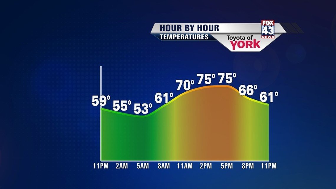
High pressure remains in control of the weather, bringing another sunshine-filled day to the region on Thursday. Expect less cloud cover than Wednesday. High temperatures are slightly warmer, and reach the middle to upper 70s. Fridays forecast calls for abundant sunshine. Highs hover around the 80 degree mark.
TURNING A BIT UNSETTLED
Some moisture down to our south begins to creep north on Saturday. The day stays dry, but it will be noticeably cloudier. Sunday a small chance for some showers creep in. Skies are mostly cloudy. A better chance for showers is Monday, but by Tuesday and Wednesday, the shower threat tapers. Highs sit in the lower 80s through the weekend, but begin warming Tuesday and Wednesday into the middle to upper 80s.
Have a great night!
-Andrea Michaels