
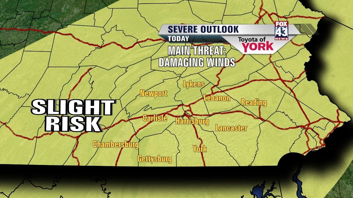
WARM & STORMY: We’re on day three of three of warm and stuffy air. After a day in the mid 90s yesterday, today we’re held in the mid to upper 80s. A cold front arrives tonight, and ahead of it today we can expect clouds to build with scattered showers and thunderstorms. The storms today will be potent with heavy rain, gusty winds, and small hail possible along with vivid lightning. Some storms could be severe, so be sure to stay alert through the afternoon and evening. The storms end late this evening, with cooling starting overnight as we drop to the low 60s.

FALL AIR RETURNS: Friday, we begin the day with some gusty winds and the new, fresh, comfortable air mass gets thrown into the state. Expect a northwest breeze around with 10-20mph winds during the day. Clouds will mix with sunshine and a stray sprinkle may make it in as the last of the energy slides away. We’ll hit the low 70s with the humidity long gone!

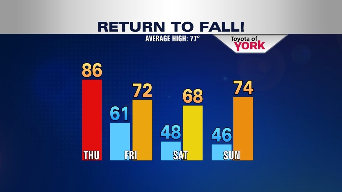
WEEKEND: Expect chilly mornings in the 40s and mild afternoons. Both days are filled with sunshine all day. Saturday we’ll be in the upper 60s as the cooler air settles in. Sunday, we warm to the middle 70s, still below average. Enjoy the great fall air!
NEXT WEEK: The tranquil pattern ensues with a reinforcing shot of cooler and drier air for Monday as a weak front slides through overnight Sunday into Monday. We remain sunny, mild and dry through midweek. A more potent storm system may arrive later in the week. We’ll keep an eye on it.
“If you want to test your memory, try to recall what you were worrying about one year ago today.” – E. Joseph Cossman
– Jeff Jumper, WPMT Fox43 Morning Meteorologist
Follow me on Twitter: @JeffJumperWX
Like me on Facebook: Jeff Jumper Fox43