

SMALL BUMP IN THE ROAD

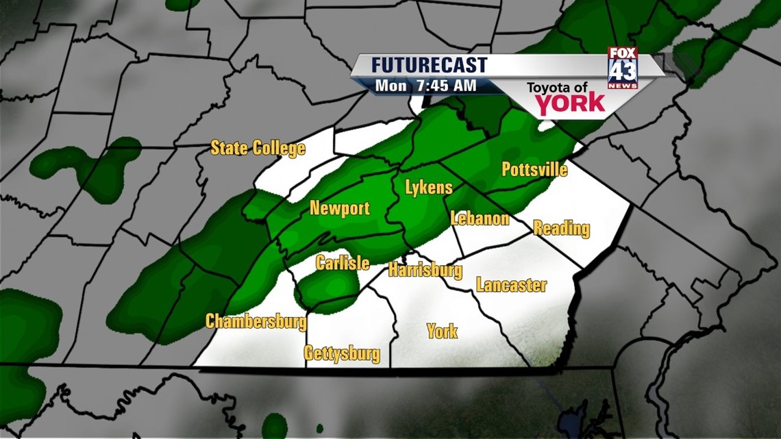
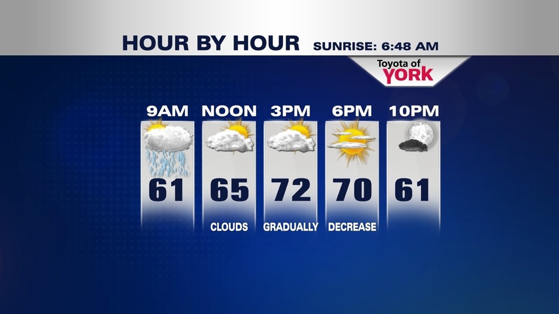
A cold front continues to advance this way, and it will slowly thicken clouds through the evening. Some light showers and sprinkles are possible late. Lows aren’t as chilly as the past couple of nights, and fall into the middle to upper 50s. During the morning, the front moves across the area, so clouds and sprinkles are expected to begin the new workweek. During the afternoon, skies clear as the front gradually passes through. Highs reach the lower to middle 70s depending on how quickly the clouds exit.
FALL FEEL CONTINUES
Tuesday remains sunny and fall-like again with another area of high pressure building in from Canada. High temperatures reach the upper 60s to lower 70s. Wednesday we warm up a bit. Clouds will build through the day, as a brewing storm system slowly heads our way. Highs reach the lower to middle 70s.
TURNING UNSETTLED
The frontal system continues to creep eastward through the rest of the week. Thursday is mainly dry with plenty of clouds. Friday, a chance for showers and thunderstorms presents itself with the passage of a warm front. Saturday is still unsettled as a cold front passes through. Temperatures hover in the upper 70s to 80 degree mark through week’s end. Sunday dries out, with highs still hovering in the middle to upper 70s.
Have a great week!
-Andrea Michaels