
Front pushed through this morning spreading showers across the area and slowing the morning commute. Clouds remained stubborn today keeping temps on the cooler side.
IMPROVING SKIES
Clouds will continue to break up heading through the evening and overnight as high pressure builds in. It will be much chillier overnight with lows dipping to the mid 40s.

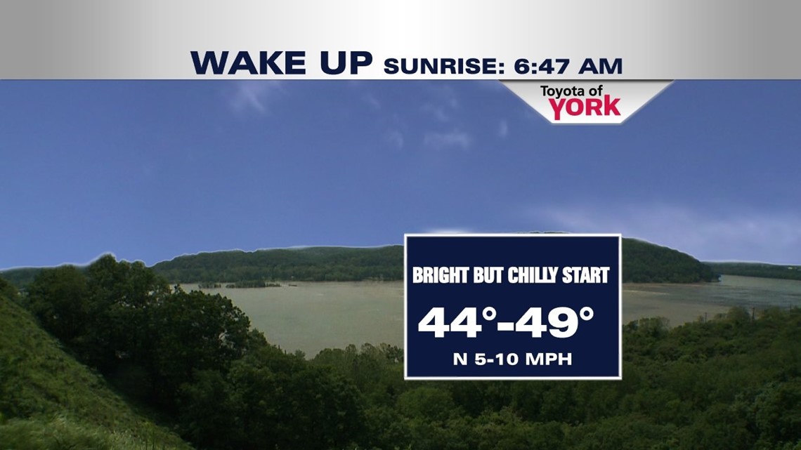
COOL START
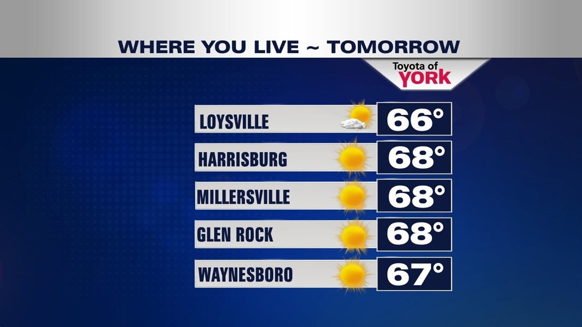
The next couple of days temperatures will remain below average despite sunny skies. Winds will be light as a broad area of high pressure parks over top of us. Highs will be cool tomorrow in the upper 60s.

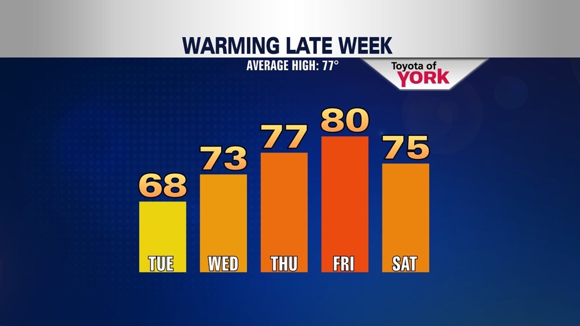
Another chilly start Wednesday but by afternoon, a light southwesterly flow develops and helps temperatures rebound into the lower 70s.
END OF THE WEEK WARMUP
We’ll see more clouds for Thursday mixing with sunshine but afternoon highs will be closer to average in the upper 70s.
Warm front pushes through very early Friday morning and will help push highs to near 80 Friday afternoon before a cooling trend returns late in the weekend into early next week.
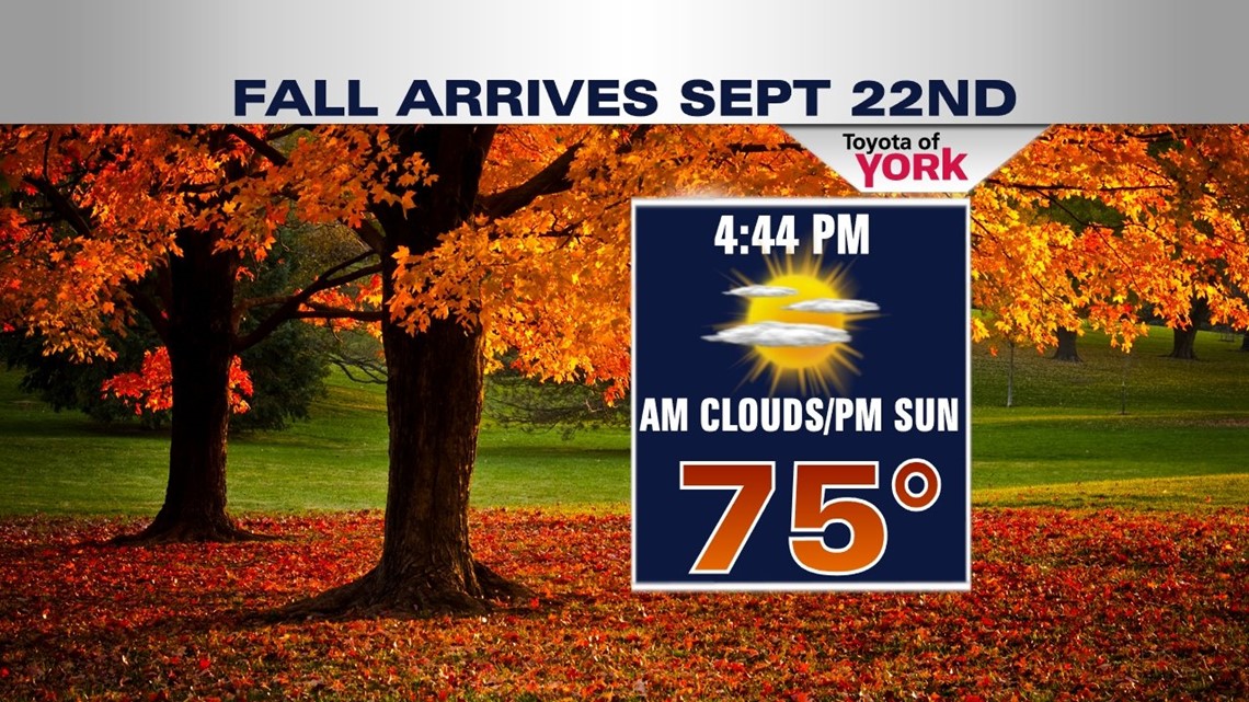
There could be a few showers Friday early in the morning but the best chance arrives Saturday as a cold front crosses the area. Scattered showers will be possible to start the weekend but the wet weather should be out of here for Sunday.

Fall official arrives Sunday and it should come in with temperatures close to average under mostly sunny skies.

MaryEllen Pann, Chief Meteorologist
Like me on Facebook: maryellenpannfox43
Follow me on Twitter: @MaryEllenFox43