

ON THE CLOUDIER SIDE
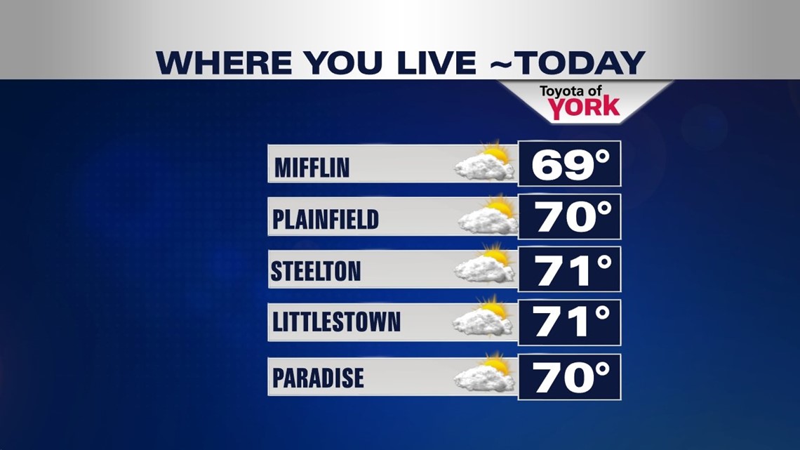
High pressure is inching back down from the north, and this helps keep us on the cloudier side, especially during the morning hours Friday. It keeps an east/northeasterly flow to begin the day. This creates a fairly cloudy start, with some foggy and misty spots likely too. Throughout the morning, clouds are fairly dominant, but sunshine begins working back in by the afternoon. Skies don’t completely clear out until the evening. It’s a more seasonable day, with highs in the upper 60s to lower 70s. Tonight, the chill works back into the region under clear skies. Temperatures dip into the upper 40s to lower 50s.
SUNSHINE & 70S

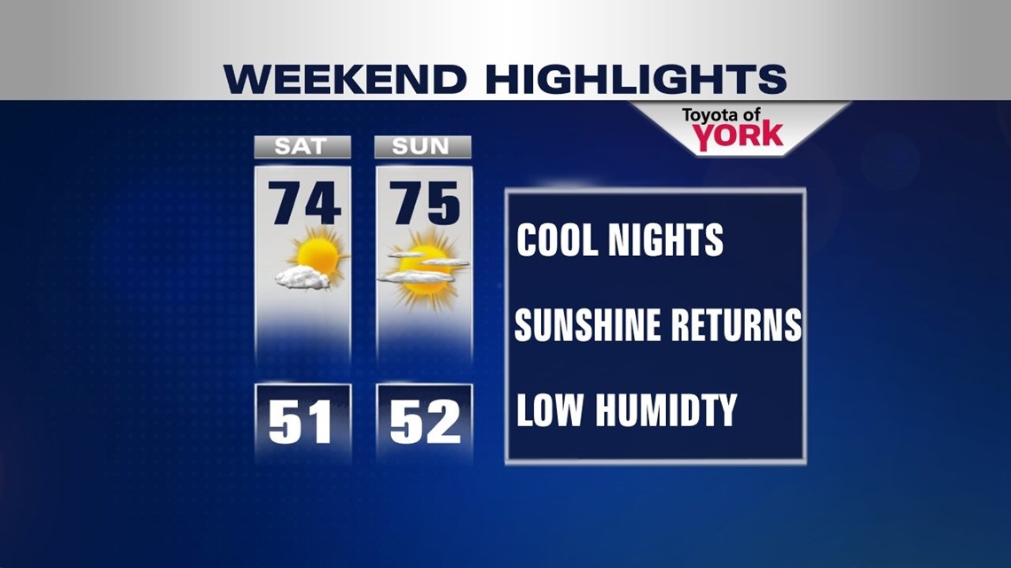
For the weekend, high pressure positions itself in a way that leads to plenty of sunshine. The weekend looks fantastic with abundant sun on Saturday. Highs reach the lower 70s. High pressure begins slipping to the northeast overnight Saturday. Sunday expect a few extra clouds to build in, but it’s still a nice day with highs in the lower to middle 70s. All outdoor fall plans look good to go! Enjoy it!
MORE OF THE SAME
A cold front from the west approaches Monday, but it will likely go through dry. Clouds increase during the afternoon with highs reaching the lower to middle 70s. A shower or two are possible late in the day through early Tuesday. An area of low pressure developing in the Atlantic could meander far enough west to slow down the front and keep some extra clouds around Tuesday. Either way, it looks dry with highs in the lower to middle 70s. Through Thursday, expect a mixture of clouds and sunshine to stick around. Highs remain in the middle 70s.
Have a great weekend!
-Andrea Michaels