
HEADING TO THE 80’s!
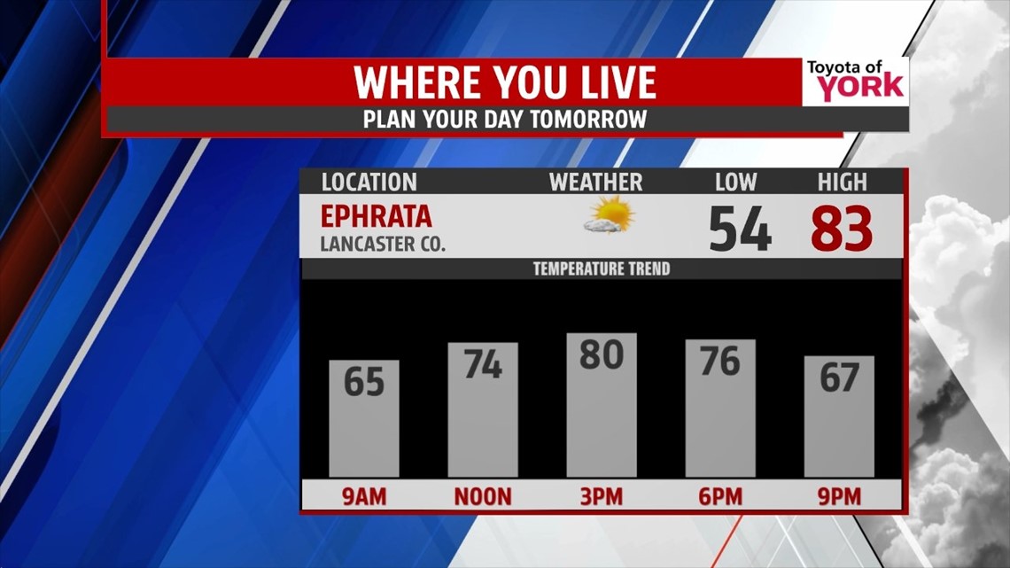
The first several days of October look to be very warm and well above average. Highs will top out at 80 degrees in many areas tomorrow through the weekend. Tonight, clouds will be decreasing and temperatures will be mild falling to the mid and upper 50s overnight.
SUNNY HUMP DAY
Plenty of sunshine for Wednesday and that will allow temperatures to warm into the low 80s. A weak front will approach late in the day but will not bring much change to the weather. In fact, temps remain warm and above normal for Thursday and the rest of the week as a strong ridge builds in aloft keeping summer like warmth around.

BEST RAIN CHANCE
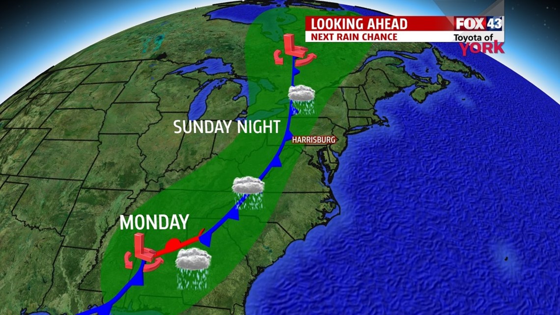
Next best opportunity for wet weather now starting to look like late Sunday with a chance for scattered showers and storms as a cold front swings eastward. Most of the day time hours looking to remain dry and warm. Showers looking possible now for Monday. There are indications that the front will stall along the coast and tropical moisture from the Gulf may be picked up by the front spreading much needed rain up the coast. Models are coming together on this scenario nicely but still too early to tell exactly what happens. Temperatures will finally cool off into the mid 70s but still average above normal for the month of October.

Have fun in the sun!
MaryEllen Pann, Chief Meteorologist
Like me on Facebook: maryellenpannfox43
Follow me on Twitter: @MaryEllenFox43