
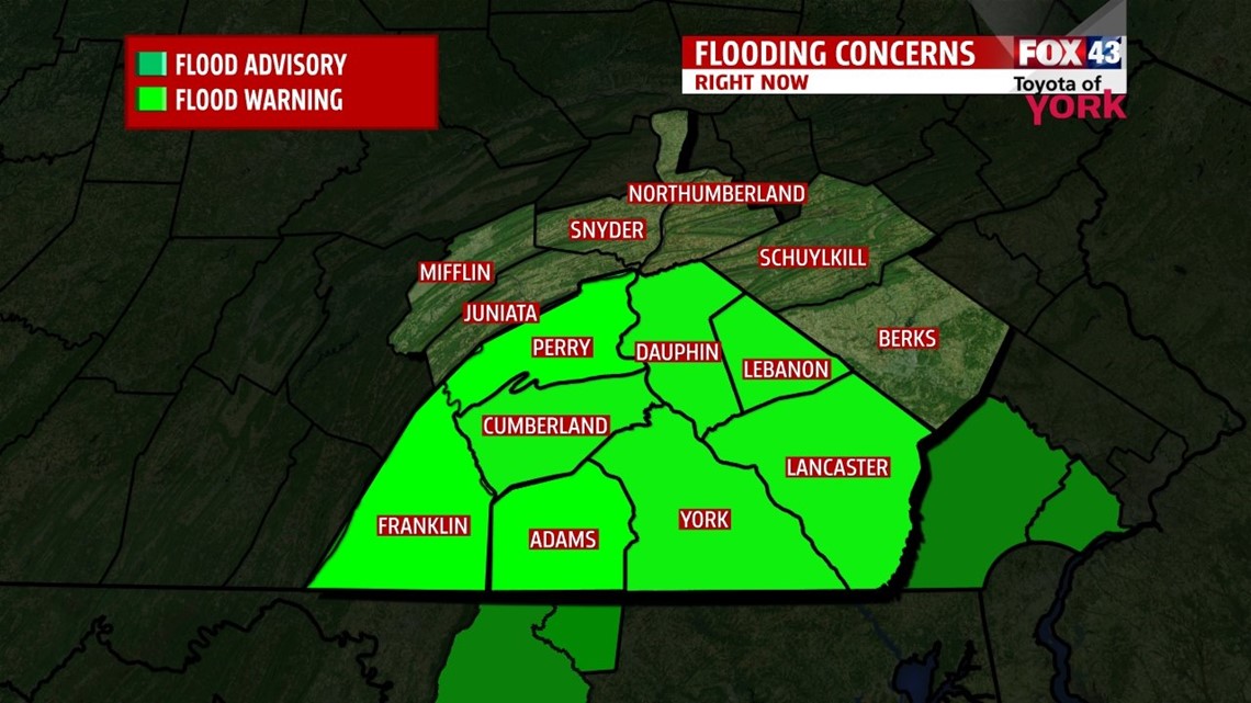
FLOOD WARNINGS continue overnight as area creeks are seeing minor flooding as well as many roadways. As the water levels recede, the warnings will be cancelled. Conditions should continue to improve through the overnight as the rain as eased up and most creeks will be cresting in the next hour or two before falling overnight.

Upper low and associated surface low near the Delmarva Peninsula continues to weaken and push out to the sea over the weekend.
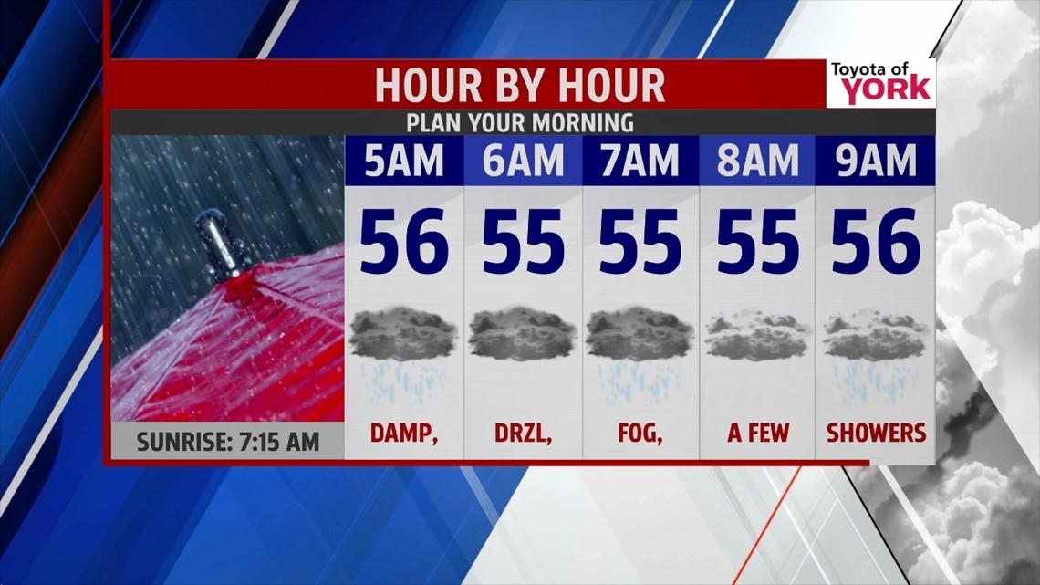
Rain has let up quite a bit across the area. Fog and drizzle likely overnight with just a chance for showers overnight into the morning. Lows will be mild in the mid 50s.

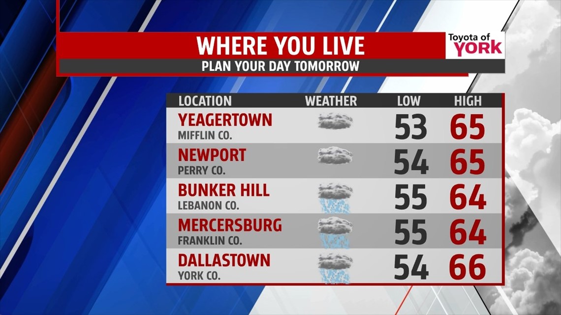
Tomorrow clouds will be stubborn for a good part of the day but some areas north may sneak a peak at late day sunshine. Highs will warm to the mid 60s some areas could top out in the upper 60s. A 40 to 50 percent chance for showers remains for the day but most areas look to remain dry.

Sunday, there is an isolated threat for a shower otherwise it will be mostly cloudy with more sunshine later in the day mixing in and out. Highs again warming into the mid to upper 60s.
Early next week, we’ll see dry weather to start the week and more sunshine. Highs around 70 or better.
Warming into Wednesday and Thursday before the next front arrives late Thursday into Friday.
Hope you can dry out quickly and enjoy the weekend!
MaryEllen Pann, Chief Meteorologist
Like me on Facebook: maryellenpannfox43
Follow me on Twitter: @MaryEllenFox43