

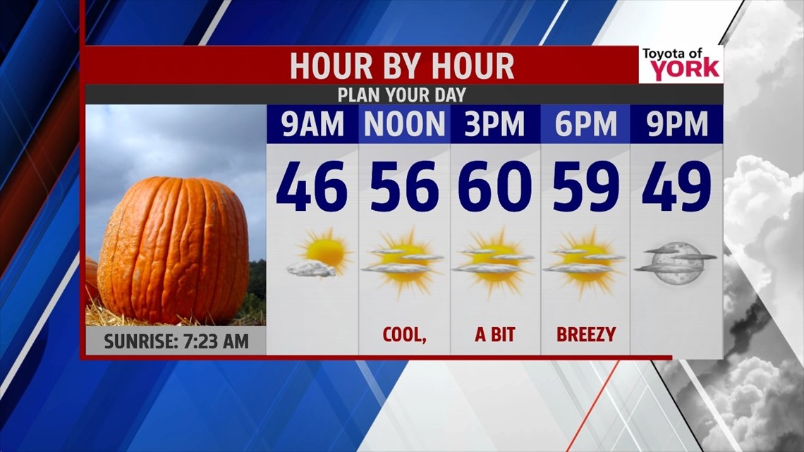
DRYING OUT FOR SUNDAY
A cold front continues to spread showers across the region this afternoon. Expect the showers to continue for most of the evening. Skies eventually dry out for most before midnight. Any lingering showers beyond that time quickly move out. The clouds also quickly decrease as the showers end. Cooler air rushes in behind the cold front. This allows temperatures to drop into the upper 30s to lower 40s. Mostly clear skies continue for Sunday. Only a few clouds move through during the afternoon hours. High temperatures reach the upper 50s to near 60 degrees.
STAYING SEASONABLE… FOR NOW

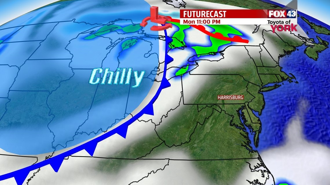
Monday is a bit warmer with lots of sunshine continuing. It’s a beautiful and seasonably warm day, with highs reach the lower to middle 60s after a chilly start in the upper 30s to lower 40s. Tuesday a potent cold front approaches from the northwest. It brings clouds and the chance for a shower or two until it passes through. Most will stay dry during the day. Highs are near 60 degrees, with cooler air rushing in late in the day and through the overnight period. It’s a sign of things to come for the end of the week.
BURST OF COLD AIR SETTLES IN
A burst of fall is on the way for the end of the week. Cold air in the wake of the cold front begins spilling into the Lower Susquehanna Valley Tuesday night. Highs are expected to only reach the 50s Wednesday through Saturday. A weak disturbance brushes across the region Wednesday. It will be a mainly cloudy day with some light showers possible. The cool air aloft allows plenty of clouds to bubble up Thursday and Friday, mainly during the afternoon. Some lake induced showers are likely, mainly for the northwestern parts of the area. Plenty of sunshine finally returns for Saturday. Chilly nights are expected as well. Lows will be in the middle to upper 30s Thursday and Friday morning. At this time, Saturday morning looks to be the chilliest. Low temperatures could flirt with the freezing mark. Agricultural interests will needs to keep an eye on the forecast for potential frosts and/or freezes for parts of the region those mornings. Stay tuned!
Enjoy the rest of your weekend!
-Andrea Michaels