
Overnight, clouds will be returning keeping temperatures from getting as cold as last night. Areas of fog is likely and those of you along the MD/PA border, you may encounter a few isolated showers early morning because of a weak upper level disturbance passing by to our south. Expect lows in the upper 30s to low 40s.
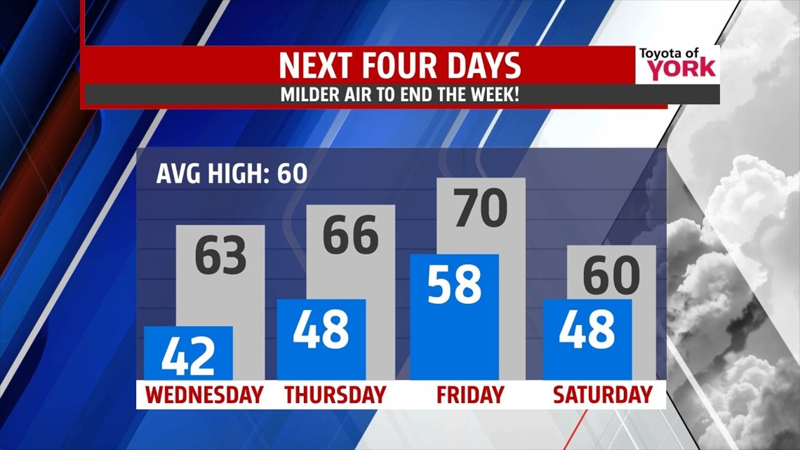
MILDER DAYS AHEAD
Starting with clouds early but they should thin out some by afternoon allowing for more sunshine. Temperatures will be able to warm nicely into the low 60s. Warm front pushes northward tomorrow into Thursday. It may trigger a shower early in the morning Thursday but the best chance for showers will be late night Thursday into Friday as a cold front sweeps across the area. Highs Thursday will be warm in the mid 60s.

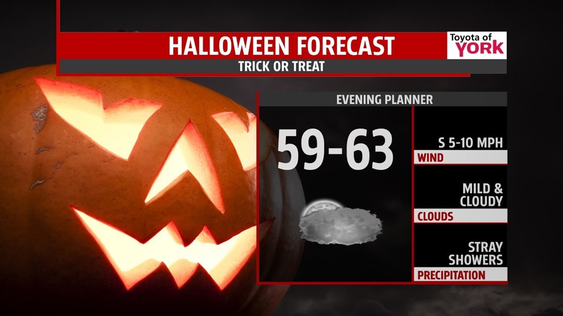
HALLOWEEN FORECAST
Only an isolated threat for showers for trick-or-treaters during the evening, but it does look as if many will remain dry for now. Best chance will hold off until after midnight. It will be mild with temperatures near 60 degrees.

70 for FRIDAY?
Cold front will cross early producing a few showers and clouds to start the day. Morning lows will be mild in the upper 50s. The cold air will be slow to arrive so with sunshine and a milder start, temperatures have a good chance of hitting 70 in some places! It will be short lived as an upper level trof swings in for the weekend.
WEEKEND OUTLOOK
Seasonal start Saturday with highs near 60 under partly sunny skies. Clouds will clear and high pressure builds in at the surface by Sunday allowing for a colder start in the upper 30s. Highs will be held in the low 50s. Another cold one Monday with morning lows near freezing and highs a few degrees below average in the low to mid 50s.
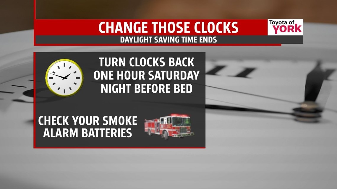
DAYLIGHT SAVING TIME ENDS
Saturday into Sunday don’t forget to turn your clocks back one hour before heading to bed. Also, it is a good time to check the batteries in your smoke detectors and carbon monoxide detectors.

MaryEllen Pann, Chief Meteorologist
Like me on Facebook: maryellenpannfox43
Follow me on Twitter: @MaryEllenFox43