

GUSTY AND UNSETTLED NIGHT AHEAD

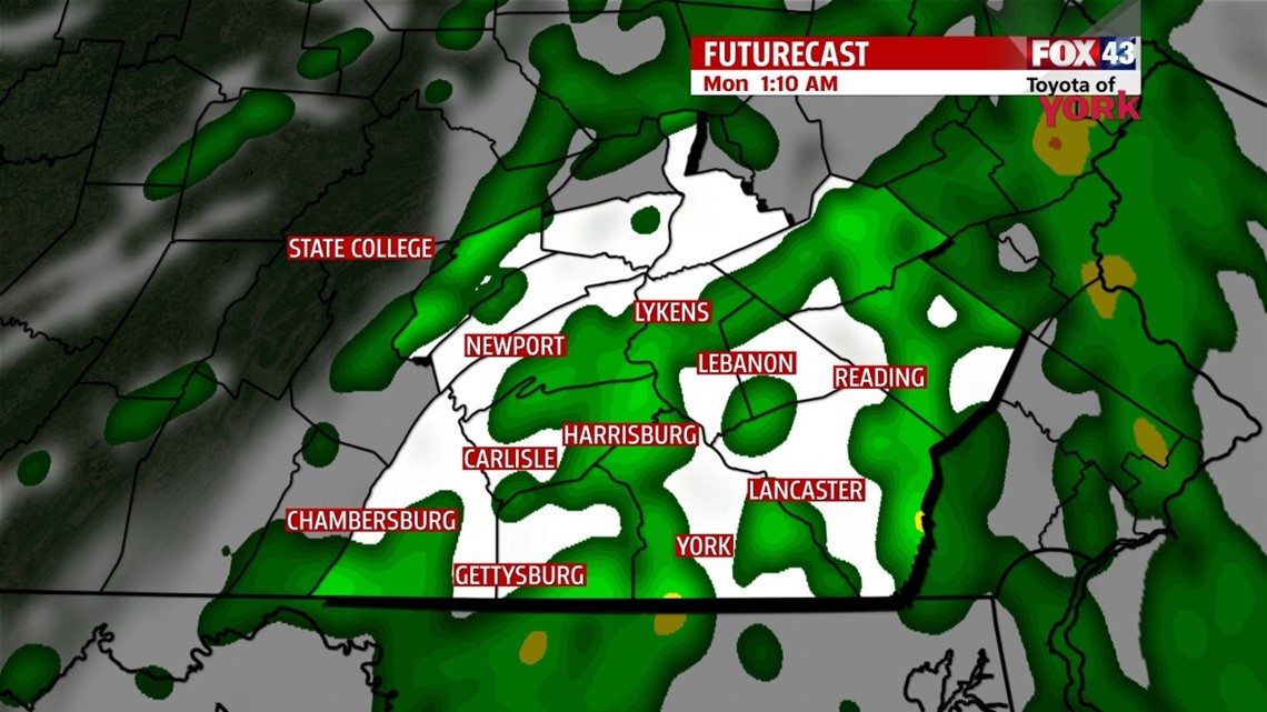
A cold front continues to race across the Midwest this evening, bringing severe storms to those parts. Fortunately for us, it looks as though the storms will weaken significantly before reaching us. For the most part, this is not a major threat for us. However, as the evening progresses, we cannot rule out a few strong storms completely, especially in our western parts through the overnight. The main threat for us is damaging winds with any storms that are able to maintain severe criteria. Winds are still going to be very gusty through the night, so even if storms do not maintain severe criteria before reaching the Lower Susquehanna Valley, we are still in for some strong breezes. Heavy rainfall is also likely with the developing line of storms as it moved this way. The timing is midnight to 4 A.M. for our region. Once the line passes through, skies overall dry out with a little bit of clearing. A few showers linger, but that’s about it. Lows drop into the upper 40s to lower 50s.
COOLING BACK DOWN
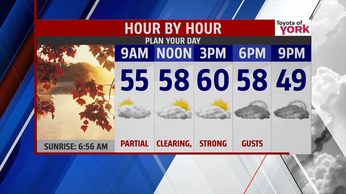
The cold front clears the area Monday morning, so a few showers could still linger into that timeframe, mainly east. The afternoon brings drying and even some clearing. It’s another mild and breezy day, with highs in the upper 50s to near 60 degrees. Tuesday, a cold air mass behind the cold front slides in, and temperatures only make it into the 40s. A mixture of clouds and sunshine is expected. It stays cool Wednesday, with temperatures in the middle 40s and plenty of sunshine. Expect chilly mornings too, with lows in the 20s Wednesday and Thursday morning.
MORE SHOWER CHANCE
Our next storm system increase clouds Thursday, but we should stay dry. Temperatures continue to moderate, with highs near 50 degrees. Friday and Saturday expect the chance for showers, with the better chance on Saturday. Highs reach the lower 50s. Sunday a cold shot of air quickly moves in, bubbling up clouds and possible triggering some lake effect snow showers. Highs could be contained in the 30s if models continue to keep this air mass potent.
Have a great week!
-Andrea Michaels