
COLD START: A frigid, near record morning gives way to a cold Monday afternoon. Highs today hit the middle 30s, well below average. Our next storm system is gathering itself today to our south, so it’ll throw some clouds in thickening through the day into the evening. It’s a dry day though. Tonight, we’re cloudy and lows hit the upper 20s before holding steady.
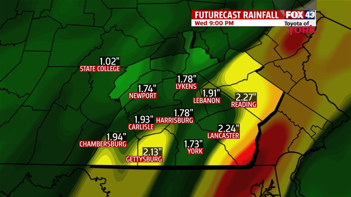
TUESDAY/WEDNESDAY STORM: A very strong low pressure will quickly race northward from the Gulf of Mexico today along the eastern seaboard and into New England by Wednesday night. This will bring us some healthy, heavy, cold rain form the most part, but we could begin as some light snow and end as some snow showers. Let’s time it out.

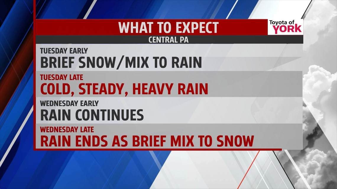
Light snow may slip in from the south early on Tuesday in the morning hours. This will quickly turn to rain as a warmer core of air rides north with the low pressure system. The rain will be heavy at times, especially late Tuesday into overnight Wednesday. Wednesday morning, the rain starts to back off, but we’ll stay wet. As the low races north, colder air fills in on the back side. This could catch up to the precip, ending as some snow showers. We’re expecting mainly rain, but the northwestern mountains of our area could see some light accumulations.

If you’re traveling Wednesday to the mountains of western PA or into north wand western New York, those spots will likely be dealing with some reasonable snowfall amounts and even some icing. This will make for slick roads with reduced visibilities early Wednesday so stay safe and plan out your travel to avoid the worst of it.

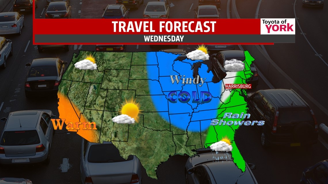

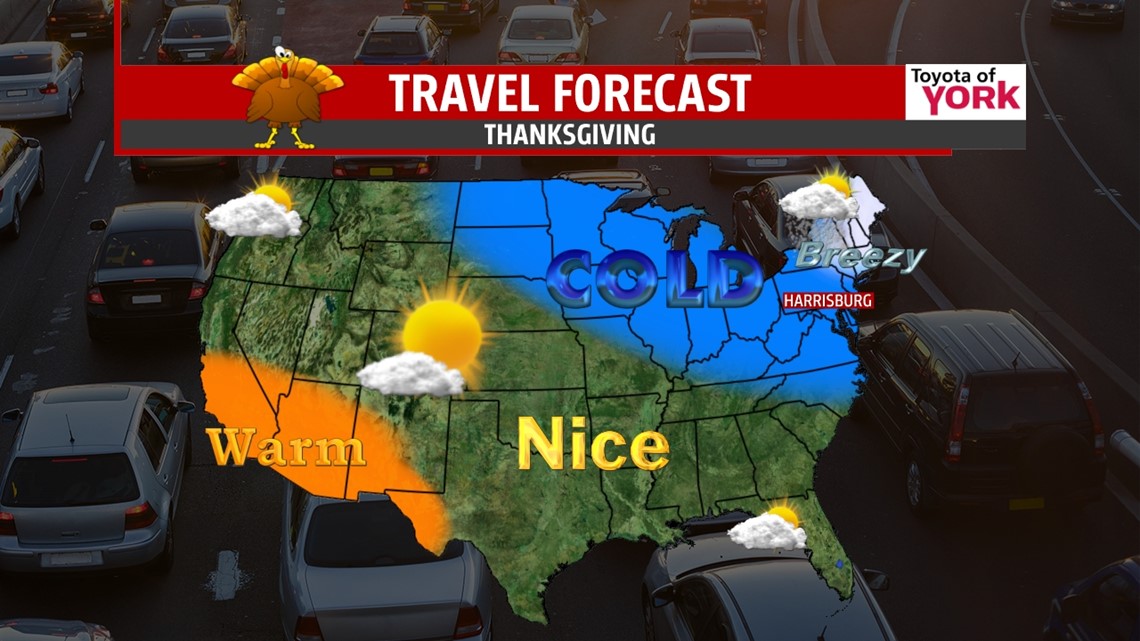
THANKSGIVING AND BEYOND: Cold air spills in late Wednesday as the precip pulls away. It will be breezy Wednesday into Thursday too. We start in the mid 20s on Thanksgiving, with sun increasing through the day and highs topping out near freezing! Overnight for those shopping, temps will be in the teens and low 20s! Friday, we only warm to the middle 30s with less of a breeze and a good amount of sunshine. The weekend looks chilly and dry with highs in the low 40s.
Have an awesome Monday and enjoy the shortened work week if you get to!
“Don’t let the fear of losing be greater than the excitement of winning.” – Robert Kiyosaki
– Jeff Jumper, WPMT FOX43 Morning Meteorologist
Follow me on Twitter: @JeffJumperWX
Like me on Facebook: Jeff Jumper FOX43