

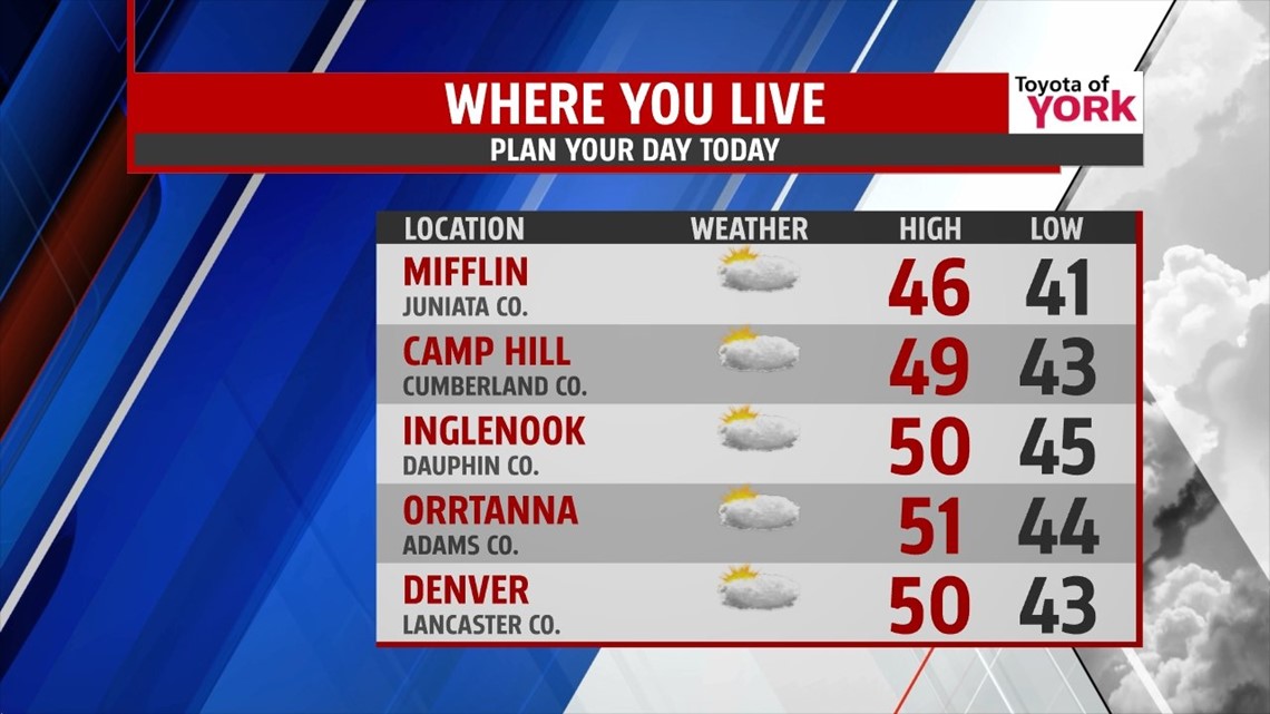
LIMITED SUNSHINE
A westerly flow continues to shoot clouds our way, and that trend continues for Wednesday. It’s a misty, foggy, and chilly start with temperatures in the upper 20s to lower 30s. Eventually, the cloudiness breaks through the morning. This allows for some intervals of sunshine to sneak in during the afternoon, but there will still be a fair amount of clouds. Highs are mild again, ranging from the middle 40s to near 50 degrees. Foggy conditions return again tonight, along with the chance for a few light showers. Lows are mild, staying in the 40s across the region.
SHOWERS RETURN

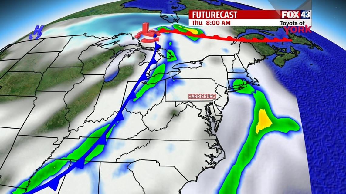
A slow moving cold front approaches the region Thursday. Clouds remain abundant, and a shower chance works in during the afternoon hours. With a strong southwesterly flow setting up, high temperatures reach the middle to upper 50s. Some 60 degree readings are not out of the question. The front slows down Friday, meaning the rain sticks around. Temperatures gradually drop through the 50s and 40s through the day as the front takes its time exiting.
COOLING DOWN AGAIN
We clear out Saturday once the front finally sinks far enough to our south. Colder air is back behind it for the weekend. Highs Saturday are near 40 degrees. Sunday clouds return again with the approach of our next system. Highs will be in the lower to middle 30s. As temperatures drop through the evening, we could get a wintry mix as precipitation begins to enter the region. It turns to rain overnight, and the rain hangs around for much of Monday. Tuesday skies should dry out.
Have a great Wednesday!
-Andrea Michaels