

FOG TO SHOWERS

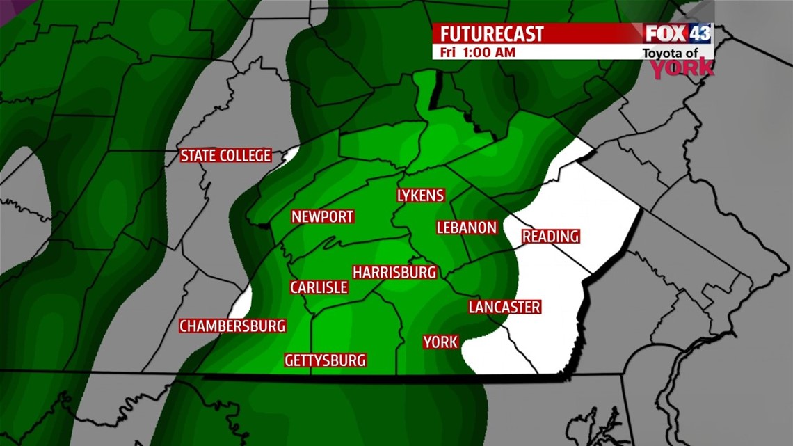
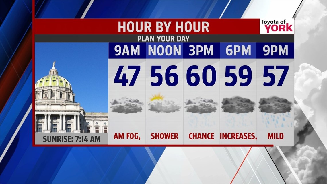
It’s another foggy, misty start to the morning. Be prepared for localized areas of dense fog that will slow down travel through the morning. It’s one of those days where an extra 10 to 15 minutes of travel time is a good idea. Temps are mild through the morning, hovering in the upper 40s to lower 50s. A slow moving cold front approaches through the afternoon. Clouds remain abundant, and a shower chance works in slowly during the afternoon hours from northwest to southeast. With a strong southwesterly flow setting up, high temperatures reach the middle to upper 50s. Some lower 60s are likely too with the strong flow. Tonight the showers continue, with foggy conditions yet again in spots. Highs for Friday occur after midnight, with temperatures dropping through the morning as the cold front slowly drags along. This means the rain also sticks around through the day. As the precipitation wrap up Friday night, there could be a few light snow showers across parts of the area, but nothing that looks significant at this time.
50/50 WEEKEND
We clear out Saturday once the front finally sinks far enough to our south. Colder air is back. Highs Saturday are near 40 degrees. Sunday clouds return again with the approach of our next system. Highs will be in the lower 30s. As precipitation approaches the region with slowly rising temperatures during the afternoon, we’ll likely see a wintry mix through the evening. Precipitation would begin as snow, with light accumulations possible, then transition to sleet and freezing rain, and then turn to all rain after midnight. Keep an eye on the forecast, because Sunday afternoon and evening travel will likely be tricky. The rain hangs around for much of Monday, with highs near 40.
FRIGID BLAST
Tuesday skies should clear out, and a cold air mass begins to settle in. Highs are near 30 degrees on Tuesday. A powerful arctic front pushes through into Wednesday, bringing a blast of cold air. Lake effect flurries and snow showers are likely. Highs will be in the 20s, and Wednesday morning lows are in the teens!
Have a great Thursday!
-Andrea Michaels