

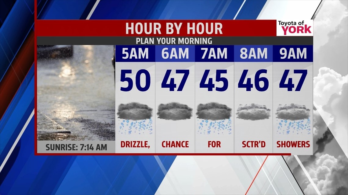
Temps will be mild until a cold front crosses through late tonight, at which time, they will start to drop slowly through the morning. So while our high will take place after midnight in the 50s, by morning, temperatures will be in the mid to upper 40s, continuing to drop from there. Fog and drizzle along with scattered showers will be around for the morning commute.
WET AND TURNING COLDER
We’ll end the week with periods of rain Friday. Areas of low pressure will ride the front which looks to stall across the area, keeping things pretty wet mainly in the afternoon and evening. As temps reach the 30s in the evening and rain starts to taper off, areas north and west of Harrisburg, will see rain briefly turn to snow but with most of the moisture out of the area, no accumulations are likely at this point.

WEEKEND OUTLOOK
High pressure builds in for Saturday bringing some sunshine back but temperatures will be colder as an upper level trough settles in overhead. Highs will be chilly in the upper 30s under partly cloudy skies. The next storm system is starting to get our attention as it could bring snow and a wintry mix Sunday afternoon and evening. It will be cold as high pressure is situated to our north reinforcing the chill. As of now, snow showers will start in the afternoon and continue for a period allowing for minor accumulations but as warmer air rides in, it may change to freezing rain and sleet as surface temps stay stubborn below freezing. Eventually enough warm air pushes in at the lower levels warming us above freezing changing the precipitation to all rain overnight into Monday. Question right now will be when will the change happen and how much snow and ice will accumulate before the changeover? We could be dealing with an icy mix late Sunday for several hours so we’ll have to watch this system closely in the upcoming days.
Monday temperatures will be mild enough for rain showers and they will be possible through the day but colder air returns by Tuesday. In fact, an Arctic blast will bring our temperatures back to the 20s and 30s with overnight lows even dipping to the teens.
We’ll keep you up to date during our newscast as well as through social media of the upcoming weather so be sure to follow us!
MaryEllen Pann, Chief Meteorologist
Like me on Facebook: maryellenpannfox43
Follow me on Twitter: @MaryEllenFox43