

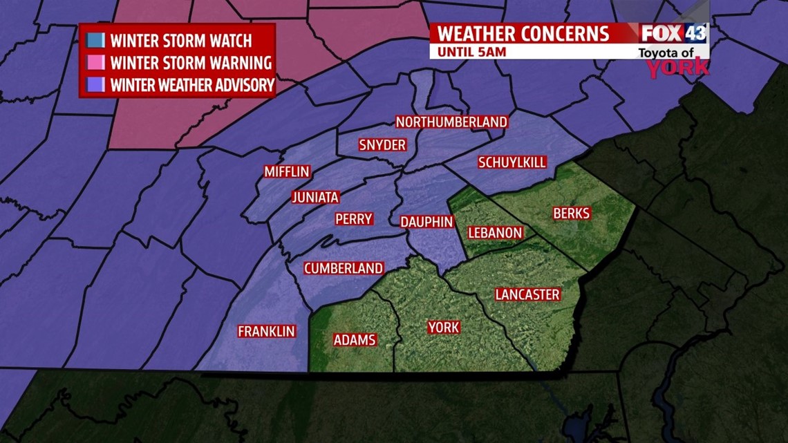
Temperatures will continue to fall this evening to the 30s by ten. Rain will be likely for several hours but as temperatures fall, we’ll see the precipitation changing to snow and a wintry mix. Areas north and west, of Harrisburg, a Winter Weather Advisory is in effect until 5am Saturday, because of the potential for light accumulations of snow and wintry mix. South and east precipitation should remain plain rain but at the very end of the event, mix or change briefly to a mix. With temps expected to drop at or below freezing, black ice may be concern tonight as wet roads and surfaces will freeze. Slick conditions will be very possible into the early morning hours of Saturday. Overnight lows will dip anywhere from 29 to 33 degrees.
QUIET START
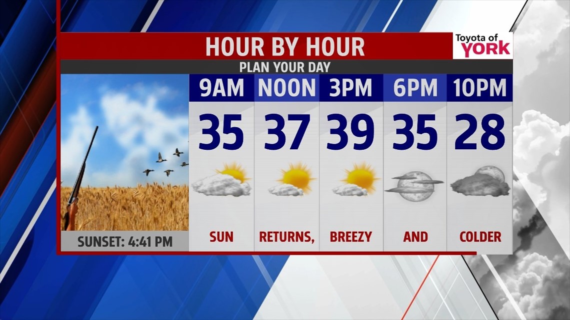
Strong area of high pressure migrates our way from the Upper Midwest for tomorrow. Morning clouds will part giving way to sunshine. Temperatures will be cold in the 30s and a breeze out of the northwest 10 to 15 mph will add to the chill.


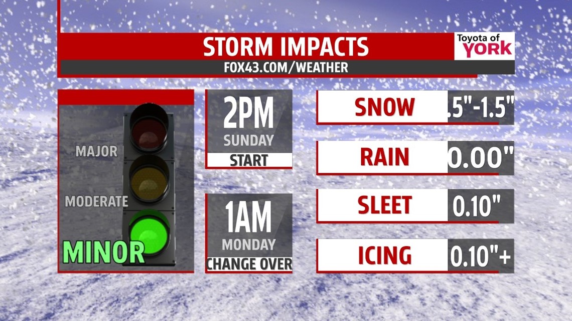
Morning lows Sunday will run in the low to mid 20s. Highs will be slow to climb to the freezing mark. With cold air at the surface and a storm system out of the southwest expected to bring in warmer air aloft, we could see a period of freezing rain. The main low should lift northward to the Ohio Valley, while another low develops along the Virginia coastline and track north-northeast just offshore.
A strong southwest flow in the upper levels warms things up but surface temps remain at or below freezing for much of the afternoon and evening hours resulting in a period of frozen precipitation for the area. It looks like temperatures will warm up in the early morning hours of Monday changing wintry mix to plain rain.
THIS WILL BE CONSTANTLY CHANGING SITUATION AND WE’LL KEEP YOU POSTED WITH UPDATED TOTALS, WATCHES AND WARNINGS.
Minor accumulations of snow followed by a significant coating of ice for parts of the area late Sunday is possible.
ARCTIC MID WEEK BLAST
Monday temperatures will be mild enough for rain showers and they will be possible through the day but colder air returns by Tuesday. In fact, an Arctic blast will bring our temperatures back to the 20s with overnight lows dipping to the teens.
We’ll keep you up to date during our newscast as well as through social media of the upcoming weather so be sure to follow us!
MaryEllen Pann, Chief Meteorologist
Like me on Facebook: maryellenpannfox43
Follow me on Twitter: @MaryEllenFox43