

CALMING DOWN

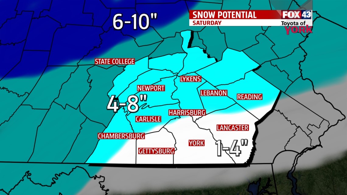
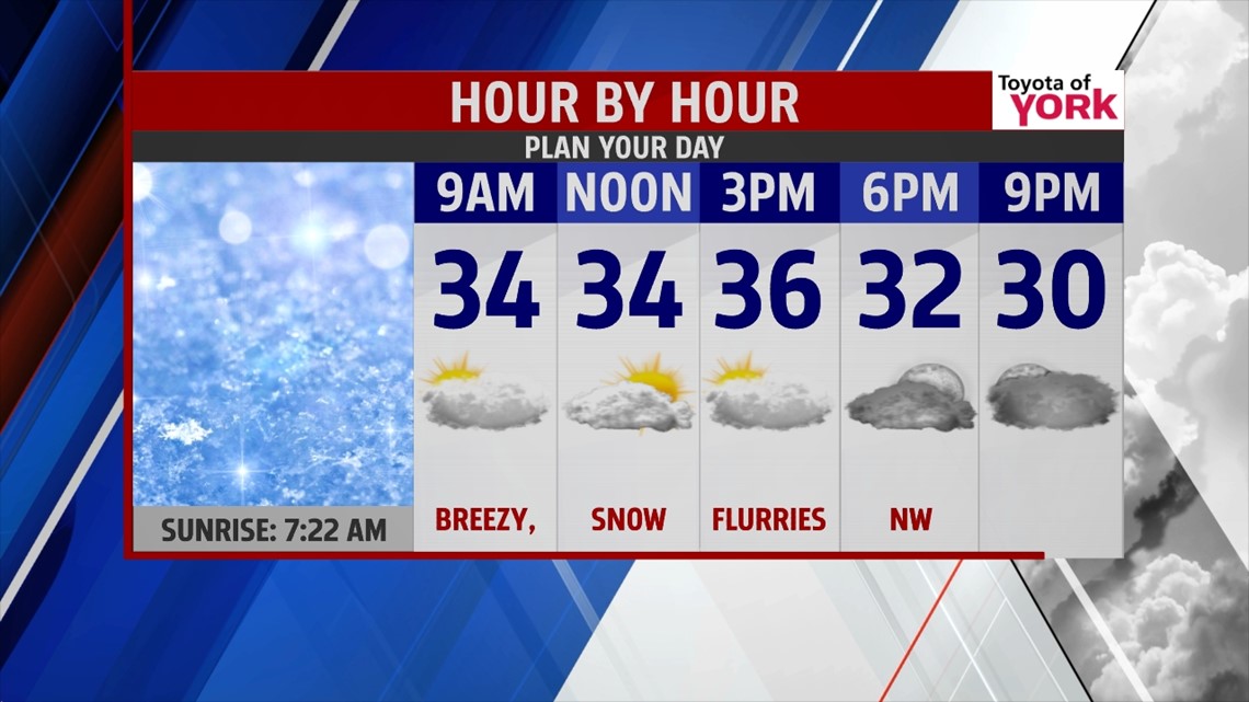
Moderate snow continues to fall across the region this evening, with some heavier bands at times as well. Some mixing also begins to work in, mainly to the south and southeast of the Harrisburg area in parts of Lancaster, York, and possibly even Adams/Franklin counties. A couple of extra inches are possible in Adams and Franklin counties if the mixing stays away. The precipitation begins to exit, with many spots dry by midnight. Some remnants may linger along the northeastern portions of the area. Otherwise, plenty of clouds stick around through the night. Temperatures hover in the upper 20 to lower 30s. Sunday stays mostly cloudy, with strong breezes. Some lake effect flurries are possible, clipping Mifflin and Juniata counties. Highs are in the middle to upper 30s.
STAYING BELOW AVERAGE
Temperatures remain below average through the middle of next week. Monday is a cold day with partly to mostly clear skies. Highs are in the upper 20s after a frigid start. Tuesday, some light snow showers are possible, but this will not be a big deal. Highs are near the freezing mark. Wednesday some sunshine returns with highs in the middle 30s.
APPROACHING AVERAGE TEMPS
A southwesterly flow kicks in Thursday, and this warms temperatures closer to seasonable averages. Highs are near 40 degrees. Friday is still a seasonably mild day, with plenty of clouds and highs in the lower to middle 40s. Our next storm system will be approaching, so a shower chance enters the picture and lasts through Saturday.
Enjoy the rest of your weekend!
-Andrea Michaels