
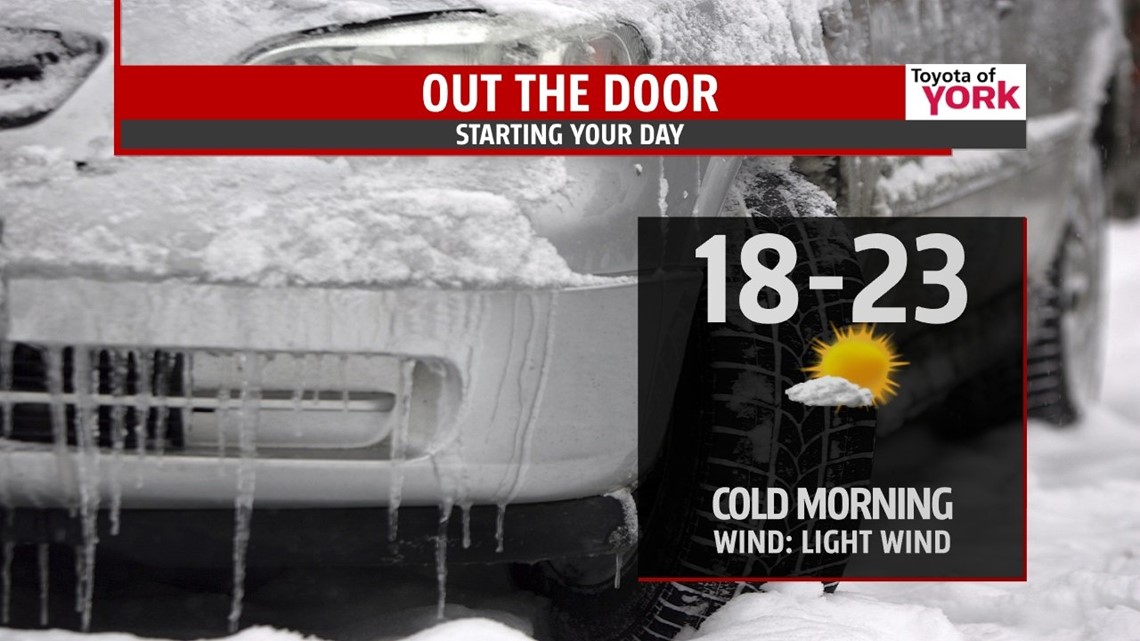
ONE MORE COLD NIGHT
Winds will die down and skies will be mainly clear as high pressure builds in. That will allow temperatures to dive to the teens and 20s. You’ll be able to give the heat a bit of a break in the next few days as temps are expected to warm up.

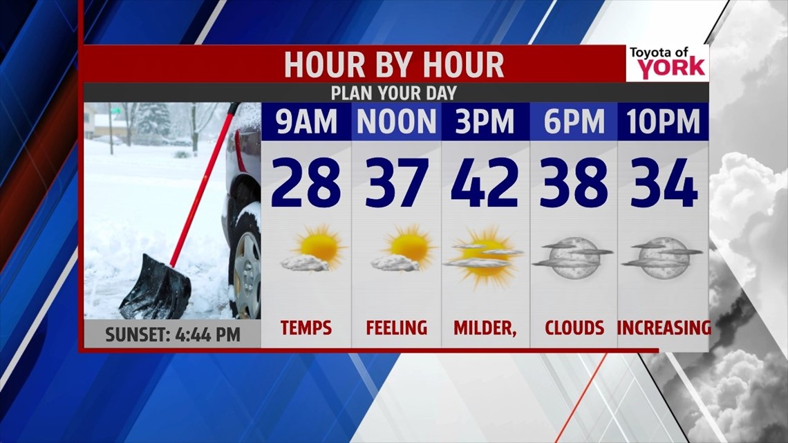
FEELING MILDER
Say good bye to the snow. It will be slowly melting in the upcoming days. It will start in the afternoon tomorrow. Plenty of sunshine expected tomorrow and with a breeze out of the south-southwest, temperatures will warm into the low 40s. It will feel quite nice after the cold spell we have had. Winds will still be a bit on the breezy side and a few more clouds may drift on in later in the day towards evening.

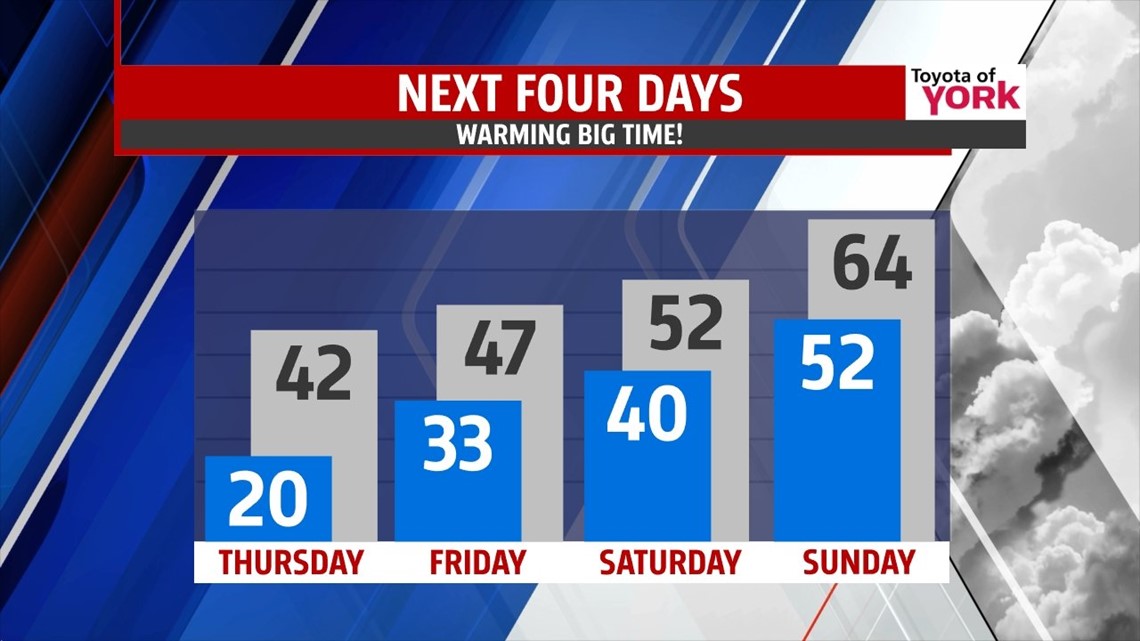
WARMER TEMPS BRING SHOWERS
A frontal system sets up shop just to our west keeping us on the mild side of the system. Areas of low pressure ride through the Great lakes bring waves of showers. So with the milder temperatures comes rain. First threat for showers holds off until Friday evening. Highs will warm into the upper 40s. Saturday will be mainly cloudy with a chance for showers but not a complete washout by any means so if you have shopping or running around to do, just keep the umbrella handy. You may not need a jacket; highs will warm into the low 50s.
RECORD BREAKING HIGHS SUNDAY?
Sunday lows will start out very mild in the low 50s and despite the clouds; the flow out of the west-southwest will boost our temps to the low to mid 60s. The record on Sunday is 64 and it looks like we could hit it. Plenty of dry hours for the beginning part of the day but showers will be possible later in the afternoon, especially in the evening.

CHRISTMAS WEEK
Right now it looks like colder air returns early next week. Monday the clouds will be clearing and temperatures look to fall through the day into the low to mid 40s.
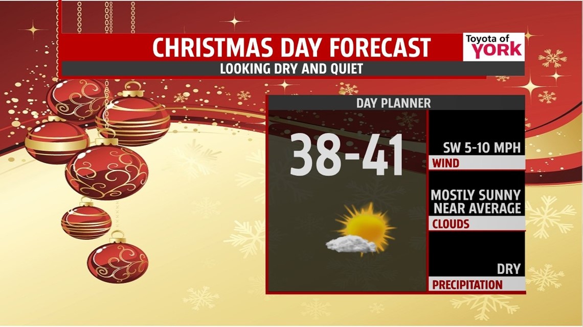
Christmas Eve morning lows return to the 20s with highs struggling to warm through the 30s but it will be dry as high pressure dominates the area. Not looking like a white Christmas either. It will be cold with lows in the mid 20s and highs in the upper 30s. But it will be dry with plenty of sunshine.

Bundle up one more night but enjoy the upcoming warming trend.
MaryEllen Pann, Chief Meteorologist
Like me on Facebook: maryellenpannfox43
Follow me on Twitter: @MaryEllenFox43