
NOT AS CHILLY TONIGHT

WARMER TEMPS BRING SHOWERS

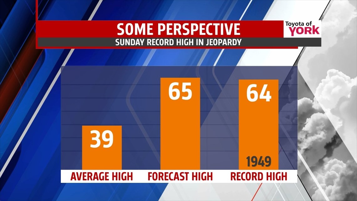
RECORD BREAKING HIGHS SUNDAY?
Sunday lows will start out very mild in the low 50s and despite the clouds; the flow out of the west-southwest will boost our temps to the mid 60s or better. The record on Sunday is 64 and it looks like we could hit it. Plenty of dry hours for the beginning part of the day but rain will be possible later in the afternoon, especially in the evening.

CHRISTMAS WEEK
Right now it looks like colder air returns early next week. Monday the clouds will be clearing and temperatures look to fall through the day into the low to mid 40s.
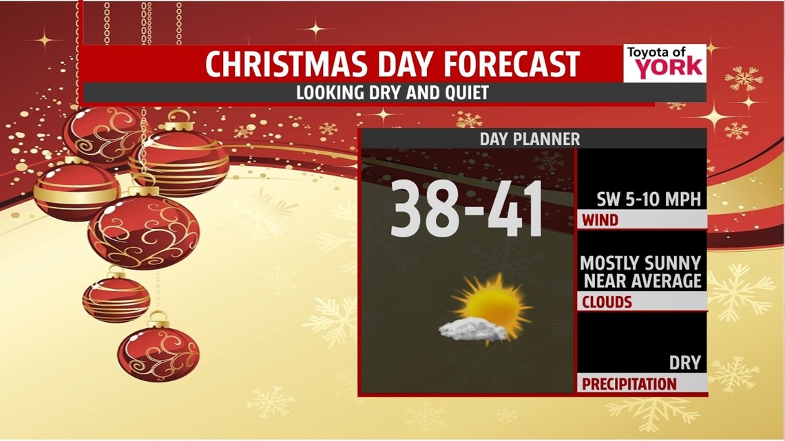
Christmas Eve morning lows return to the 20s with highs struggling to warm through the 30s but it will be dry as high pressure dominates the area. Not looking like a white Christmas either. It will be cold with lows in the mid 20s and highs in the upper 30s. But it will be dry with plenty of sunshine.

Make it a great evening!
MaryEllen Pann, Chief Meteorologist
Like me on Facebook: maryellenpannfox43
Follow me on Twitter: @MaryEllenFox43