
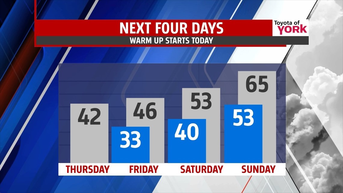
WARM UP BEGINS: We’ve spent the last 12 days below average, and at times much below average. But today, it’s about to change. The average high is 40° and we should make it today with highs nudging to and above 40°. Expect sun to start the day with some clouds arriving as the day progresses. Enjoy the milder weather. We keep going up!


WARMER YET: Friday, we make it to the middle 40s. A complex storm system develops, bringing rain on Sunday late, with a few showers of Friday and Saturday ahead of it along a weaker frontal system. This setup forces warmer air into the state. Saturday, we’re in the low 50s and Sunday we’ll top out in the middle 60s. That’s warm! The record high is 64 in 1949 and we may just break it.

RAIN CHANCES: A few showers may arrive later Friday as a weak cold front approaches and holds up. Isolated showers may be around Saturday, but energy transfers to a low pressure deepening over Texas. This will gather moisture and rain closer to the low. The low races northeast and brings rain for Sunday, lasting into the early overnight hours. Once it shuts off, we’re back to the chill.


HOLIDAY WEEK: Monday, we feel the chill return as temps drop through the 40s for the day. Christmas Eve and Christmas Day look cold, dry, and mostly sunny at this point with highs in the upper 30s to near 40°. We’ll continue to fine tune the details on the holiday forecast.
Make it a spectacular Thursday.
“A friend is a gift you give yourself.” – Robert Louis Stevenson
– Jeff Jumper, WPMT FOX43 Morning Meteorologist
Follow me on Twitter: @JeffJumperWX
Like me on Facebook: Jeff Jumper FOX43