
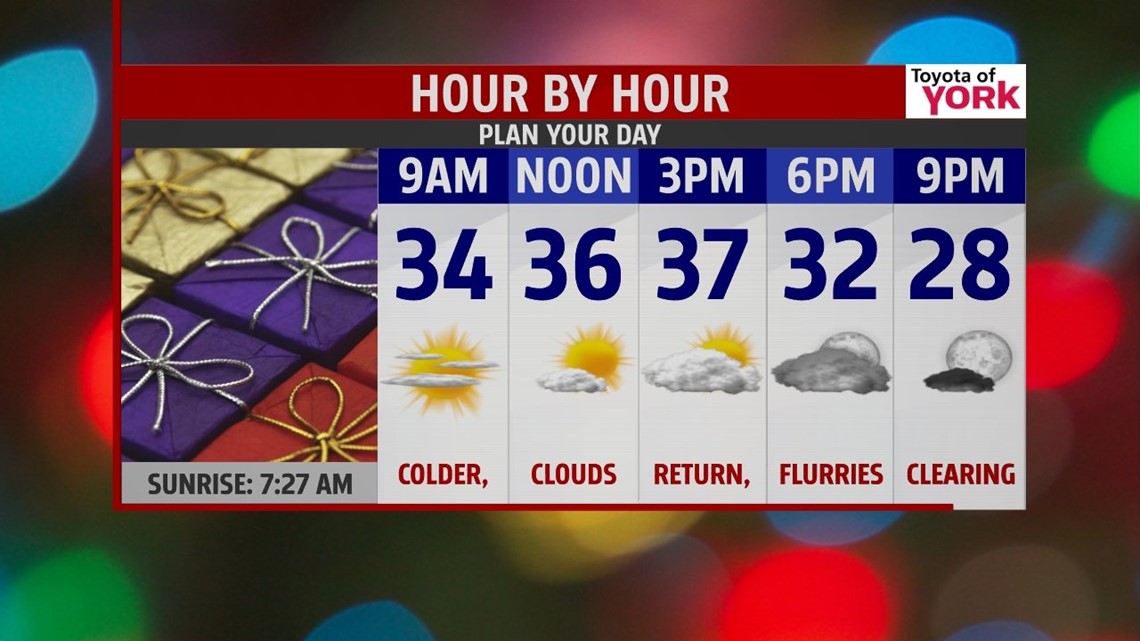
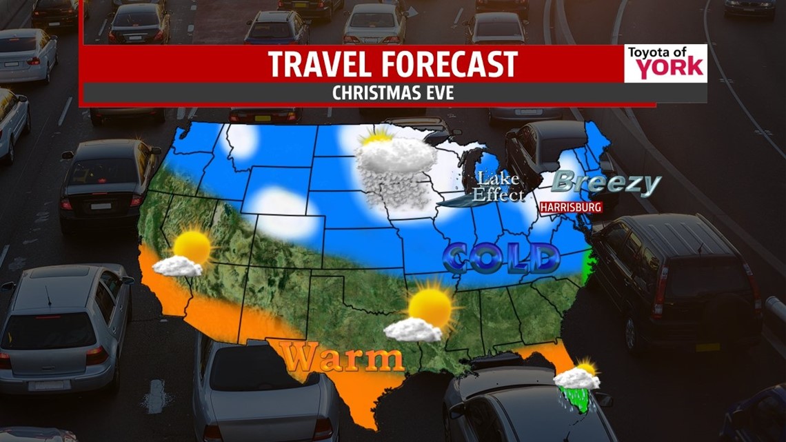
CHRISTMAS EVE: It’s a cold start to the day and it stays cold and breezy through the afternoon. The clouds return with some snow squalls and flurries possible through the day as a weak wave aloft swings through. Squalls may briefly reduce visibilities, so sty alert if you’re driving. Highs today will top out in the upper 30s. For evening plans the clouds break up a bit as temperatures drop back into the upper 20s, with wind chills in the teens. The cold breeze will relax overnight as temperatures tumble through the 20s.

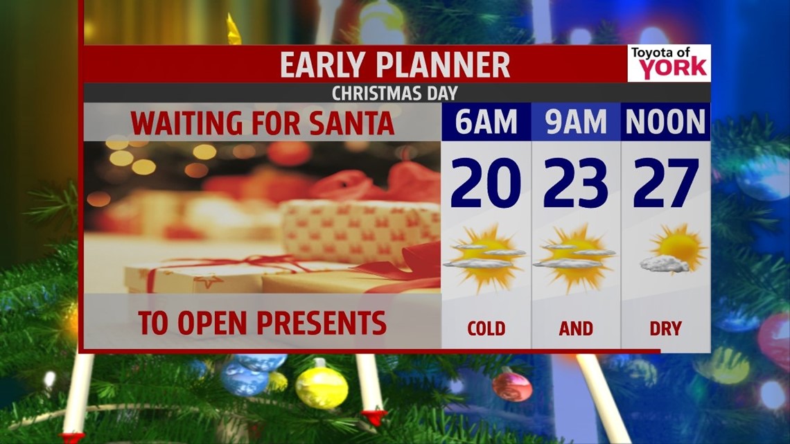
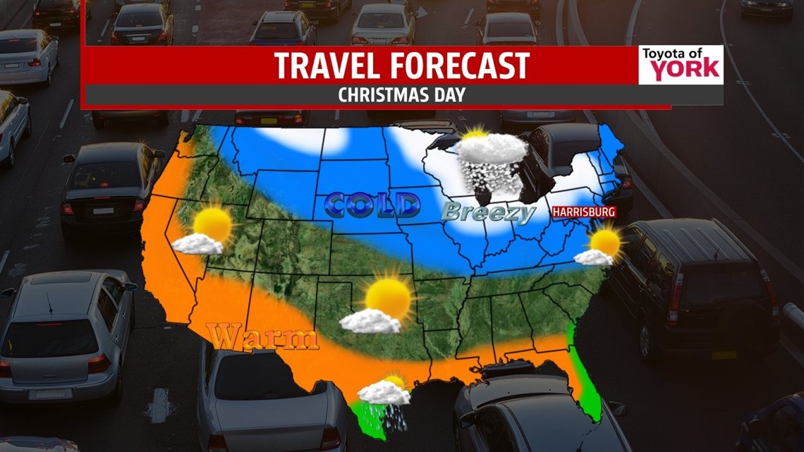
CHRISTMAS DAY: The day starts cold with temperatures in the low 20s and mostly clear skies. Some high clouds fill in through the day as temperatures only make it to the low 30s for highs. Clouds thicken through the late afternoon but we’ll remain dry. Enjoy the holiday!


TRAVEL: Travel looks great for the vast majority of the contiguous United States. Check out the maps below for more.


ENDING THE WEEK: We return to the low 40s for Thursday with some clouds in play as a disturbance moves over top of us. Friday Saturday, and Sunday, we range from the upper 30s to mid 40s with sunshine and clouds mixing. More clouds arrive for Sunday into next week. It looks dry for now through the stretch so enjoy!
Have a safe and Merry Christmas if you’re celebrating. See you next week!
“I will honor Christmas in my heart, and try to keep it all the year.” – Charles Dickens
– Jeff Jumper, WPMT FOX43 Morning Meteorologist
Follow me on Twitter: @JeffJumperWX
Like me on Facebook: Jeff Jumper FOX43