

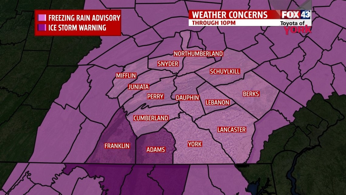
The National Weather Service in State College, PA has extended its Freezing Rain Advisory for Mifflin, Juniata, Perry, Cumberland, Berks, Dauphin, Lancaster, York, and Lebanon counties until 12 A.M. Ice accumulations up to 0.2″ are likely, making roads hazardous and slippery.
An Ice Storm Warning has been issued for Franklin and Adams counties until 12 A.M. Sunday. Ice accumulations up to 0.3″ are possible, making roads dangerous and slippery. Use extreme caution if you must travel.
BRIEF OVERNIGHT WARMING

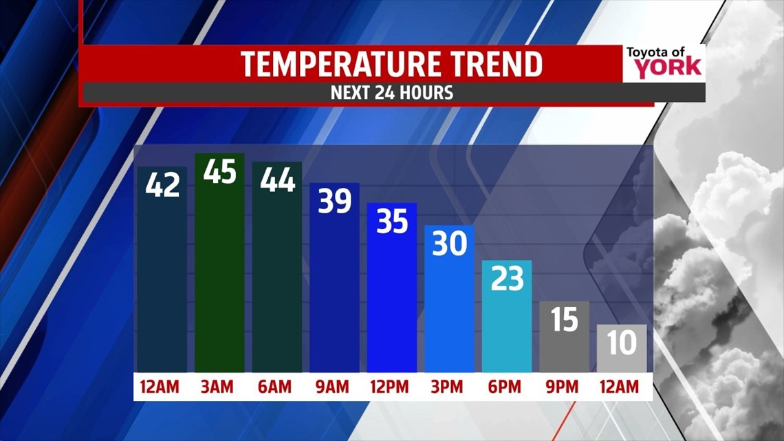
Patches of freezing rain and freezing drizzle continues this evening, but as temperatures gradually warm over the next few hours, expect the freezing rain threat to subside. Overnight Sunday temperatures peak in the upper 30s to lower/middle 40s. A round of rain along a cold front passes through beginning a bit before daybreak and lasting through about mid morning Monday. At the very end, some brief snow is likely in spots, but only enough to bring minor accumulations at best (under an half an inch). Behind the front, the coldest air we’ve seen since 1994 slams into the region, and temperatures drop into the 20s during the afternoon. Strong winds bring brutal wind chills. Temperatures continue to drop, bringing even colder air than we experienced last Friday!
POLAR BLAST

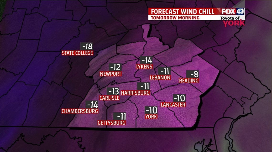
The coldest air since 1994 settles in Tuesday morning! Subzero temperatures are expected across the entire region. Breezes make it feel like -10s and -20s at times! Gusts could make it feel like -30s for the coldest locations at times, but this should be few and far in-between. Bundle up to prevent frostbite for those who must venture out Tuesday morning. Highs Tuesday only reach the single digits! Breezy winds produce wind chill values below 0 throughout the day. Wednesday sees another brutally cold start with temperatures ranging on both sides of 0 degrees. Highs do rebound to near 20 degrees. Sunshine both days does nothing to help warm us.
THAWING OUT
Thursday a clipper system looks to bring some light snow to the area. Accumulations should be minor. Highs are near 30 degrees. Friday we get a break, with temperatures continuing to warm above freezing under sunshine! Saturday brings our next chance for showers, and temperatures rise above 40 degrees. Sunday is mostly cloudy and mild, with a shower possible.
Have a great week!
-Andrea Michaels