
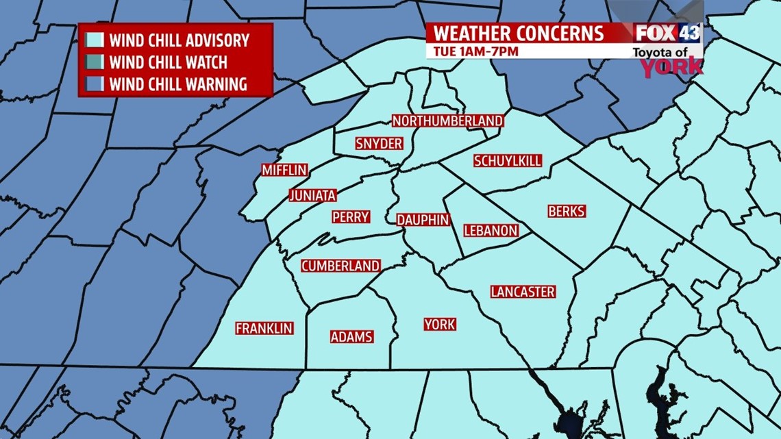
…A Wind Chill Advisory is in effect for our area from 1AM until 7PM Tuesday for wind chills below -15°….

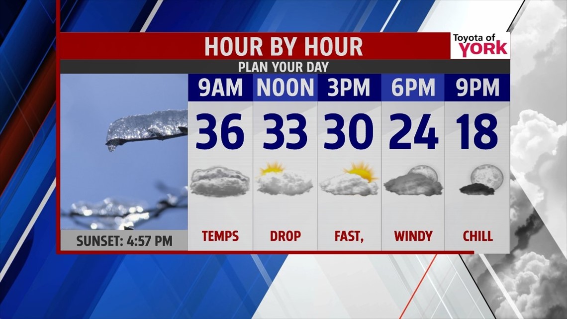
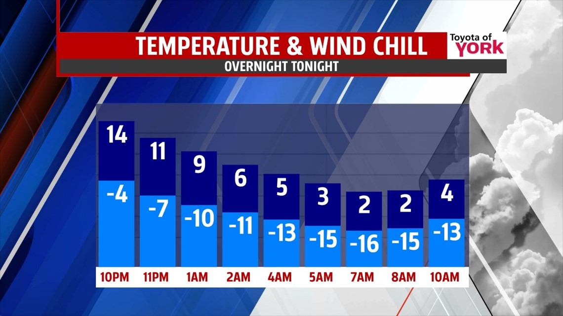
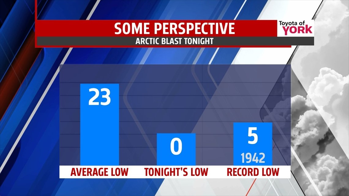
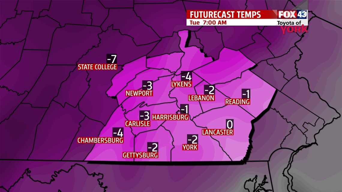
COLDEST AIR IN YEARS: Rain showers end as some rain/snow mix for the morning commute. By midday, precipitation ends as the door blasts open to arctic air. Expect strong, gusty westerly winds at 15-25mph to allow temps to fall from this morning’s 40s and 30s to the 20s for the afternoon. Skies will clear to sunshine, but winds will pick up to the 30mph range late as temperatures continue to drop off. By evening, wind chills will be in the negative single digits. Overnight, temps fall to near 0° with winds continuing at 20-30mph, bringing wind chills into the -10° to -20° range. Tuesday, we make it back to the low teens with wind chills staying in the negatives, despite sunshine.


GRADUAL WARM UP: Temps will begin in the chilly single digits Wednesday, warming to the low to mid 20s with some clouds rolling in later. On Thursday, we start in the teens and end in the low 30s. A quick system may bring some light snow overnight into early Friday. Friday, we touch 40°!
WEEKEND: A bit of a January thaw is in store for the weekend. Highs will make it to the middle 40s, but unsettled weather arrives with showers for Saturday. Sunday, for now, is looking dry.
Have a great Monday and stay warm tonight! Don’t forget about the pets too!
“The future belongs to those who believe in the beauty of their dreams.” — Eleanor Roosevelt
– Jeff Jumper, WPMT FOX43 Morning Meteorologist
Follow me on Twitter: @JeffJumperWX
Like me on Facebook: Jeff Jumper FOX43