
***UPDATED: 11AM***
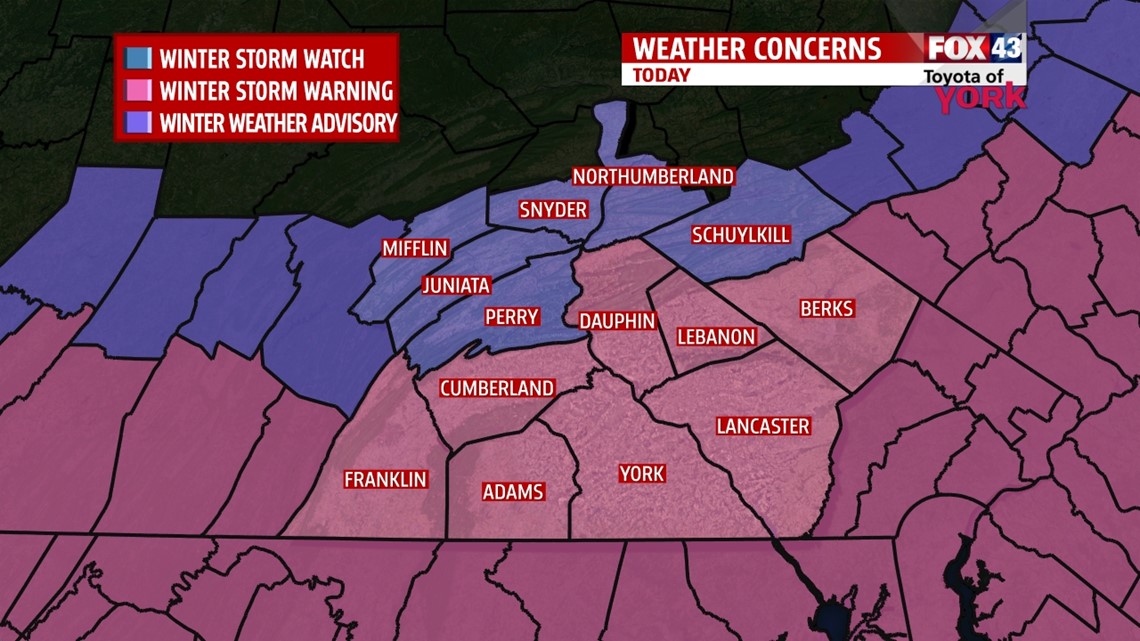
…A WINTER STORM WARNING is in effect for Adams, Cumberland, Dauphin, Franklin, Lancaster, Lebanon, and York counties through Tuesday night for up to 10″ of snow along the PA/MD border…
…A WINTER WEATHER ADVISORY is in effect for Juniata, Mifflin, and Perry counties through Tuesday night for up to 2-5” of snow in spots…

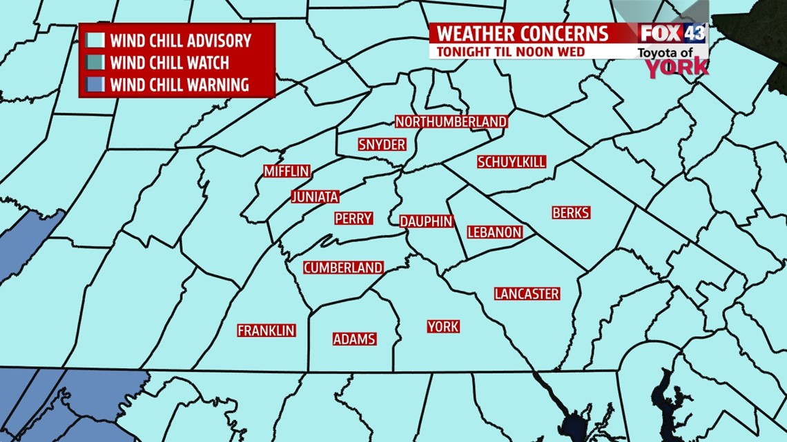
…A WIND CHILL ADVISORY is in effect from 6PM today until noon Wednesday for wind chills as low as -15°…

SNOW BREAK DOWN: A fast moving, but potent clipper system is bringing steady, fluffy, accumulating snow to the region currently. Expect the snow to continue through the day today. The system is moving west to east, so we’re expecting the snow totals to be highest along the PA/MD border and lowest toward the I-80 corridor.
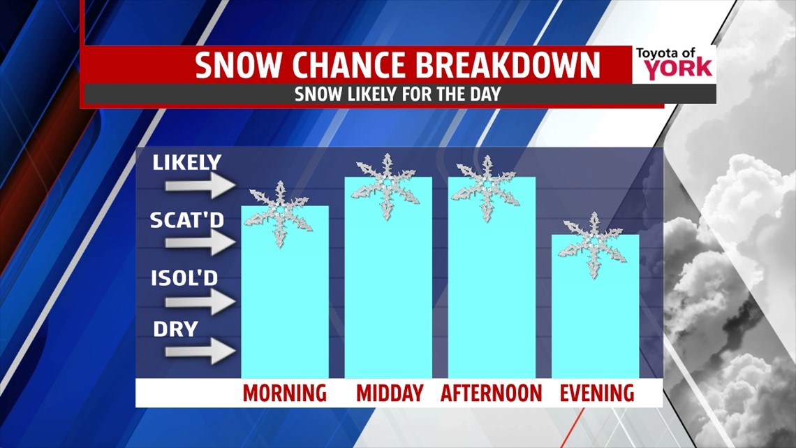
>TIMING: Light to moderate snow continues at this midday time frame. Expect moderate to heavy snow at times through the day. The heaviest snow will fall to the south and east of the I-76/I-81 corridor through 6PM. Snow tapers in the north and west between 6-8PM, but hangs on in the south and east until 10PM to midnight.

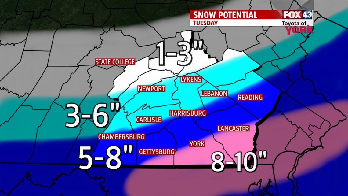
>AMOUNTS: There will be a sharp cut-off of snow from north to south. So we have this broken down into N/S oriented regions. See our total maps for a graphical depiction. Areas closer to and north of the US-22/522 corridor will be in the 1-3” range. Areas between the US-22/522 to the PA Turnpike can expect 2-5”. Along the PA Turnpike +/- 15 miles N/S can expect 3-6”. Between the the 30 corridor and the PA Turnpike, expect 5-8”. There will be locations from York to Lancaster to Reading that will see 8-10″ of snow with isolated higher amounts possible in spots.

>OTHER CONCERNS: Winds will be at 10-20mph with higher gusts through the afternoon. Blowing snow along with heavy snow will reduce visibilities greatly at times. Also, temps will be falling through the day with winds, making wind chills dump into single digits today and negative teens overnight tonight.
BRUTAL COLD: Once the snow is gone, the rest of the week features single digit lows and teens for highs. It’s breezy too, adding to the chill. We’ll see sunshine on Wednesday and Friday, with clouds and some light snow showers possible on Thursday.

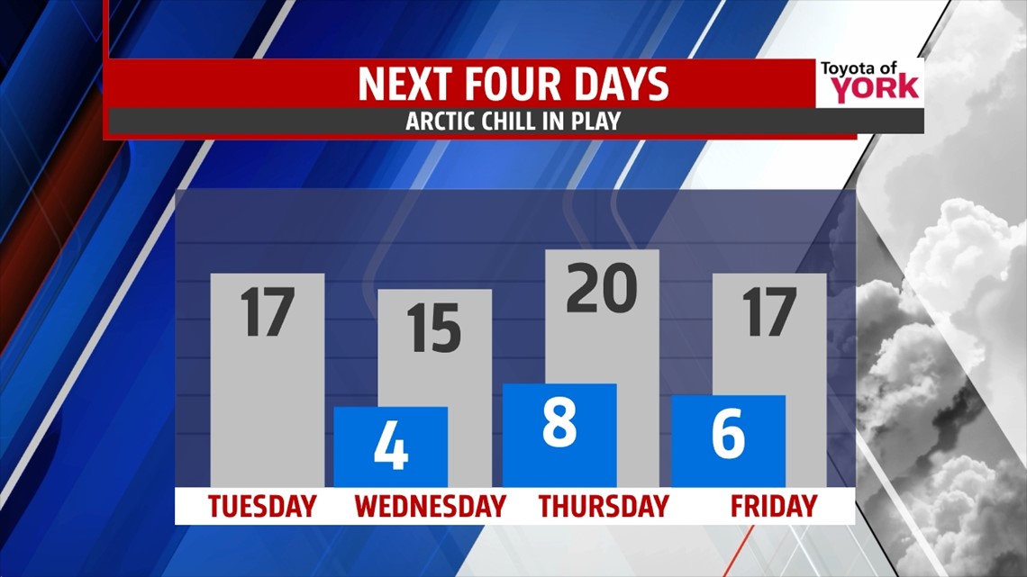
WEEKEND: It warms a bit to the 30s on Saturday, but a clipper will bring clouds and some light snow. Sunday we get a break as we chill again. Monday, it’s cloudy and yet another clipper brings a light snow chance in this very active weather pattern.
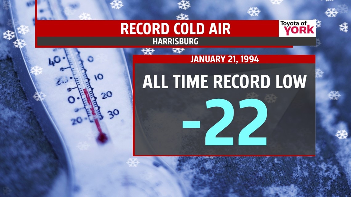
RECORD LOW: Today, 20 years ago, we hit the all time record low in Harrisburg as part of a brutal arctic cold snap. The low was -22°! Records have been kept for Harrisburg since 1889.

Stay safe today. Please send us your snow reports and totals on our Facebook pages and via out Twitter accounts.
“No one is wise by birth. Wisdom results from one’s own efforts.” – Krishnamacharya
– Jeff Jumper, WPMT FOX43 Morning Meteorologist
Follow me on Twitter: @JeffJumperWX
Like me on Facebook: Jeff Jumper FOX43