

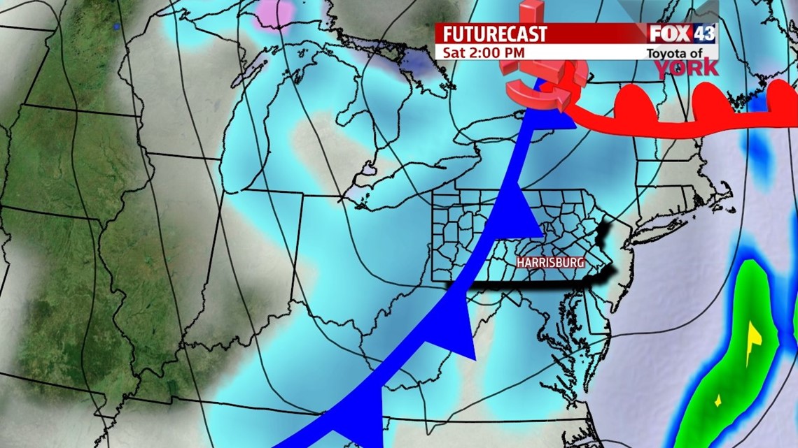
ANOTHER CLIPPER SATURDAY

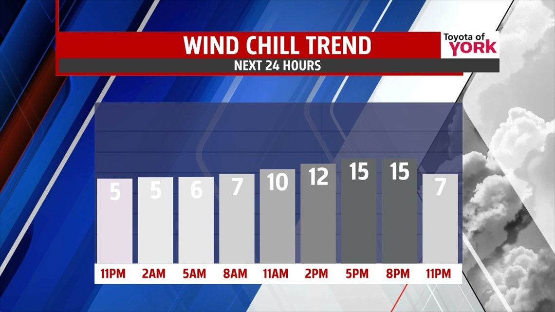
Skies are clear for now, but our next clipper system just to the northwest changes things into the weekend. Clouds increase a bit overnight, but that does not prevent lows from bottoming out in the lower to middle teen. Most of Saturday morning looks dry, but expect snow showers to enter the picture mid to late morning. Through the afternoon, they overspread. Snow squalls bringing heavier bursts of snow are possible at times. Accumulations of a coating to two inches are expected for most. Locations that see more of the heavier snow squalls could see as much as 3 inches. The snow showers taper Saturday evening, and skies partially clear overnight. Highs reach the middle to upper 20s.
WEAKER SUNDAY NIGHT CLIPPER
Colder air rushes in again for Sunday morning. Some sunshine begins the day, but clouds increase during the afternoon ahead of yet another. This one does not look as impressive as Saturday’s. A few flurries are likely late in the day, with a chance for some more snow showers overnight. Accumulations reach a half an inch at best, with many spots not even picking up a light coating. Highs are in the upper teens to lower 20s Sunday.
YET ANOTHER ARCTIC BLAST
Monday skies clear a bit into the afternoon hours, but another arctic air mass is coming! By Tuesday morning, the chill settles in, with lows possibly near 0 degrees! Afternoon highs are in the teens. The brutally cold air sticks around through Wednesday. We’ll have to wait until Thursday and Friday for some slight moderation to take place, but even then highs are still below seasonable averages in the 20s!
Have a great weekend!
-Andrea Michaels