
OVERALL: Finally the upper level pattern changes with the trough lifting out allowing a ridge to build in. This means temperatures
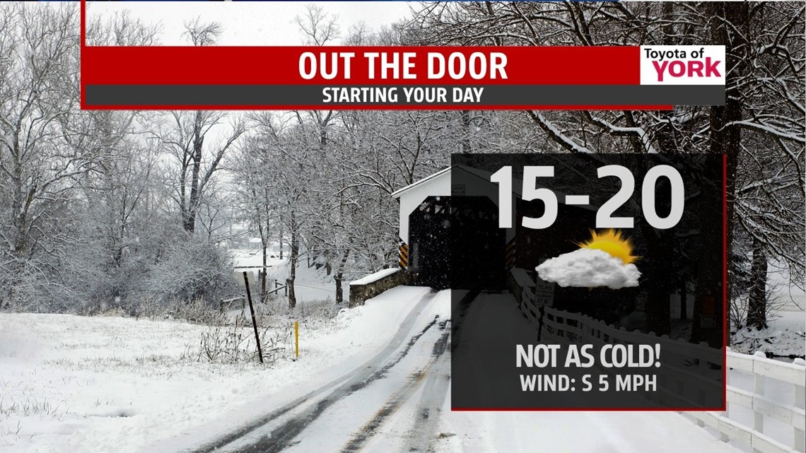
TONIGHT: Clear skies to start then they start to increase as the next frontal system moves in from the west. Lows will not be as cold but still run below average in the middle teens.

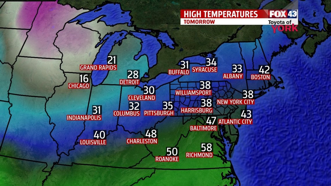
TOMORROW: Lots of clouds around to the end the week but despite the overcast conditions and with the help of a light westerly breeze, temperatures should warm to near seasonal averages in the mid to upper 30s.

SATURDAY: A few morning flurries or light snow showers mainly north and west of Harrisburg is possible as a front nears us but retreats back to the north as a warm front early. Clouds will thin out some allowing for a bit more sunshine that will help to warm us into the low 40s. After thinking we could have a few rain showers late in the evening, the forecast is looking drier and the showers if any, will hold off until overnight.
SUNDAY: Cold front slides through late morning and may be accompanied by a few showers but nothing more. Winds will pickup and become quite breezy and with breaks of sunshine, temperatures should remain mild in the low 40s. Colder air sinks in overnight into the start of the work week.
NEXT WEEK: Things really start to get interesting with the jet stream close by the pattern of storms will ride real close to us. Watching how far south a cold front will go on Monday because some indications are a wave of low pressure could develop along it and bring a couple of inches of snow in the morning. Not all models agree but will watch this situation closely. Another storm arrives late Tuesday into Wednesday. Concern here is a mix possibly a period of freezing rain Tuesday night before changing to rain some time on Wednesday. As of now it looks like with the track of the low through the Ohio Valley, we will be on the milder side of the storm resulting in more rain but initially it will be cold enough for snow, then a wintry mix and perhaps a period of icing. Still many days away and much can change.
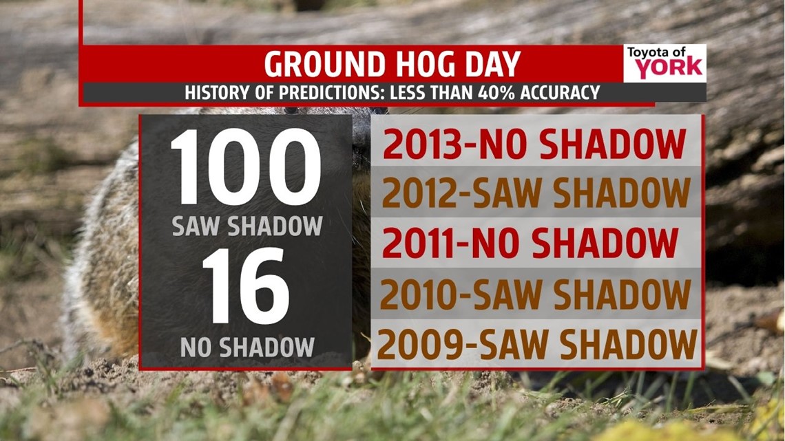
Ground Hog Day is Sunday. Will he see his shadow and keep winter around longer or will he not, bringing a sign that spring is just around the corner!

SUPER BOWL OUTLOOK: There could be an isolated shower otherwise; a few scattered clouds and breezy winds with temperatures around the upper 30s at kick off. Can you guess the kick off temperature? If so, you could win a $599 gift card from Best Buy!!


MaryEllen Pann, Chief Meteorologist
Like me on Facebook: maryellenpannfox43
Follow me on Twitter: @MaryEllenFox43