
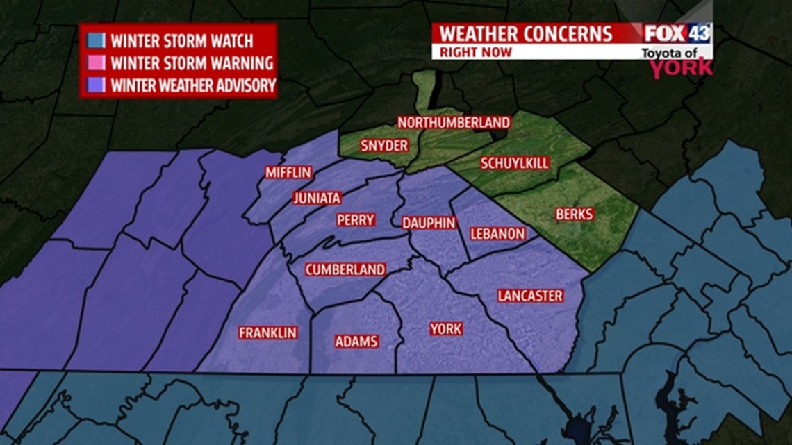
The National Weather Service has issued a WINTER WEATHER ADVISORY which will go into effect Monday from 1am and continue until 3pm.

We’ll have a few isolated showers with the front this evening, then the front sags a bit to our south at which time an area of low pressure develops along it moving through NC and VA then off the coast by morning. Temperatures will be falling and cooling tonight. Showers are likely to transition to a mix initially as rain-snow-sleet for a period until the temperature profile cools enough then it should change to all snow for the duration.
TIMING: Rain possible after 11pm and will mix with sleet and snow for a period into the morning before changing over to all snow. Moderate to heavy snow may fall for a period through the early afternoon before coming to an ind.
AMOUNTS: North of the turnpike, expect snow to accumulate 2 to 4″ and south of the turnpike, 4 to 6″. There may be a band that sets up very close to the MD/PA line which may accumulate to as much as 8″.
IMPACTS: Unfortunately, this storm arrives during the morning commute so it is likely to cause a lot of problems. Visibility and slick road conditions are a concern.
TEMPS: Will range from 29 degrees to 32 degrees.
AND WINTER KEEPS COMING
With the front just to our south, an area of low pressure is expected to develop along it tonight and move through the North Carolina and Virginia before exiting off the coast near the Delmarva. This will result in the possibility of accumulating snows, leaving the best chance for heavier accumulations near the state border.
Unfortunately, it will all come during the morning rush hour. Scattered rain showers overnight Sunday begin to mix with sleet overnight. By daybreak, it changes to snow, with perhaps some of the mixing remaining along the southeastern parts of the area. The snow is heavy at times through the morning, and wraps up from west to east during the afternoon hours. Accumulations look to be heaviest along the south and eastern parts of the area, especially near the state border because the system passes to our south. See the map for accumulations in your area. These could change depending on how the models sort out the mixing scenario over the next 24 hours.
THIS WEEK
Tuesday is looking quiet now with highs in the 30s but Tuesday night into Wednesday, yet another system heads our way. This one looks to ride just to our west keeping us on the warmer side of things meaning we may see a brief period of snow and sleet but a changeover to rain is expected some time early on Wednesday. We are quiet but cold again Thursday and Friday with temperatures returning to the 20s. We’ll be watching a storm, yes another storm, for the weekend. It looks like right now to also bring a mix bag of wintry weather. We’ll keep you posted!