
WINTER STORM WATCH has been issued for Tuesday night into Wednesday night for the entire area.

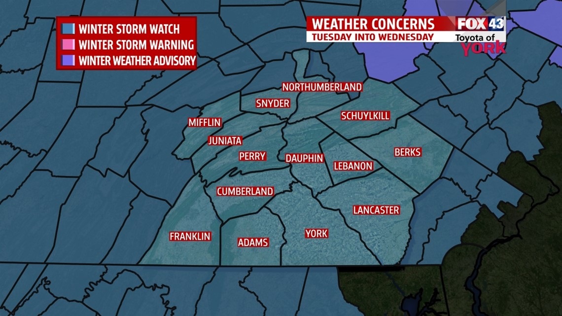
A WINTER STORM WATCH means there is the potential for significant snow…sleet…or ice accumulations that may impact travel.
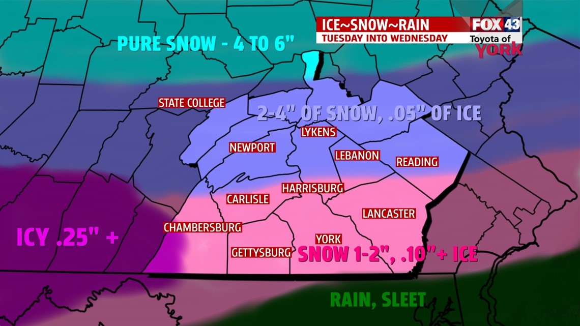
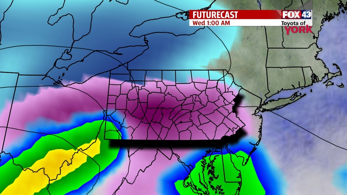
TIMING: A wintry mix will begin Tuesday night and end Wednesday afternoon. The period of most intense snow or ice will be Wednesday very early.

This could be a significant storm which unfortunately is expected to impact the morning commute on Wednesday.
OVERALL: Today’s storm continues to pull away and snow will continue to taper off west to east. Quiet Tuesday as high pressure brings us a welcome and much needed break before the next more complex system rolls our way. Then another quiet stretch to end the week before the next system arrives Sunday. It looks to bring another round of wintry weather which could stretch into the start of the second week of February as a train of system continues to hit the area. Looking ahead to near Valentine’s Day, it looks as if another storm could bring a wintry mix as well.
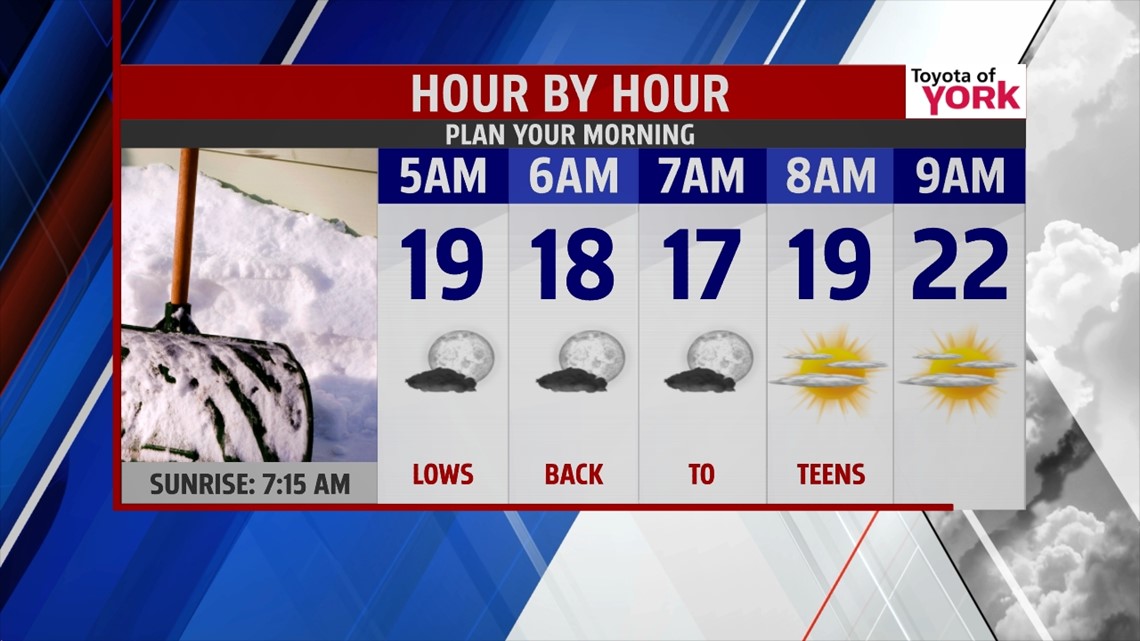
TONIGHT: Skies will clear and winds will be light which will lead to a much colder night with lows in the teens. Wet roads and surfaces will freeze causing slick conditions and black ice.


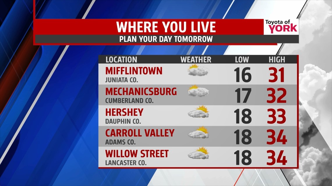
TOMORROW-WEDNESDAY: High pressure will temporarily provide a quiet day with highs in the low to mid 30s, but Tuesday night, the next system is raging towards us. Again we will be dealing with snow, freezing rain to start. Concern will be how long we see freezing rain before changing to rain. Most of the moisture will fall in the overnight period ending by noon on Wednesday. We could be dealing with significant accumulations of ice and rain, flooding is a concern and the situation will be monitored closely.

THURSDAY-FRIDAY: High pressure provides a couple of quiet days but it will be cold again with lows in the teens and highs only in the 20s.
WEEKEND OUTLOOK: February continues to start off very active with a storm every other day or two. We’ll have a quiet start to the upcoming weekend but the next storm of the week arrives Sunday and could bring us a wintry mix but also looks to transition to all snow which may linger into Monday resulting in a good amount of accumulations. We will certainly be bringing you the latest through the week.
MaryEllen Pann, Chief Meteorologist
Like me on Facebook: maryellenpannfox43
Follow me on Twitter: @MaryEllenFox43