
…A Winter Storm Warning is in effect until 4PM for Adams, Cumberland, Dauphin, Franklin, Lancaster, Lebanon, Perry, and York counties…

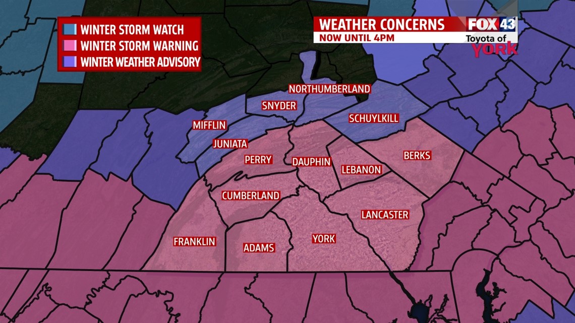
…A Winter Weather Advisory is in effect until 4PM for Juniata and Mifflin counties…
TRIPLE THREAT: There are three storm systems expected over the next seven days, and each comes with its own challenges. Today, it’s snow. Wednesday it’s freezing rain and an icing concern. Over the weekend, it’s timing and precip type that will be in questions. Let’s tackle today first.
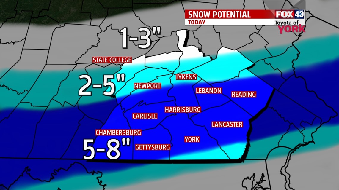
SNOW TODAY: Overnight rain switched over to snow through the early morning. We expect the snow to ramp up and be most intense between 6AM through NOON today. The snow will then taper in the afternoon form west to east. Snow will reduce visibility. It accumulates as a heavier wet snow, great for snowballs and snowmen! Many of us will be in the 6-8” range, with a less right along the PA/MD border and south and a big drop off to the north of the US-22/522 corridor. See the map for the latest amounts.

Highs today hover near freezing, with clearing skies for overnight, allowing temperatures to drop into the teens. Tuesday looks dry and sunny to start. Highs hit the middle 30s. We see clouds come in ahead of our next system.
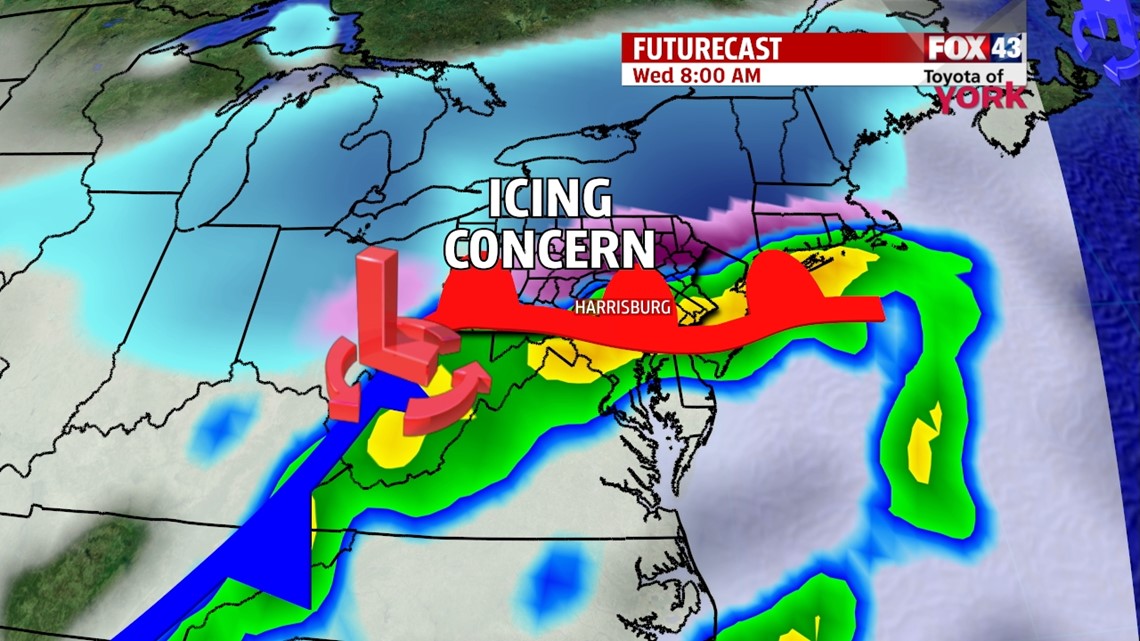
SYSTEM TWO: This one looks tricky. Most of the atmosphere will be warm enough for rain, but at the ground, temps will be at or below freezing for several hours. This is a recipe for accumulating freezing rain. It begins late Tuesday as snow, quickly changing to rain which will freeze on contact with anything below 32° on the ground. This may last into the morning hours, before it switches to just rain. We’re talking the difference of a degree or two here, so we’ll err on the side of caution. Wednesday morning could be a dangerous commute.

LATE WEEK: We’ll dry out and hold temps in the 20s for the rest of the week. It does, however, look dry.
WEEKEND: The models have been hinting a storm system for the weekend for a while. For now, the timing and precipitation type is still in question. For now, Saturday into Sunday expect a shot at a rain and snow mix with temps near 30°. More to come as the week progresses!
Be safe today. Make it a good week.
“We are a product of the choices we make, not the circumstances that we face.” – Roger Crawford
– Jeff Jumper, WPMT FOX43 Morning Meteorologist
Follow me on Twitter: @JeffJumperWX
Like me on Facebook: Jeff Jumper FOX43