
OVERVIEW: High pressure builds in over the area keeping our skies mostly clear through the evening but more clouds drift in overnight. Several weak, fast moving areas of low pressure will bring a chance for light snow showers both Saturday and Sunday.
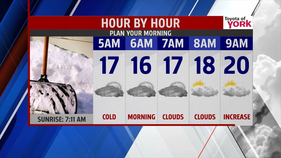
TONIGHT: Mostly clear skies right now will allow temperatures to drop fast. Clouds will be thickening up overnight; lows will still be cold again in the middle and upper teens. Winds will become light out of the northwest.


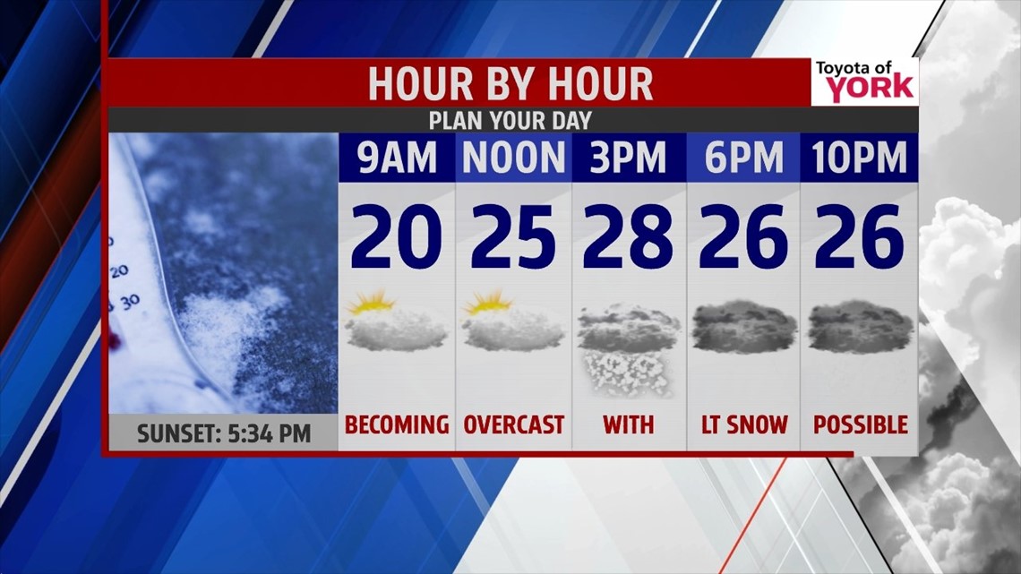
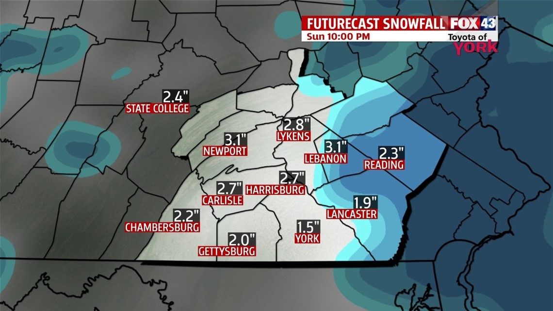
Total snow potential is anywhere from 1 to 3” for the entire weekend. Temperatures will be a bit better warmer in the low 30s.

EARLY NEXT WEEK: Light snow showers may linger into the morning commute. Lows will be back into the teens to start the day. Skies will become partly sunny with temperatures remaining below average only climbing to the upper 20s. We get even colder Tuesday and Wednesday as the upper level trof deepens providing colder Canadian air. Morning lows will run in the low to middle teens while highs will warm and stay below average in the mid to upper 20s to near 30.
OUR NEXT STORM: We are watching the next storm which models are depicting arrives Wednesday night into Thursday. Some models actually show it Thursday into early Friday. The trend is showing milder air so we may see more of a mix then pure snow. If this happens, snow amounts will be less with mixing. Still too many days out to comment much more than we could see a chance for a rain/snow mix. We’ll watch it closely, keeping you up to date of any additional changes.
MaryEllen Pann, Chief Meteorologist
Like me on Facebook: maryellenpannfox43
Follow me on Twitter: @MaryEllenFox43