
…A WINTER STORM WARNING is in effect from 1AM until 10PM Thursday for Adams, Cumberland, Dauphin, Franklin, Lancaster, Lebanon, Perry, and York Counties…
…A WINTER STORM WARNING is in effect from 1AM until 10PM Thursday for Mifflin and Juniata Counties…
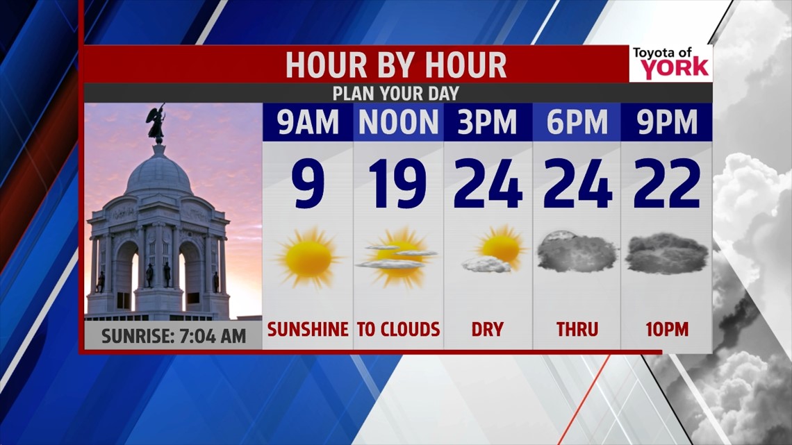
COLD MORNING: Temps are in the single digits and negatives this morning as a cold dome of high pressure sits right over top of us. We’ll rebound today to the low and middle 20s with early sunshine. Clouds slip in through the afternoon, filling the sky by evening ahead of our next storm.

SNOW: Plain and simple, the much advertised snow storm will arrive tonight and last about 20-24 hours. Bottom line, expect snow to snarl traffic and cancel many of your plans for Thursday. The heaviest will fall the farther south and east you live from Harrisburg.

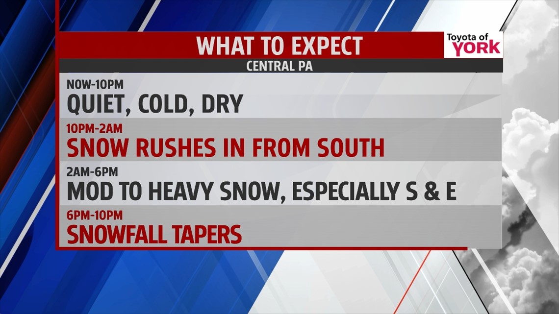
TIMING: Snow pushes in from the south from 10PM-2AM. It will continue, heavy at times, from 2AM-6PM. Snow tapers after that and should all be gone by 10PM.
AMOUNTS: Check the map below for your area. Basically, there will be sharp cut-off of snow amounts the farther west you travel. This system will have plenty of moisture to work with and we’ll be watching for a band of heavy snow to set-up. That band has the potential to pump out 12” or even more in some spots. Right now, we see that heavy band setting up over Adams, York, and Lancaster counties. Some sleet or isolated pockets of freezing rain may briefly mix in Thursday morning to the southeast, but overall it shouldn’t change the forecast much.

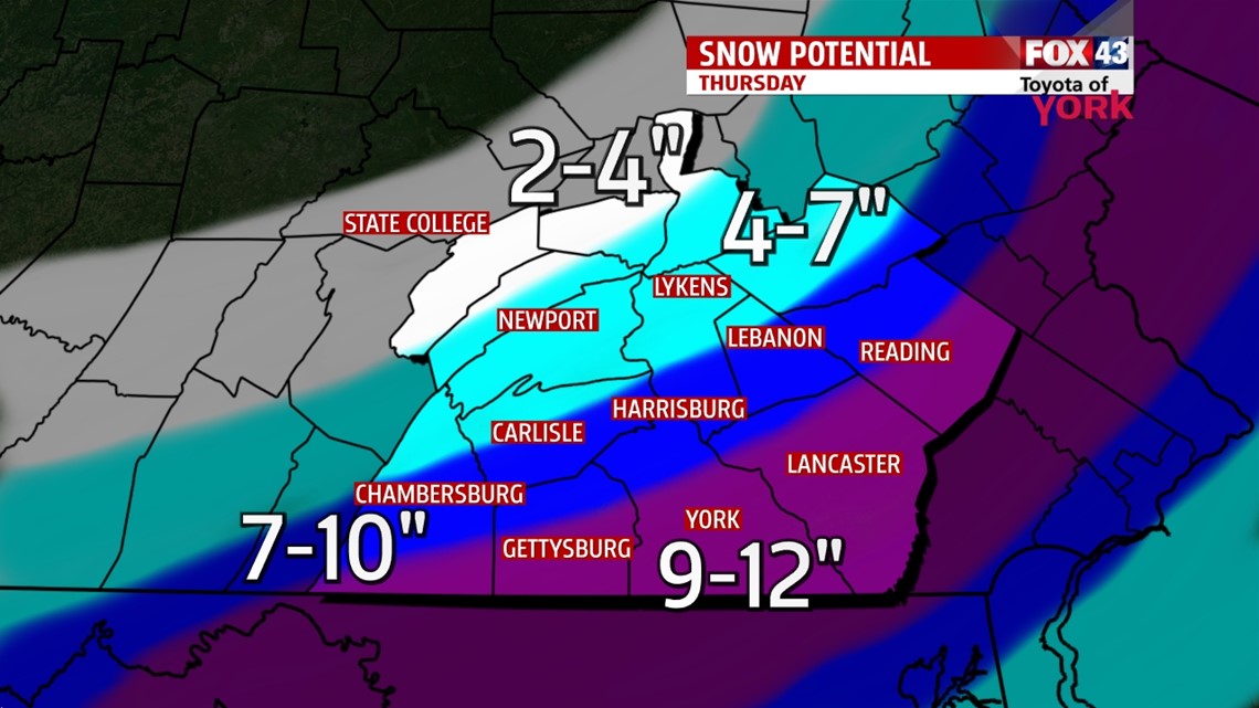
Here’s a list of the major towns in each range.
9-12”: Gettysburg, York, Lancaster, Reading
7-10”: Chambersburg, Carlisle, Harrisburg, Lebanon
4-7”: Newport, Lykens, Pottsville
2-4”: Mifflintown, Lewistown, State College
HAZARDS: The snow will mainly cause travel problems. Some weakened trees from the ice storm last week may fall with the added weight of the new snow, so beware of downed limbs and even power lines. Snow will greatly reduce visibilities.
VALENTINE’S DAY: We’ll keep most of the clouds but we’re dry most of the day. Highs hit the middle to upper 30s. A clipper brings some snow late, but your evening plans should still be ok!
WEEKEND: Saturday looks dry and partly cloudy with a cold high of 30°. Sunday, we may begin with a handful of light snow showers, giving way to partly cloudy skies and highs in the upper 20s.
NEXT WEEK: A warming trend begins. Highs are in the low 30s Monday and near 40° by Tuesday! A system will bring some rain or rain/snow mix into Tuesday.
Have a wonderful Wednesday!
“Snowflakes are one of nature’s most fragile things, but just look at what they can do when they stick together.” – Vesta Kelly
– Jeff Jumper, WPMT FOX43 Morning Meteorologist
Follow me on Twitter: @JeffJumperWX
Like me on Facebook: Jeff Jumper FOX43