
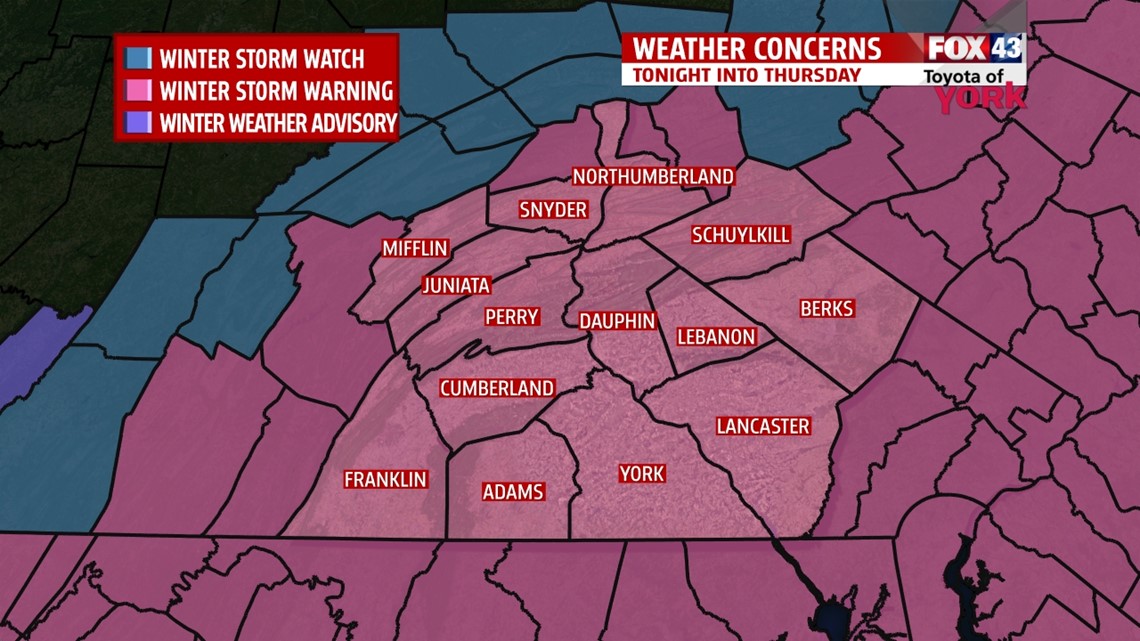
WINTER STORM WARNING in effect tonight through Thursday evening for the entire area.


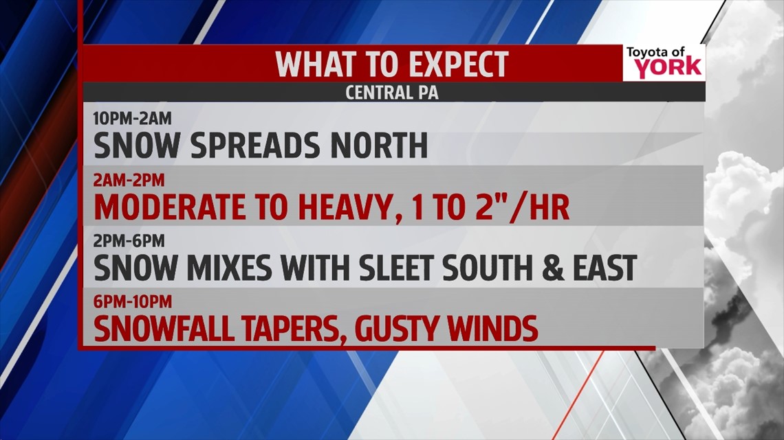
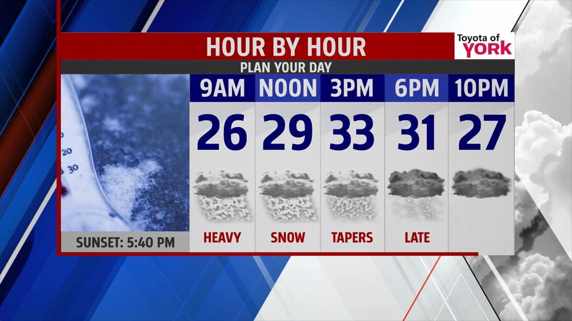
Snow is now creeping in from the south and will spread north and continue through the day Thursday. Some indications from the models show the snow lingering into early evening as moisture wraps around the departing storm. Snow will be heavy at times during the morning commute. Snow starts out light and powdery due to temperatures but as they warm, the snow will become heavier. Another complication to the forecast besides the track of the low is the amount of mixing that may take place in the afternoon. Models are now indicating sleet perhaps even freezing rain could mix with the snow. This would decrease snow amounts depending on how much mixing takes place. The best chance for snow to mix is south and east of across York and Lancaster Counties. Several inches will have accumulated by morning making traveling very difficult with snow covered roads.

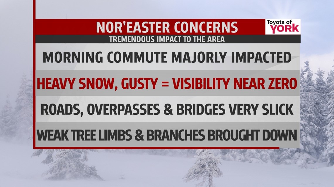
The main part of the storm will be under way by early morning. As it moves up the coast, Atlantic moisture will stream in, combined with upper level energy sets up a heavy snow band across our area. Where the band settles exactly could shift but for now appears to be mainly south and east of I-81.
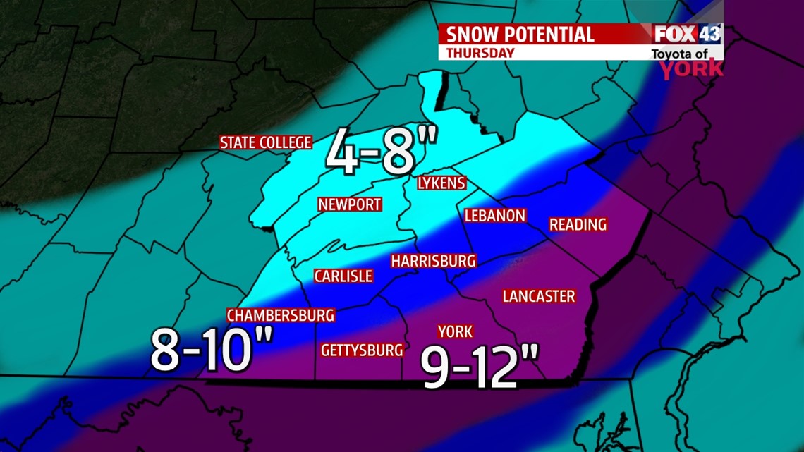
As of now, the potential for the area south and east to receive 8 to 12” is high with amounts decreasing north and west but still in the 4 to 8” range. There is the possibility of mixing with sleet and freezing rain later in the day which may knock down amounts a bit depending on how much and for how long we see a mix.

Precipitation will taper off towards evening west to east.

VALENTINES DAY: Looks like most of the day will be dry and quiet. Temperatures will be warmer and closer to average in the upper 30s. The next clipper system comes in Friday night into Saturday and may produce a few light snow showers.


WEEKEND OUTLOOK: Temperatures will continue cold and below average with morning lows in the teens and 20s and highs around 30° There will be another quick moving system Saturday night into Sunday morning which may produce some light snow flurries or light snow showers.
EARLY NEXT WEEK: Looks like temperatures warm a bit with rain showers possible late Monday. Highs Tuesday and Wednesday could reach the 40s!
MaryEllen Pann, Chief Meteorologist
Like me on Facebook: maryellenpannfox43
Follow me on Twitter: @MaryEllenFox43