

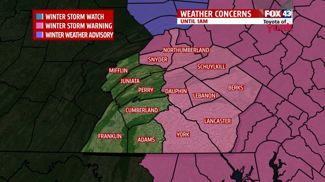
OVERVIEW: Upper low is intensifying and moving up the coast. Mix precipitation has now changed back to snow across the area. This storm will continue for the next several hours. It looks like the storm will lift out and we should see the snow ending in our southwest counties then our eastern counties around midnight and soon after. Our winds will pick up out of the north-northwest 10 to 20mph creating and drifting of snow. Temperatures will drop to the 20s causing wet surfaces to ice up. There will be another system diving to our south Friday night into Saturday which will bring snow once again. It is possible we could see several inches of snow with this system especially along the southern counties. Sunday morning another weak disturbance rides in and may produce some flurries. Next week it looks like milder temperatures in the 40s along with several opportunities for showers.
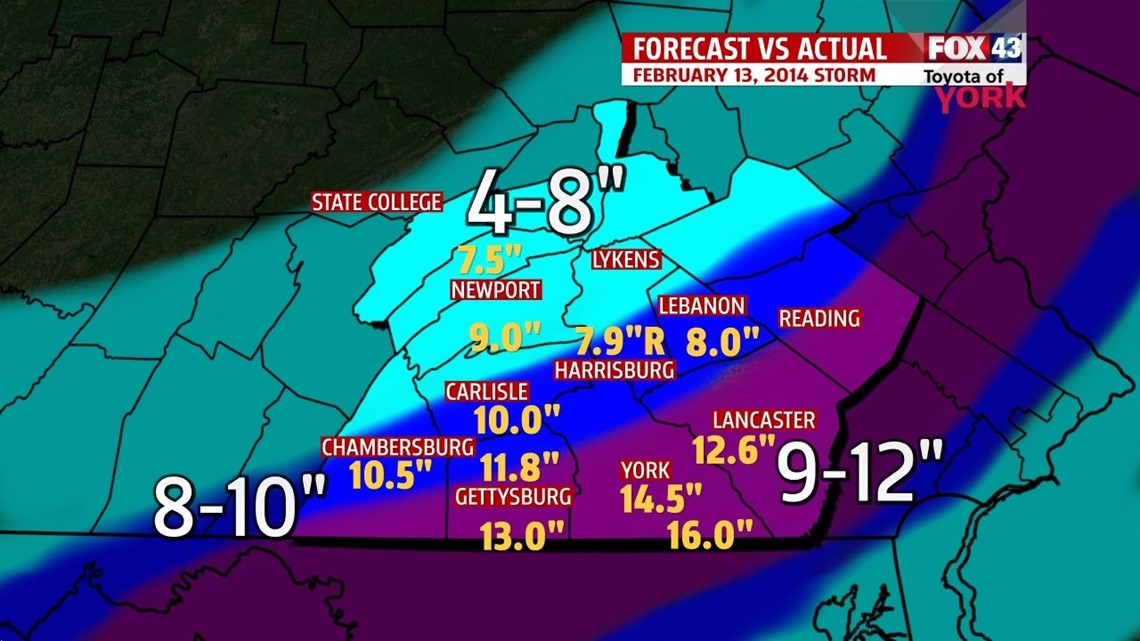
Here is a look at snow amounts compared to our forecast.

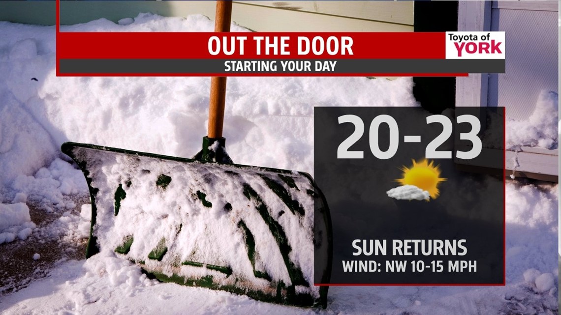
TONIGHT: Snow will end after midnight and skies will slowly clear. Temperatures will drop to the 20s this means wet surfaces will refreeze and make for slippery conditions in the morning. Parking lots, driveways, walkways and less traveled roads will be icy.

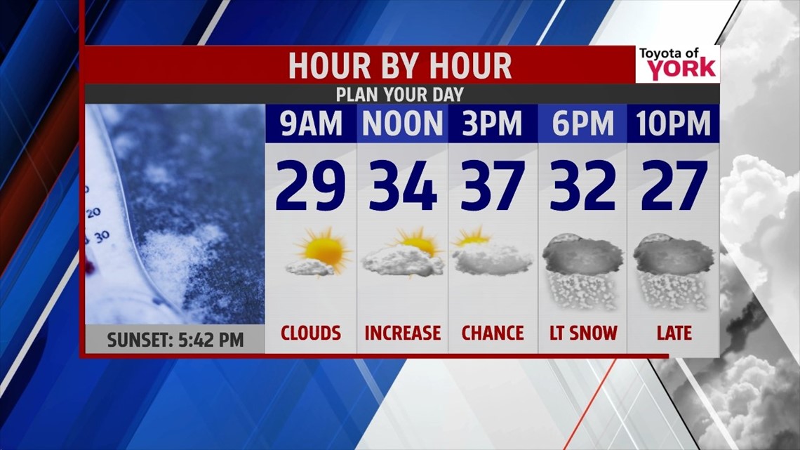
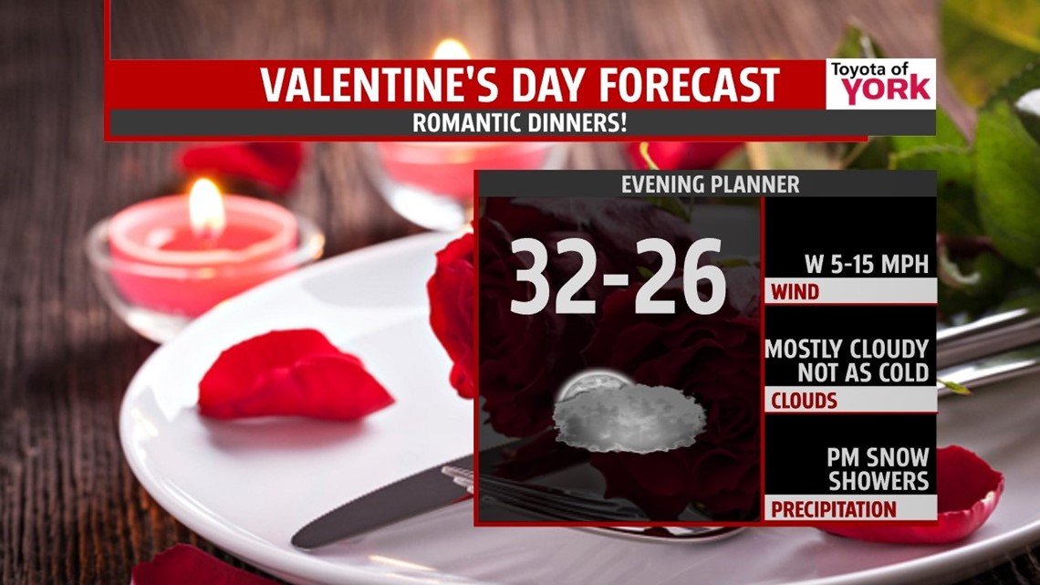
VALENTINE’S DAY: A breezy and sunny start to the day. Clouds will be increasing as the next system approaches. Highs will warm to the mid and upper 30s. A few flurries are possible in the late afternoon but a better chance for light snow arrives in the evening and overnight period. We could see several inches of snow with more to the south, lesser amounts north and west of Harrisburg.


WEEKEND OUTLOOK: Temperatures will continue cold and below average with morning lows in the teens and 20s and highs in the upper 20s to near 30°. Another quick moving system Saturday night into Sunday morning may produce some light snow flurries or light snow showers.
EARLY NEXT WEEK: There will be a chance for rain or snow showers Tuesday but most of the week should be fairly quiet. Temperatures also look to moderate into the 40s in the middle to latter part of the week.
MaryEllen Pann, Chief Meteorologist
Like me on Facebook: maryellenpannfox43
Follow me on Twitter: @MaryEllenFox43