
OVERVIEW: Cold air mass continues to hang across the area. We remain dry and will deal with clouds drifting in tonight and again Wednesday night as quick, weak clipper systems track north of us. High pressure remains strong, building in across New England, and keeping our temperatures below average a few more days. There will be front approaching Friday which helps to shift our winds and moderate our temperatures as we round out the week.
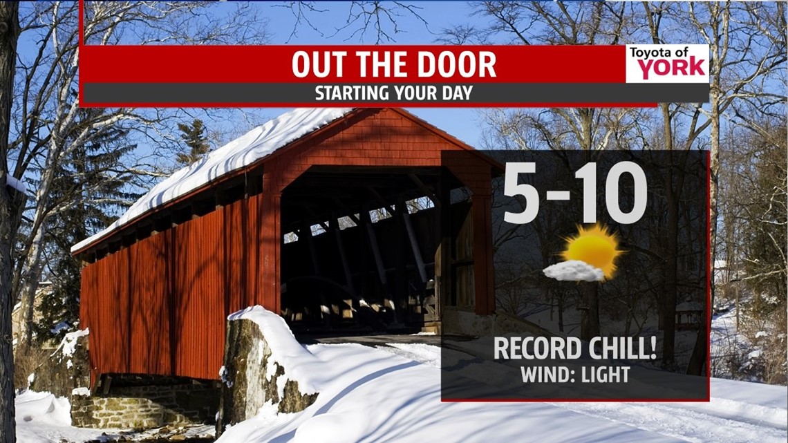
NEAR RECORD LOWS AGAIN: Tonight’s record low is 10 set in 1978. It is possible we could tie it. Skies will start out partly cloudy becoming mostly clear by morning. Lows will range from 5 to 10 degrees with light to calm winds.


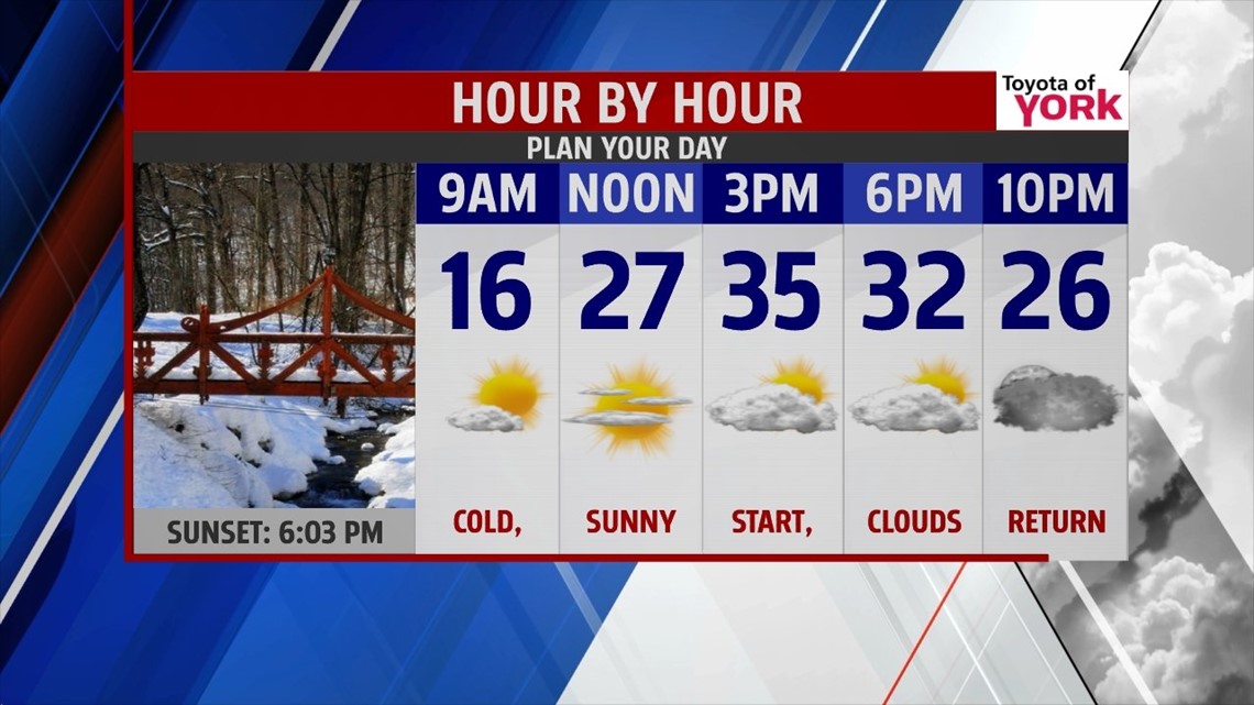
CLOSE CALL: We are keeping our eyes on a coastal storm that will come close to the area Thursday night into Friday. A persistent easterly flow which starts late Wednesday will help to stream in some moisture and clouds. There is a small chance for a rain or snow shower on Thursday as the easterly flow remains persistent and highs will still be running below average in the lower to middle 30s. The system will pull away by Friday late morning taking with it the clouds so more sunshine is expected to end the week before another frontal system returns. The next cold front approaches late Friday and the flow out ahead of it will moderate our temperatures so highs will finally be cracking 40 degrees as we warm to the low 40s. The front doesn’t push through the area until late Saturday so we will see even milder temperatures to start the weekend in the upper 40s to near 50. With the front dropping south Sunday, it may trigger a shower or flurries and will cool down the temps just a bit but we should still manage the low 40s for highs.
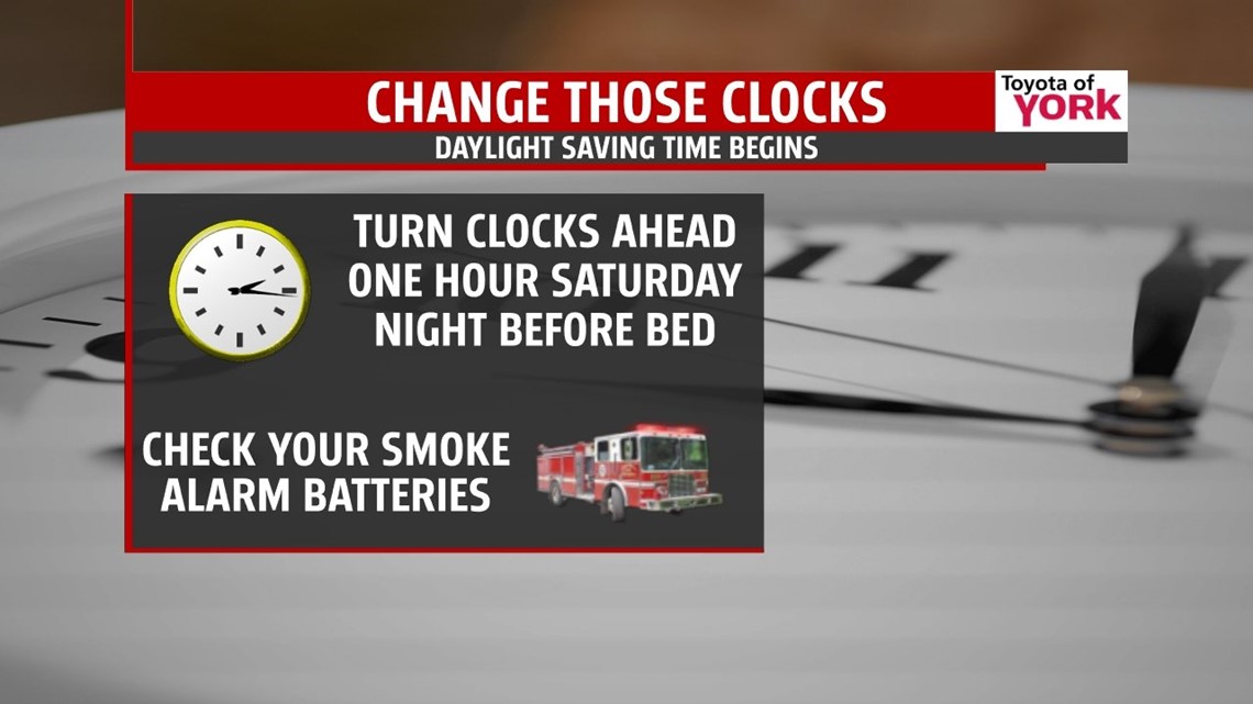
DAYLIGHT SAVING TIME TO BEGIN: March 9th we lose an hour of sleep as we spring ahead an hour Saturday night before going to bed but sunset will take place after 7pm!!! It’s also a good time to check and change the batteries in your carbon monoxide and smoke detectors.

EARLY NEXT WEEK: We are looking to see temperatures get to the 40s again Monday and Tuesday with dry conditions. The winds shift more southwesterly on Tuesday so we could see highs near 50.
MaryEllen Pann, Chief Meteorologist
Like me on Facebook: maryellenpannfox43
Follow me on Twitter: @MaryEllenFox43