

COOLING DOWN A BIT


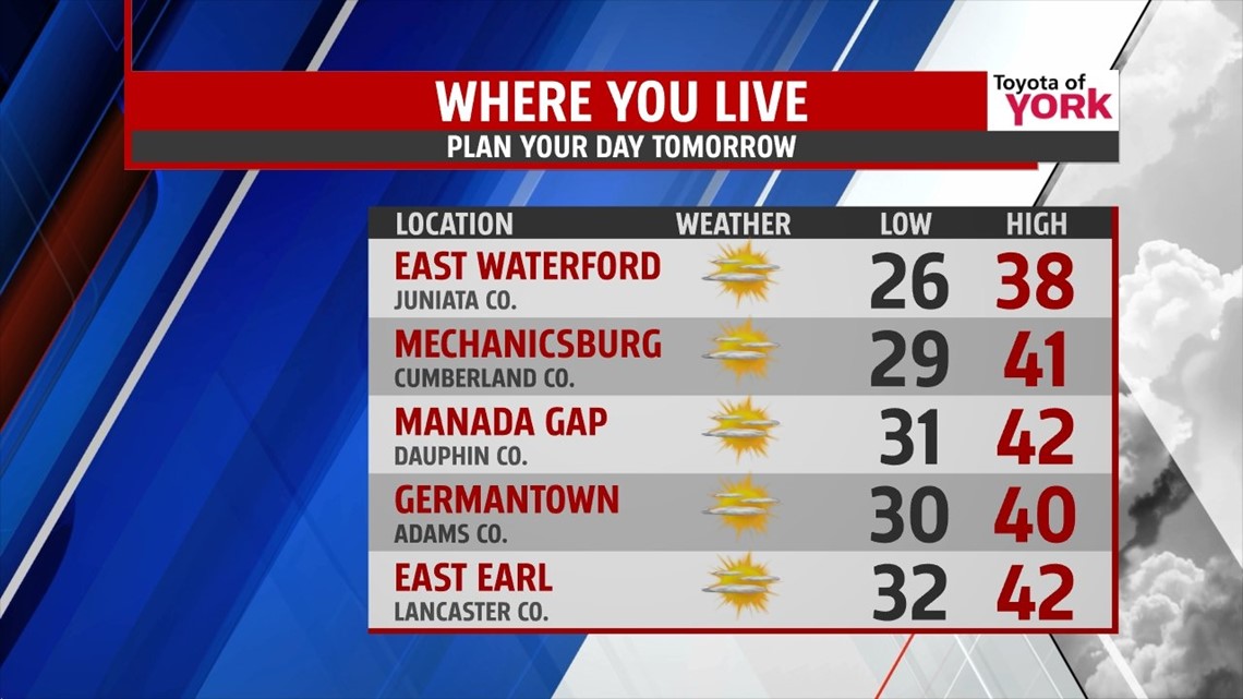
It’s been a nice reprieve from the bitter cold, but temperatures scale back a touch for Sunday as our next cold front approaches. It continues to thicken clouds through the evening hours, and it brings the chance for some sprinkles and rain showers. Overnight as temperatures cool, flakes mix in. No accumulations are expected. The front is quick to move out before daybreak and skies quickly clear. Lows fall into the upper 20s to lower 30s. Don’t forget, Daylight Saving Time begins Sunday morning! Push those clocks forward an hour before bed on Saturday night. It’s also a great time to change the batteries in your smoke detectors and carbon monoxide alarm. Sunday is dry with a plenty of sunshine. Highs are in the upper 30s to lower 40s.
MORE MILD DAYS
Conditions stay quiet into the beginning of next week, with temperatures continuing to rise. It’s fairly cloudy both Monday and Tuesday with a warm front draped just to our north. That shouldn’t prevent temperatures from being near 50 degrees on Monday and rising into the middle 50s on Tuesday!
NEXT STORM SYSTEM
Our next storm system comes this way Wednesday, bringing rain showers with temperatures still mild to start. Cold air rushes in behind the system late Wednesday into very early Thursday morning, so it’s possible we could see some snow on the backside of the storm as it lifts away. Either way, it’s a return back to the cold that lasts through Thursday. Friday and Saturday moderate, with temperatures rising from the 40s into the 50s again.
Enjoy the rest of your weekend!
-Andrea Michaels