

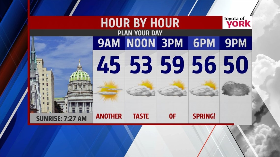
MILD START TO THE WEEK
A taste of spring has returned across the area this afternoon. The clouds are exiting too, and that trend continues through the evening hours. Skies are mostly clear through a good chunk of the night. Lows are mild in the upper 30s to lower 40s. The breezes are slow to taper through the night. Clouds return during the early morning hours Tuesday, and stick around through much of the day. It’s mild once again, with highs in the upper 50s to near 60 degrees in many spots!
NEXT STORM SYSTEM

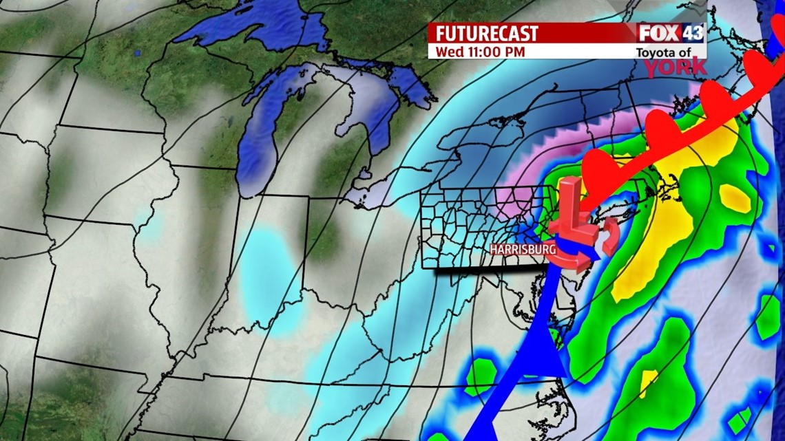
Our next storm system comes this way Wednesday, bringing rain showers with temperatures still mild to start. Highs reach the 50s yet again. Colder air comes rushing in behind the system Wednesday evening, and rain will end as snow showers for some spots, mainly to the north and northwest. No accumulations will result from this; it’ll be too warm beforehand for any snow to stick. Temperatures fall into the 20s Wednesday night, leading way to a cold and breezy Thursday with highs near 30 degrees.
QUIET PERIOD
Friday and Saturday moderate, with temperatures rising from the 40s into the 50s again. There’s plenty of sunshine for Friday, but clouds return again Saturday. There’s a chance for a few showers Saturday, but the day does not look like a washout. Sunday temperatures drop into the 40s. Monday turns unsettled with a chance for rain and snow showers.
Have a great night!
-Andrea Michaels