
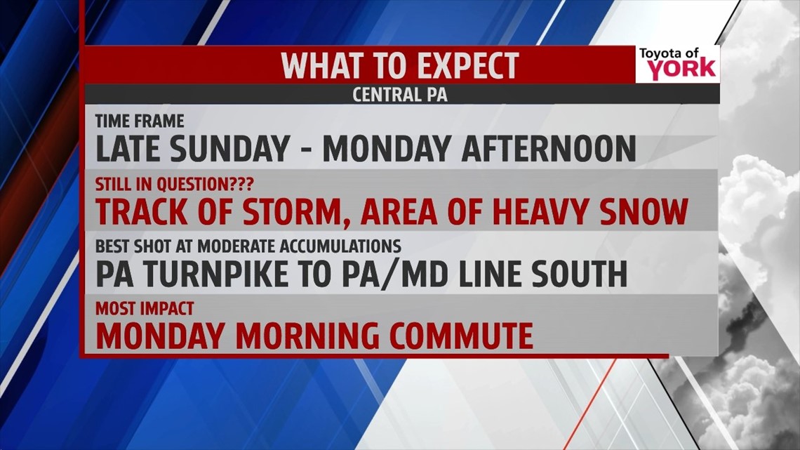
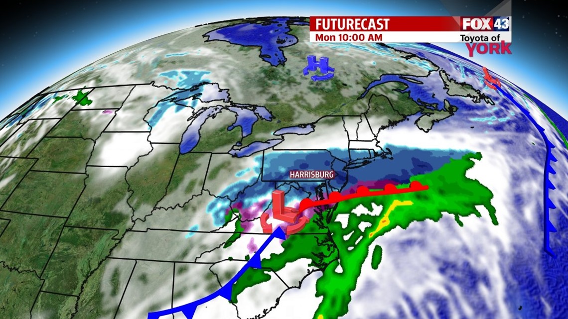
STORM UPDATE: As of the latest model runs this morning, it looks like the storm has trended so far south, it will be a miss for us. So that means we are not looking at snow for the area. There could be some flurries but the accumulating snows should remain well south of the MD line. Andrea will be in later to assess afternoon model runs, if things change she will send out an update. Enjoy the mild temperatures as it will still chill down for the second half of the weekend!

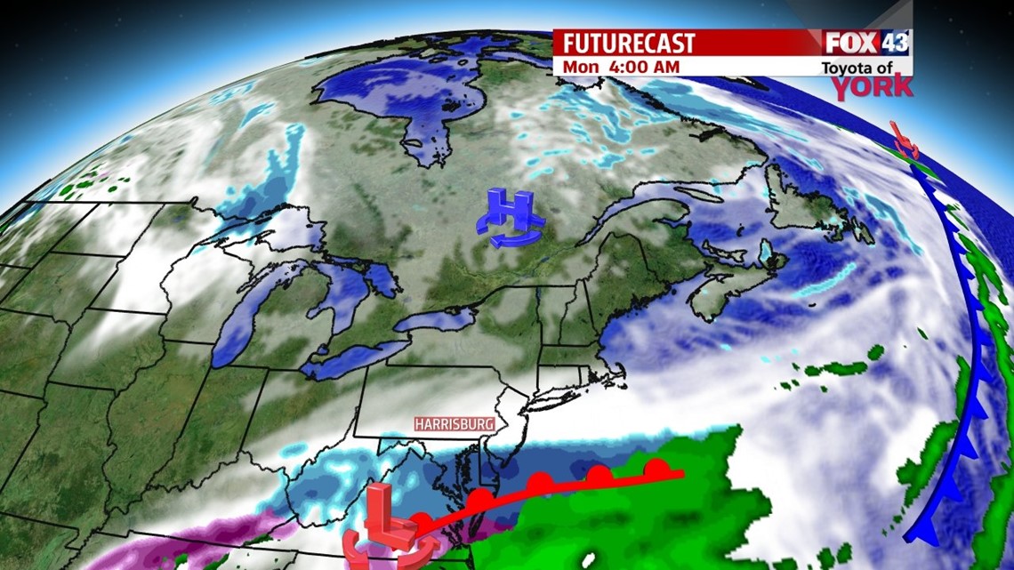
OVERVIEW: Clouds have returned as a cold front approaches from the west this afternoon. Temperatures are much warmer as winds have picked up out of the south-southwest bringing in milder air. There could be a few drops or a brief shower after midnight with the front as it pushes eastward but any rain threat will be gone by early morning. Secondary front pushes through late in the afternoon with little to no moisture with it but it will be followed by much cooler air. High pressure builds in Saturday night into Sunday morning and will assist in reinforcing colder air. Eyes on the next system expected to eject out of the southwest bringing snow to the area late Sunday into Monday. Cold start to the week next week but temps should rebound by the middle part of the week.
THIS EVENING: Clouds thicken, breeze continues and both will keep temperatures mild. Temperatures will fall from the 50s to the middle 40s.
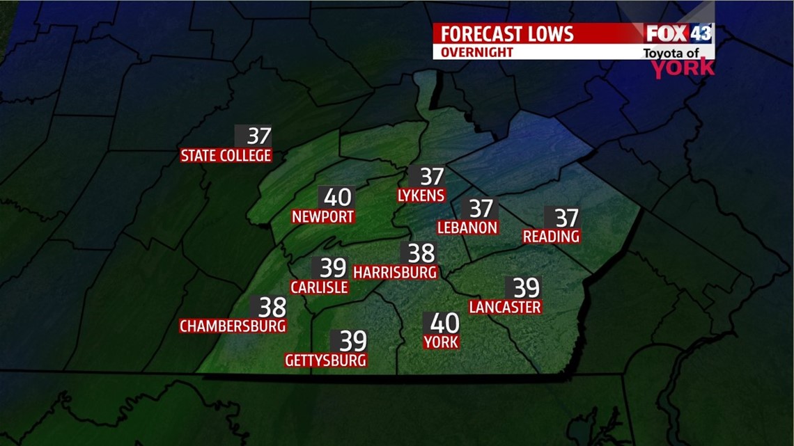
OVERNIGHT: Skies will be mainly cloudy with a chance for a few isolated showers after midnight as a cold front traverses southward. The clouds and mild breeze will keep lows in the upper 30s, which will be much milder compared to the last few mornings.

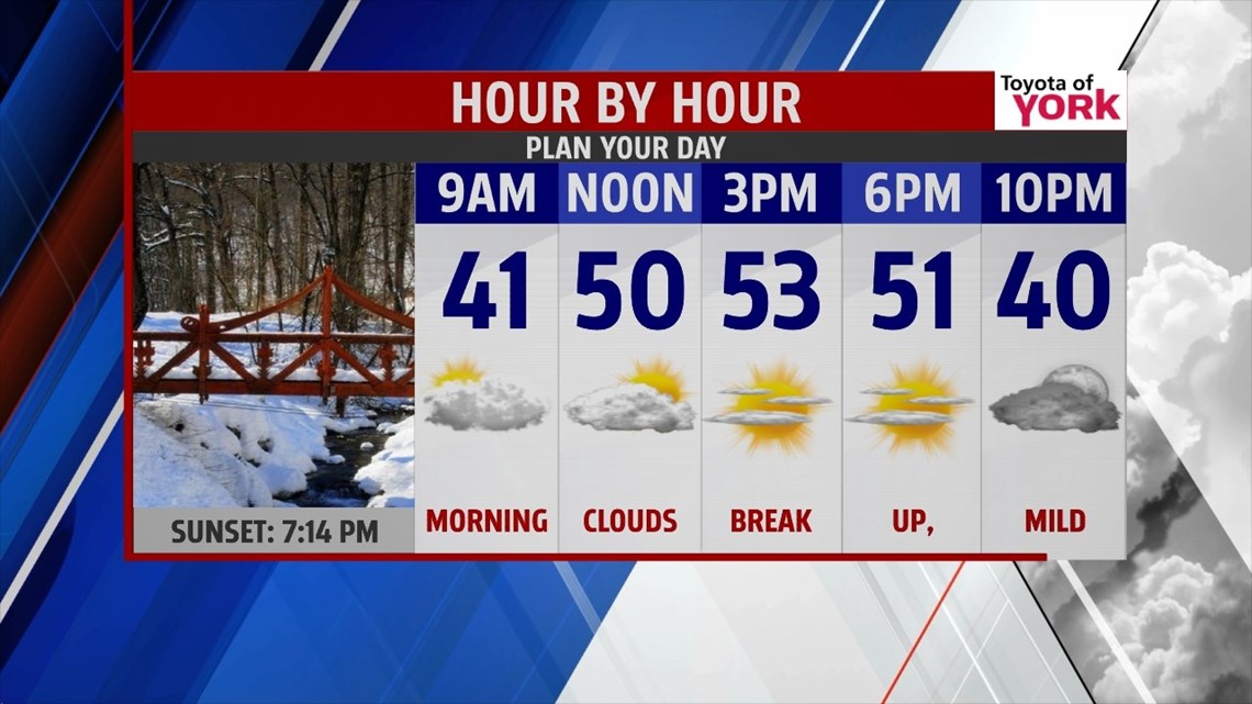
SATURDAY: Morning clouds give way to more sunshine by afternoon. Winds will pick up out of the west which will provide another mild day in the 50’s. Another front pushes south late in the day but has no moisture associated with it. It will bring in much colder air by the second half of the weekend.


THINK SPRING: Spring officially arrives 7 days from now. So even though we could see snow early next week, spring officially arrives next Thursday!!! Let’s hope it starts to feel like it soon.
Have a great day!
MaryEllen Pann, Chief Meteorologist
Like me on Facebook: maryellenpannfox43
Follow me on Twitter: @MaryEllenFox43