
OVERVIEW: Low pressure that brought some snow to the area has pulled well away allowing high pressure to nose into the area. Cold front comes through very late Wednesday and Thursday. And during the early part of Thursday, we’ll see some upper level energy swing through early in the day producing some clouds but nothing more. Friday, a warm front slides to our north allowing much milder air to flow in. It will be followed by a cold front Saturday afternoon. Upper level pattern goes zonal late Thursday into Saturday night before a trough digs in, bringing in colder air along with breezy conditions for the second half of the weekend into Monday.
THIS EVENING: Clouds will break up, winds will be light out of the east and temps will fall from the middle 30s to the upper 20s.
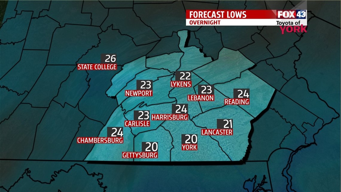
TONIGHT: Partly cloudy skies with a light easterly breeze, lows down into the low 20s.


NEXT RAIN CHANCE: Wednesday will bring our next chance for showers as a cold front approaches from the west. There may be a slug of moisture that arrives early enough, which would result in a brief shot of freezing rain. A bulk of the moisture comes in later in the day and temperatures will be warm enough to support rain. Front is through in the overnight period. Highs will warm to the low to mid 40s.
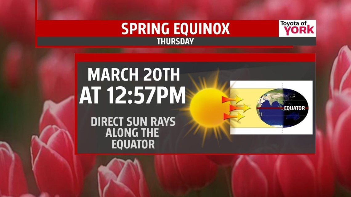
MILD DAYS AHEAD: As we head into the first day of spring, we start to enjoy temperatures cracking 50 degrees. We’ll enjoy several days in the 50s before colder air returns Sunday.

Have a great day!
MaryEllen Pann, Chief Meteorologist
Like me on Facebook: maryellenpannfox43
Follow me on Twitter: @MaryEllenFox43