
OVERVIEW: High pressure moves east setting a southeasterly flow. A warm front moving in from the west, will bring back the clouds tonight and aid in producing some freezing drizzle, freezing rain and rain by morning. A cold front will trigger more rain showers in the afternoon. With the persistent southeasterly flow, temps
THIS EVENING: Nice sunshine before it sets. Temps fall from the low 40s to the mid 30s.
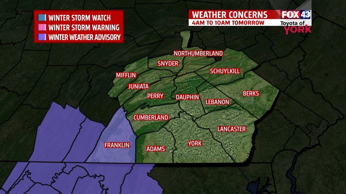
OVERNIGHT: Clouds fill back in with freezing drizzle or freezing rain developing by morning. Best chance will in the southwest across Franklin County. Elsewhere, it may take awhile for the precipitation to fill in and by then, temps will have warmed to freezing or above. Lows will be in the upper 20s to low 30s.

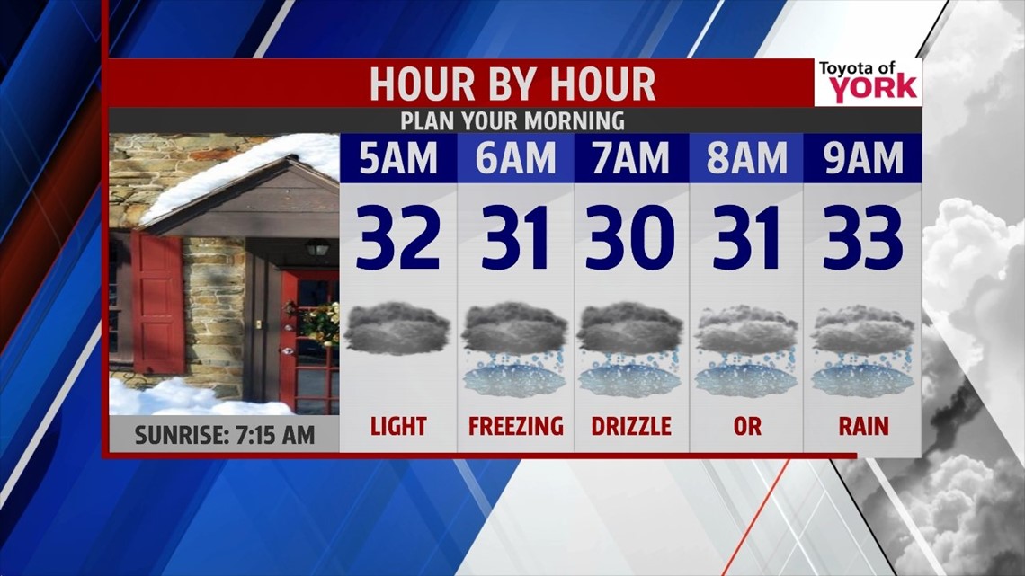
WINTER WEATHER ADVISORY FOR FRANKLIN COUNTY: There is the possibility for a light glaze of ice to form as there is a chance for freezing rain early morning. This could make traveling a bit tricky early morning so allow for some extra time.

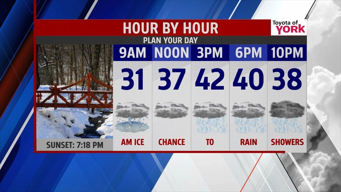
TOMORROW: Overcast skies with afternoon showers likely as a cold front approaches from the west. Highs will be cool once again in the low 40s. Winds will be breezy out of the southeast 10 to 15mph.

MILD DAYS AHEAD: As we head into the first day of spring, we start to enjoy temperatures cracking 50 degrees. We’ll get to enjoy plenty of sunshine Thursday and Friday with highs in the low 50s. Another cold front comes in Saturday but with little moisture. Still mild with 50s to start the weekend but colder air returns Sunday.
Have a great day!
MaryEllen Pann, Chief Meteorologist
Like me on Facebook: maryellenpannfox43
Follow me on Twitter: @MaryEllenFox43