
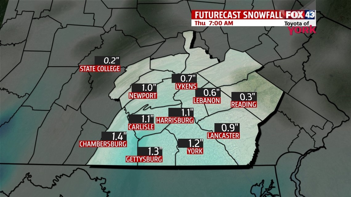
SNOW SHOWERS: Yupper, the winter that just won’t give up brings us snow showers today. A potent, growing storm system off the east coast will stay far enough away to keep any massive snows off the table, but enough energy will swing through allowing for light snow showers today. Expect a dry morning commute but mid morning hours, light snow showers arrive. Scattered light snow can be expected, on and off for several hours through the daylight hours. Expect a break in the early evening, with a final band of snow showers rolling through later this evening into overnight tonight. Accumulations look limited, with most seeing C-1” and an isolated few spots around 2”. This is a minor event, but slick spots are expected. Highs today are in the middle 30s.

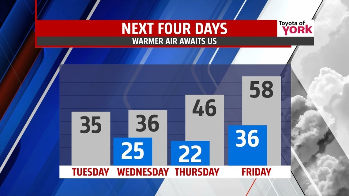
CHILLED WEDNESDAY: Cold air is reinforced for the day with highs in the middle to upper 30s. Despite sunshine, a gusty northwesterly wind keeps the chill in place for the day.
WARMER: Warm air drifts north into the state for late week. We’re talking temperatures in the upper 40s Thursday with increasing clouds. Friday, we’re into the upper 50s, but a front moves in bringing more clouds and the chance for showers.

WEEKEND: The weekend starts with another quick wave that will keep us seasonal but wet. Showers arrive Saturday as a system passes by, so expect a soggy day with highs in the middle 50s. Sunday, clouds break and seasonably cool air greets us. Highs hit the middle 50s. The nice weather spills into the start of next week.
Make it a tremendous Tuesday!
“For every minute you remain angry, you give up sixty seconds of peace of mind.” – Ralph Waldo Emerson
– Jeff Jumper, WPMT FOX43 Morning Meteorologist
Follow me on Twitter: @JeffJumperWX
Like me on Facebook: Jeff Jumper FOX43