
OVERVIEW: Gusty winds will diminish this evening as low pressure to our north moves away. Mild dry air will move in for the next couple of days. It will be cooler for Wednesday but high pressure will build in by Thursday bringing back milder air. Showers arrive Friday with our next frontal system. A few isolated showers may linger into the early morning hours of Saturday but overall the weekend looks great.
THIS EVENING: It’s breezy but plenty of sunshine mixing in and out of puffy cumulus clouds. Temperatures are running in the upper 50s to around 60 but will fall back to near 50 as we head towards 10pm. Winds will continue to ease up a bit the next few hours.
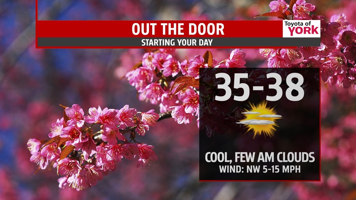
OVERNIGHT: Partly cloudy to mostly clear skies. It will be much cooler with lows dipping into the mid and upper 30s. There will be a slight breeze out of the northwest.

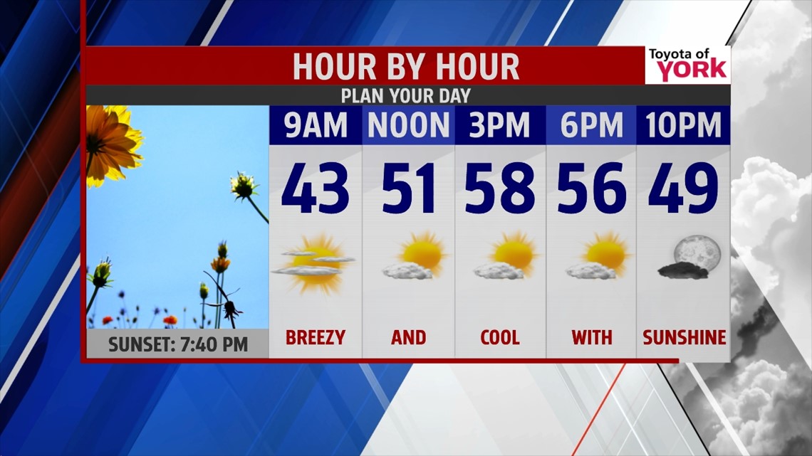
TOMORROW: A great looking day with mostly sunny skies however, temperatures will be a tad below average only warming to the mid and upper 50s. Winds will pick up during the day out of the northwest 10-15 mph but will relax in the evening as high pressure builds in.

REST OF THE WEEK: Thursday, with the high setting up in the Atlantic, will provide a milder flow out of the south-southwest. This in combination with mostly sunny skies will help temperatures jump ten degrees into the mid and upper 60s. Friday another weak front comes in. Timing is still a question but we should see a few showers and maybe a rumble of thunder. With the clouds and possible rain, temperatures will be cooler in the low 60’s.
WEEKEND OUTLOOK: Should be a nice weekend to look forward too. A little disturbance early Saturday keeps a small chance for showers around in the morning. The clouds will quickly clear and the rest of the day looks to be mostly sunny with highs in the upper 60s. Sunday despite increasing clouds should remain mild and well above average near 70.
STARTING WET NEXT WEEK: We stay mild for Monday with highs near 70 again but the next system will be approaching bringing an increase in clouds and the threat for showers Monday. They are likely to linger into Tuesday. Cooler air in the upper 50’s to low 60’s returns for Tuesday behind the front.
Make it a great day!
MaryEllen Pann, Chief Meteorologist
Like me on Facebook: maryellenpannfox43
Follow me on Twitter: @MaryEllenFox43