

WARM & BREEZY DAYS AHEAD

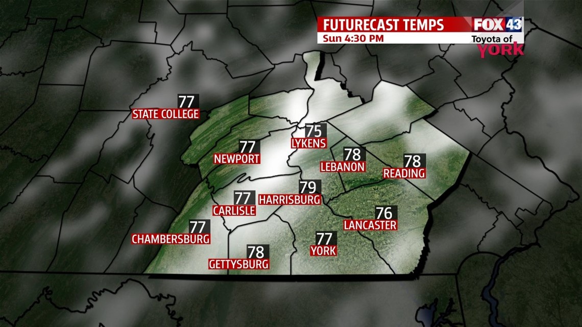
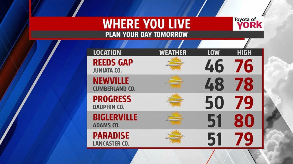
After a clear and mild day, temperatures are expected to quickly tumble through the evening out of the 70s and into the 60s. It’s clear to start, but after midnight some clouds begin to roll in with an approaching warm front. Overnight low temperatures fall into the middle 40s to lower 50s. The clouds hang around through mid-morning, and then begin to lift north as the front exits. This allows temperatures to soar through the afternoon, with strong southerly breezes bumping highs into the middle to upper 70s. Many spots flirt with 80 degrees. Monday clouds quickly increase ahead of an approaching cold front, with highs reaching the middle 70s. It’s another breezy day too.
NEXT SYSTEM
The cold front brings showers to the area Monday night. Heavier showers, perhaps a few rumbles of thunder too, are expected as the cold front sweeps through late morning to mid afternoon Tuesday. Highs temperatures reach the 60s, and then rapidly plummet once the front crosses. It’s a gusty day as the colder air rushes into the region.
QUIET AGAIN
The weather turns quiet again through week’s end. Highs fall into the 50s Wednesday under a mixture of sunshine and clouds. Temperatures rise back to near seasonable averages under plenty of sunshine Thursday. Expect highs near 60 degrees. Friday is a little warmer, and ample sunshine continues. Our next storm systems looks to bring soaking rain on Saturday, with cool temperatures in the 50s.
Have a great night!
-Andrea Michaels