
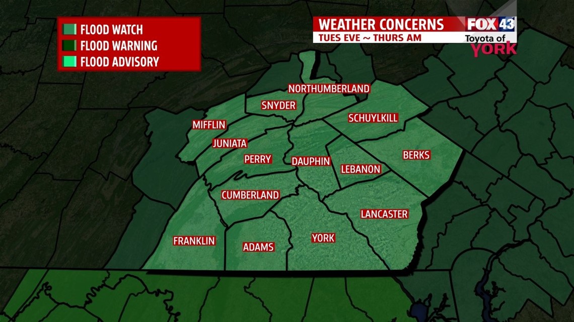
FLOOD WATCH for Tuesday into Thursday for the area as quite a bit of rain is expected to accumulate the next couple of days. Anywhere from 2 to 4” or more of rain may lead to minor flooding especially in poor drainage areas, small creeks and streams. The major rivers will see rises but should remain below flood stage. The concern right now is for the smaller tributaries.

THIS EVENING: Showers are spreading in from the west and will continue to move east. Rain will be light this evening and overnight but pickup from time to time through the day Tuesday. Easterly flow will keep low level moisture around producing fog, mist and light showers. Temps will fall out of the 60’s rather quickly into the mid 50s.
OVERNIGHT: Rain continues overnight thanks to a persistent easterly flow. Fog, mist and wet weather remains due to an easterly flow for the next 24 hours.


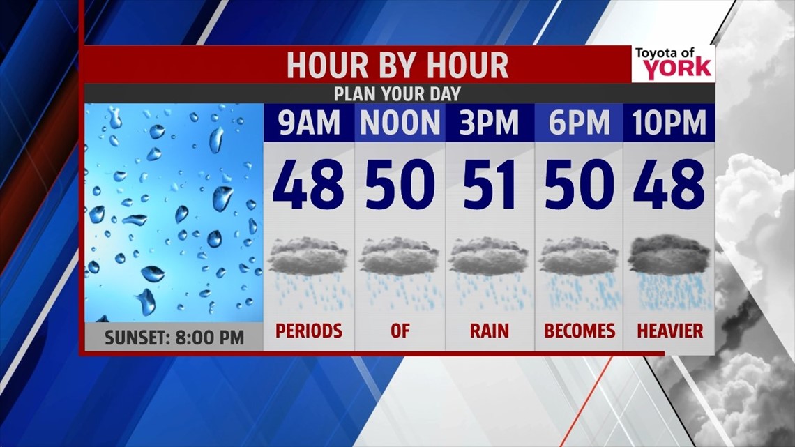
TUESDAY: Periods of rain likely through the day. It will be raw with temperatures remaining far below average in the upper 40s to low 50s. Winds will be persistent out of the east 10-15 mph. Tuesday night the rain could become heavier. Can’t rule out a rumble of thunder although the best threat for storms will remain far to our south.

UNSETTLED WEEK AHEAD: Wednesday will be another wet day with heavy rainfall. Warm front pushes north early followed by the cold front overnight. Temperatures will slowly climb through the day and evening into the upper 50s to low 60s but it will take all day. Impressive rainfall amounts are likely. Again we’ll be watching for the potential of minor flooding. Thursday our rain chances drop but are a few showers in the afternoon are still possible as we remain under the influence of colder air aloft which will interact with daytime heating, combine with the some upper level energy, resulting in a few showers, maybe a few thunderstorms. Even though clouds will be in abundance, highs will warm to around 70. Friday appears the least likely for rain in the next four but there is still a small threat for isolated showers. Cooler air behind the cold front will drop afternoon highs to the low to mid 60s under partly sunny skies.


WEEKEND OUTLOOK: Another cold front and some upper level energy will trigger a few showers on Saturday. Highs will be in the middle 60s with plenty of clouds to start the weekend. Flow becomes more zonal and we see more sunshine by Sunday. We could still see an isolated shower but most will remain dry. Highs will warm to the upper 60s. Heading back to work Monday it appears we will be dry with minimal rain chance and highs in the middle 60s.
Stay dry and keep an eye out for rising water if you live nearby a creek or stream.
MaryEllen Pann, Chief Meteorologist
Like me on Facebook: maryellenpannfox43
Follow me on Twitter: @MaryEllenFox43