
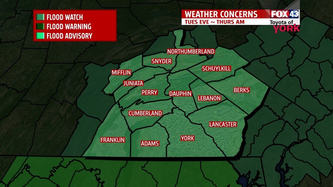
FLOOD WATCH: is in effect tonight until Thursday morning. Main threat for flooding will be along the creeks and streams and poor drainage areas. Low lying areas may also experience some problems. If your basement is prone to flooding during rain events you will need to be prepared for the possibility of minor flooding issues.

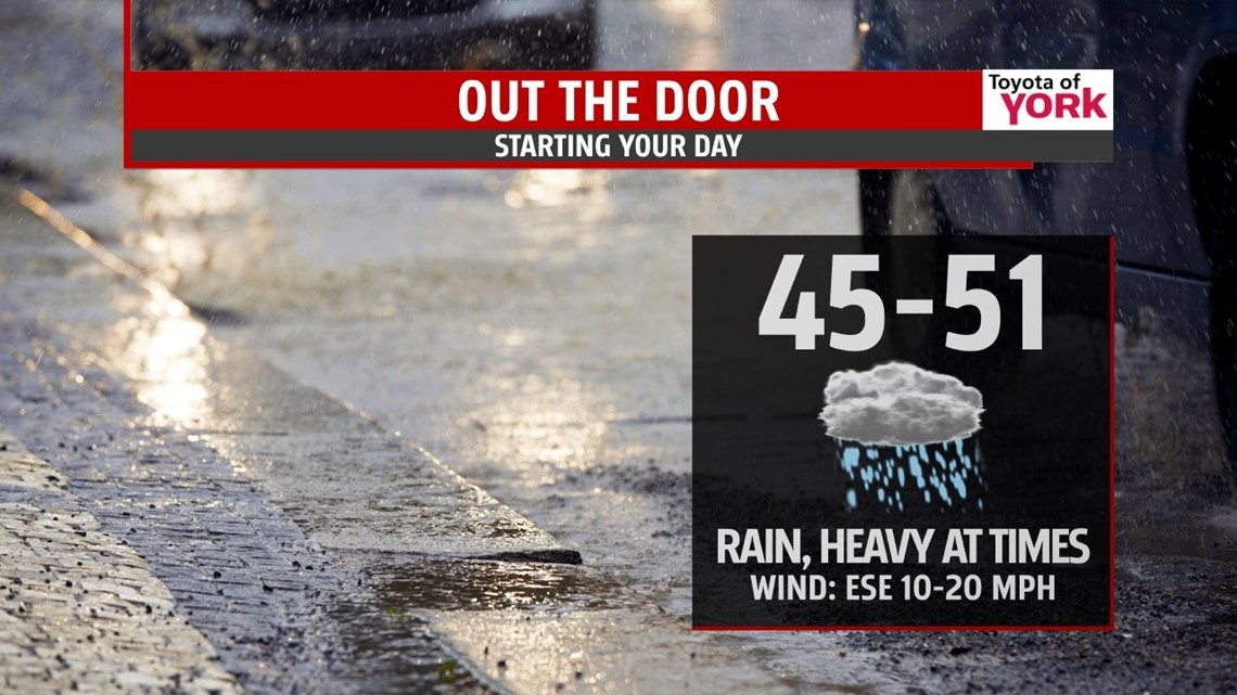
EVENING FORECAST: Rain will continue this evening as an upper level low moves slowly northward through the Midwest. We are on the east side of this system and will continue to see an influx of moisture from the Gulf and with an easterly flow, will see moisture enhanced from the Atlantic. Temperatures will hold steady and on the cool side in the 40’s.
OVERNIGHT: Rain will be heavy at times as some mid level energy swings in overnight. This will enhance rainfall amounts across the area. Temps may fall a few degrees to the low to mid 40s.

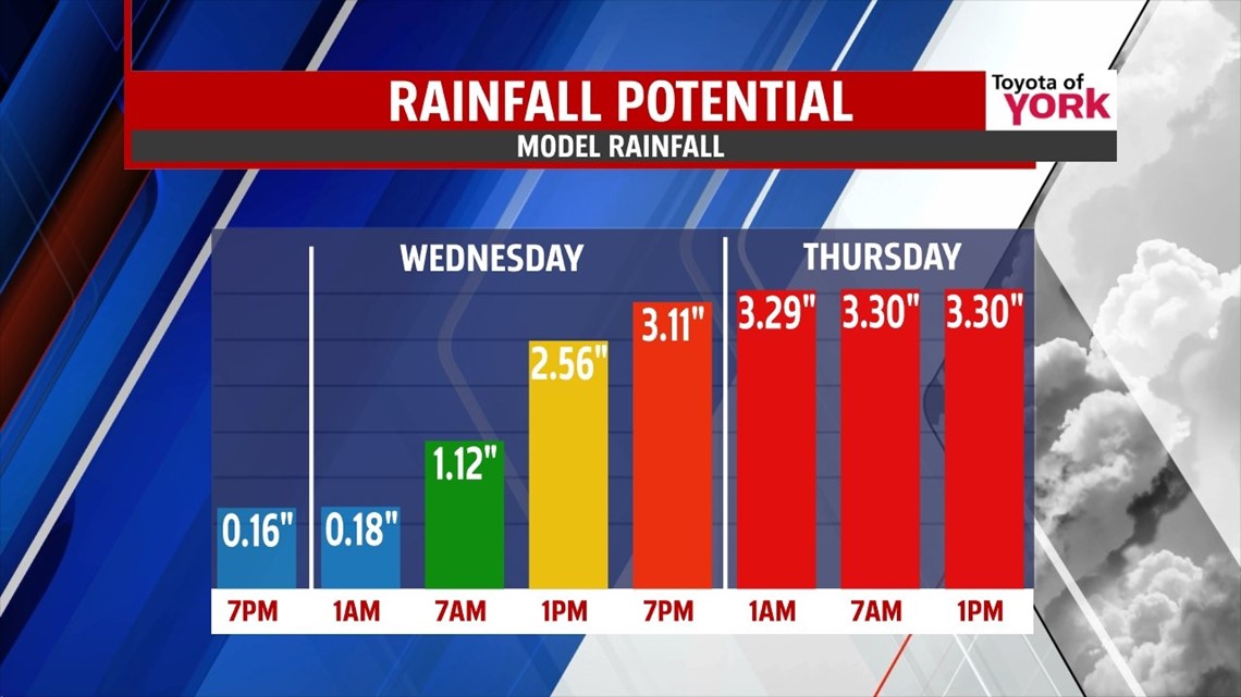
WET WEDNESDAY: Periods of heavy rain will continue through the day. Warm front pushes north shifting our winds more to the south. This will help to slowly warm temperatures. Our high temp of near 60 will likely take place very late in the evening hours while most of the day is spent in the 40s and low 50s. A strong mid-level jet and approaching cold front may produce the potential for very heavy rain to set up over top of us and may also trigger a few thunderstorms. Rain starts to wind down overnight into Thursday as the upper level low weakens over the Great Lakes. Thursday looks to be much drier with just a few showers possible in the afternoon. Highs will be mild in the low 70s.


RAINFALL AMOUNTS: Still expect to see storm total rain amounts around 3 to 4 inches by the time the storm moves out of the area Thursday morning. Models are all coming up with an average of a little over 3”.

FRIDAY INTO THE WEEKEND: We get a nice break from the wet weather Friday with partly sunny skies. Highs in the middle 60’s. Our next system comes in Saturday bringing another threat for showers to start the weekend. Temperatures will remain just a tad below average in the low 60s. By Sunday and Monday we are dry once again with sunshine and highs, a bit cooler than average, in the middle 60’s.
Stay dry and keep an eye out for rising water if you live nearby a creek or stream.
MaryEllen Pann, Chief Meteorologist
Like me on Facebook: maryellenpannfox43
Follow me on Twitter: @MaryEllenFox43