

EVENING FORECAST: The next few hours there remains a threat for scattered showers and maybe a rumble of thunder. Otherwise, it will be partly to mostly cloudy skies, muggy and warm with temps fall through the 70s.
OVERNIGHT: Partly to mostly cloudy skies, muggy and warm with lows well above average in the low to mid 60s. There is only an isolated threat for shower but much of the overnight looks dry.
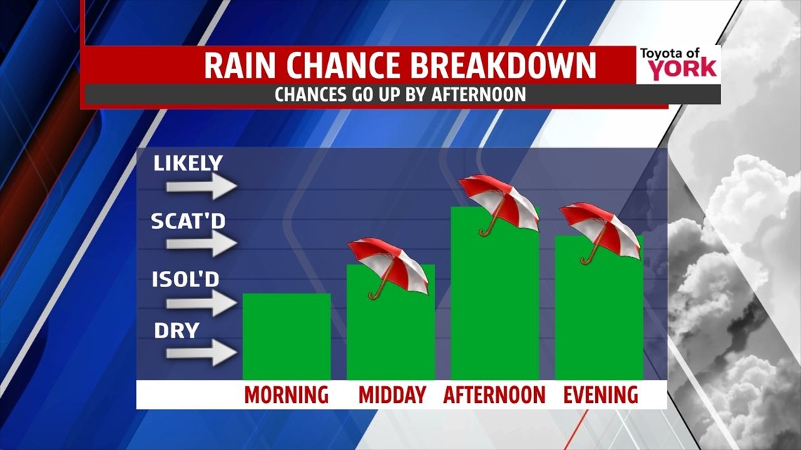
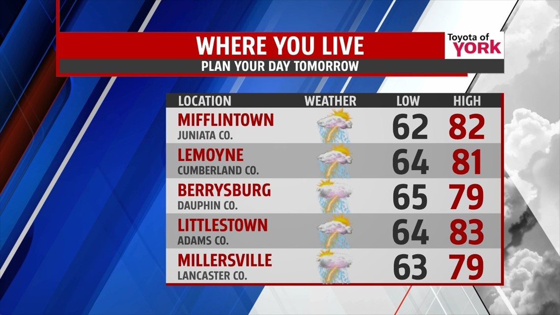
SEVERAL DAYS OF SCATTERED SHOWERS AND STORMS: There will be chance for scattered showers and thunderstorms tomorrow, mainly in the afternoon. Highs will be tricky thanks to a backdoor cold front that slowly sags in our direction from the northeast, so areas where the front pushes through will remain in the mid to upper 70s, while areas south of the front will warm to the low 80s. Wednesday, the front stays to our south before moving back to the north as a warm front. This means our flow is out of the east-southeast and that will keep the low level moisture around resulting in more clouds and a continued threat for showers and thunderstorms. Highs will be cooler in the low to mid 70s. Thursday we get back into the warm sector so despite the clouds hanging around and the threat for showers and thunderstorms, highs will bounce back to the upper 70s. Friday the front and upper level trough finally arrive bringing a good shot of wet weather to the area. Highs will be held to the upper 60s.

WEEKEND OUTLOOK: Upper level trough and energy keeps the clouds around mixing with sunshine. Temperatures will be noticeably cooler in the upper 60s both days. Some upper level energy swinging in late Sunday may trigger a few isolated showers that may linger into early Monday.
EARLY NEXT WEEK: Monday will start out with clouds and possibility of showers with improving conditions later in the day. Highs remain in the 60s.
Have a good day!!!
MaryEllen Pann, Chief Meteorologist
Like me on Facebook: maryellenpannfox43
Follow me on Twitter: @MaryEllenFox43