
DREARY WEATHER CONTINUES
A backdoor cold front has stalled across the region, with an east/southeasterly flow keeping the clouds and cool air in place. Sunshine has broken out in our locations to the far west and northwest, helping to warm temperatures there out of the 60s. The sunshine combined with some moist air could spark a few thunderstorms out there through the evening, but most are dry. Overnight, the foggy and misty conditions return to the region. A couple light showers are also possible. Temperatures don’t budge much and fall into the lower to middle 60s overnight. The humidity also returns.

WET END TO THE WEEK
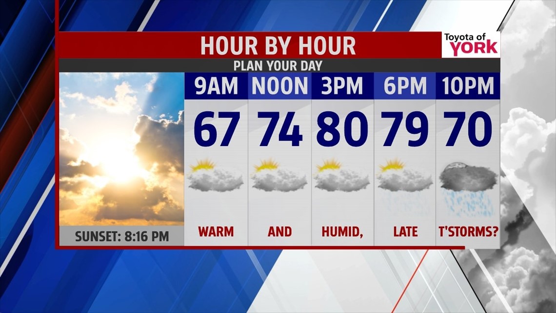
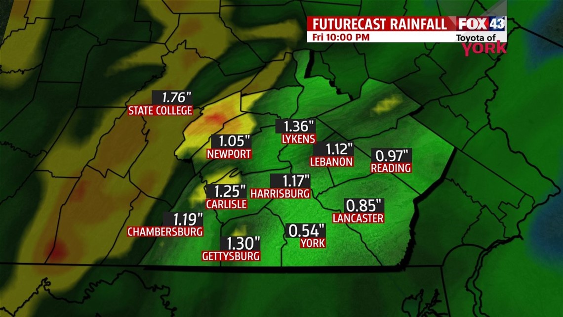
The stalled front dissolves early Thursday and allows the fog and mist to break. A slow moving cold front approaches through the rest of the day. A breezy and warm flow helps bring warmer air back to the region. By late day, a few thunderstorms will pop up, with some locally heavy downpours possible. Highs are in the upper 70s to lower 80s throughout the area. Overnight Thursday expect plenty of rainfall with some rumbles of thunder possible. Some spots can receive an inch or two of rainfall through Friday, so we’re keeping an eye on some flooding concerns for poor drainage roads and area creeks and streams. It’s also gusty, with some rumbles of thunder still possible. Temperatures will slowly fall through the 60s Friday, with the rain wrapping up during the afternoon.

DRYING OUT FOR THE WEEKEND
The cold front pushes out by Friday night, bringing drier and less humid weather back to the area just in time for the weekend. Cooler air also works in too! Expect sunshine with some afternoon clouds on Saturday, with high temperatures in the mid to upper 60s. Sunday is similar. The only difference is a weak disturbance swings down, increasing clouds and bringing the chance for a shower or two. Most of the area stays dry. Highs are in the 60s yet again. Monday there is still the chance for a few showers. Otherwise, temperatures look to warm back into the 70s with a mixture of sunshine and clouds through the middle of next week.
Discussion written by Meteorologist Andrea Michaels
Have a great day!
MaryEllen Pann, Chief Meteorologist
Like me on Facebook: maryellenpannfox43
Follow me on Twitter: @MaryEllenFox43