
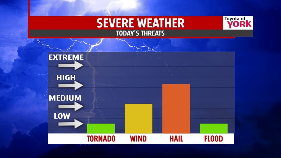
SHOWERS & STORMS: A cold front slowly sags southward today into Wednesday. With it we have mostly cloudy skies and showers and thunderstorms over the next two days. Today, expect highs to top out in the middle 80s with scattered showers and thunderstorms. Some of the storms may be strong with a potential for damaging hail and some gusty winds. Tonight, we drop into the middle 60s, hanging on to the clouds and a few storms. Wednesday, showers and storms linger early, with cooler air arriving late. It’s mostly cloudy with highs in the upper 70s.

THURSDAY COOL DOWN: Low level flow kicks in out of the east for Thursday. What does this mean for us? Moisture gets trapped in the low levels, bringing in a deck of clouds and a supply of cooler air off the Atlantic. This means highs will only touch the upper 60s with limited sunshine. A few showers will be possible as well.

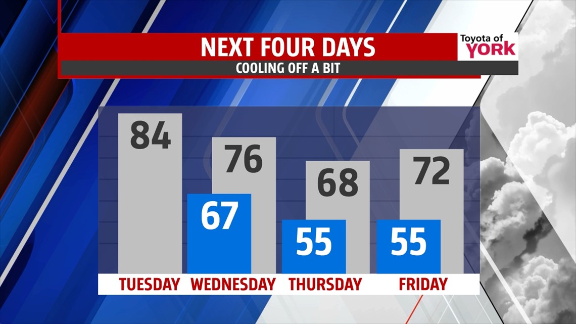
INTO THE WEEKEND: Friday, a cold front passes, helping to scour out the cool and cloudy weather. Despite it being a “cold front”, it’s more of a change in air masses instead. So with sunshine and some wind, we’ll actually warm a bit into the low 70s. Saturday and Sunday feature another great weekend with high pressure helping out. We’re expecting highs in the upper 70s to near 80° lasting into the start of next week.
Have a fantastic Tuesday!
“Start where you are. Use what you have. Do what you can.” – Arthur Ashe
– Jeff Jumper, WPMT FOX43 Morning Meteorologist
Follow me on Twitter: @JeffJumperWX
Like me on Facebook: Jeff Jumper FOX43