
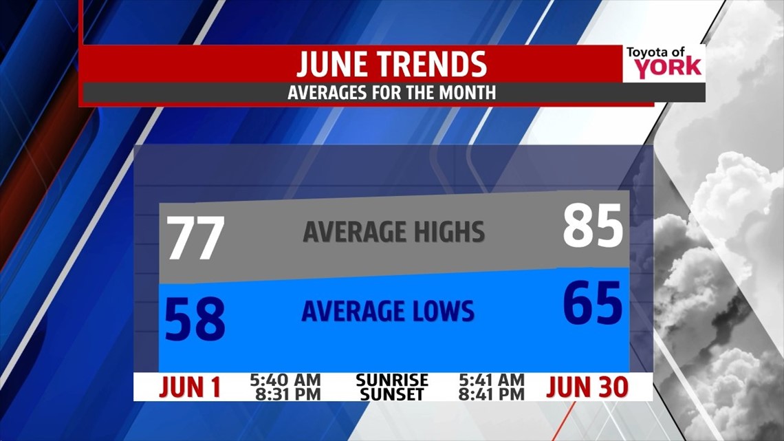
JUNE MONTHLY AVERAGES: Here is a look at the averages for the month of June.

OVERNIGHT: Clear and starry night, lows in the low to mid 50’s.

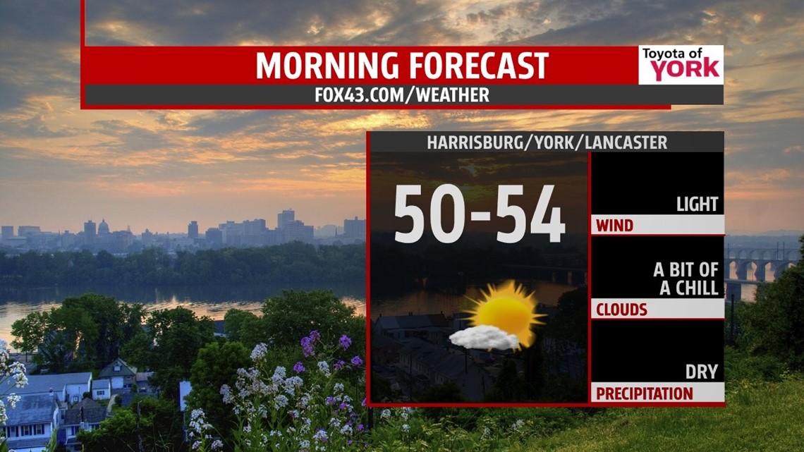
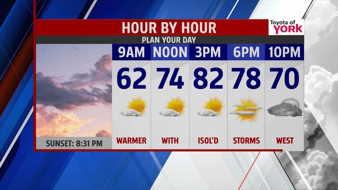
TOMORROW: Plenty of sunshine with clouds streaming in late in the day. Humidity won’t be too bad to start the week but will increase tomorrow night into Tuesday. Highs will be warmer in the lower 80’s. Expect the wind to come in from the south 5 to 10mph.

OUTLOOK: High pressure slips off the coast tonight shifting our winds to the south-southwest. That means an increase in the heat and humidity which will also mean an increase threat for storms especially after Monday. Tuesday a cold front advances towards us and with temperatures reaching the mid 80s and more moisture in the area, there is a good chance for afternoon showers and thunderstorms. They could linger into the early morning hours on Wednesday but the front, as of now, looks to stall just south of the Maryland/PA line. A wave of low pressure develops along it and pulls it back to the north late Wednesday night bringing the threat for showers once again. Showers and storms will continue on Thursday as the front oscillates back to the south. Highs will be warm Wednesday in the mid 80s and down a few degrees to around 80 for Thursday. Friday and the start of the weekend are looking dry right now but it is possible with the pattern to see the storm threat right through Friday. It warms back to the 80’s on Saturday.
Welcome to June!!!
MaryEllen Pann, Chief Meteorologist
Like me on Facebook: maryellenpannfox43
Follow me on Twitter: @MaryEllenFox43