
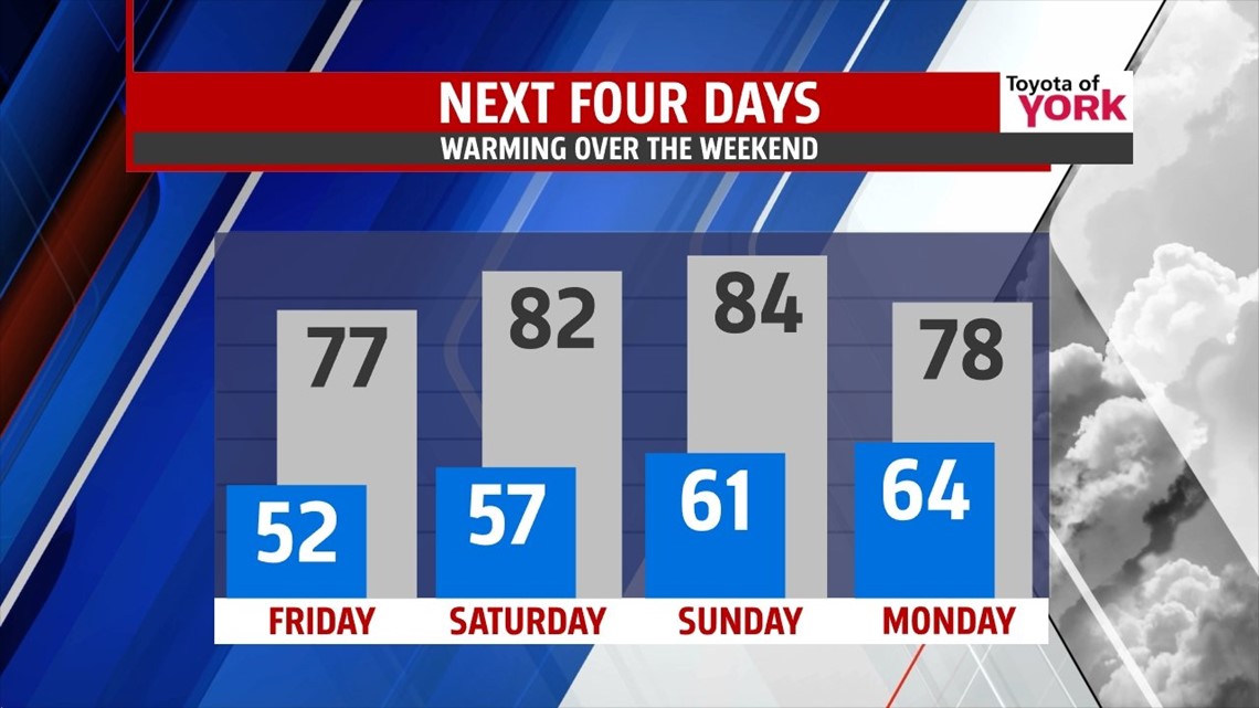
Temps will be at or below average for tomorrow but warming back to the 80s over the weekend before the next system arrives on Monday. Enjoy!

OVERNIGHT: A beautiful, breezy evening is under way. Temps will fall from the mid 70s to the low 60s. It will be a cool night under mostly clear skies; lows will be down to the low to mid 50s by morning. It will be a great night to open the windows if you don’t suffer too badly from allergies.

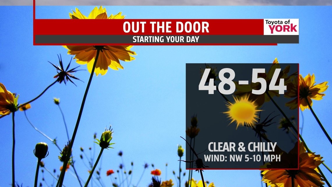
TOMORROW: High pressure continues to build in bringing a fantastic end to the work week. Plenty of sunshine combined with a northwest breezy will allow temps to warm to the mid and upper 70s.

OUTLOOK: High pressure builds in for several days bringing fair and dry weather to the area. We warm it up a bit heading into the weekend with highs in the low 80s Saturday. Sunday the clouds will be increasing and there could be a late day thunderstorm but it will be warm and dry for most of the day. Highs will reach into the mid 80s. Our next significant chance for showers will be Monday and Tuesday as a frontal boundary moves in and an upper level low cuts off for a few days. This means the clouds hang around and the threat for scattered showers and thunderstorms through Wednesday.
Enjoy the nice stretch of weather!
MaryEllen Pann, Chief Meteorologist
Like me on Facebook: maryellenpannfox43
Follow me on Twitter: @MaryEllenFox43