

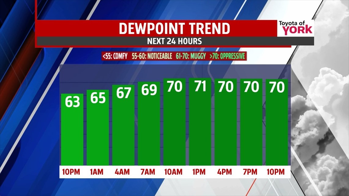
THIS EVENING: Partly to mostly cloudy skies with a isolated threat for a shower or thunderstorm mainly in our western counties. It is feeling stickier as dew points have increased thanks to a breezy southerly wind. Temps will fall from the low 80s to the mid 70s.
OVERNIGHT: Generally cloudy skies with an isolated shower possible. Hazy and fog will be likely as temps fall close to the dew point by morning. Morning lows will be in the upper 60s to near 70.

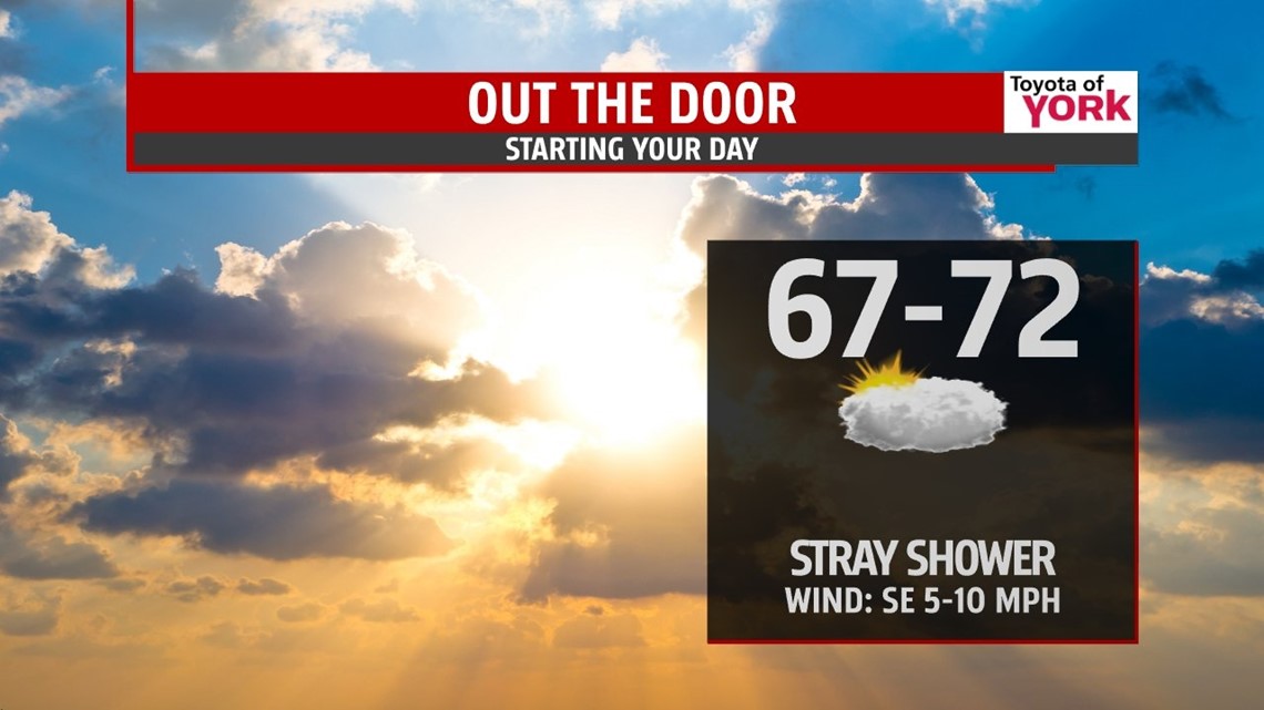
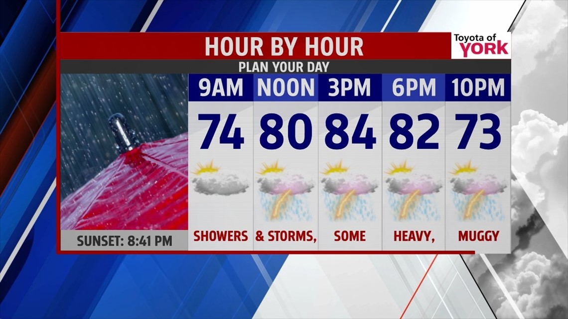
TOMORROW: Showers and thunderstorms will be likely as a cold front sweeps in late in the evening. Storms may produce very heavy downpours which could result in flooding. We’ll be keeping an eye on things especially in the afternoon and evening when the threat will be highest. Highs tomorrow will warm to the low to mid 80s.

OUTLOOK: While storm chances continue for the next 7days, the threat will be isolated. Humidity will drop a bit for Thursday and Friday and highs will be more seasonal in the low 80s under partly to mostly sunny skies. We crank up the heat and humidity over the weekend into next week as an upper level ridge builds in. Storm chances will increase by Tuesday as the next frontal system advances towards us. Temperatures will climb from the mid to upper 80s over the weekend to near 90 as we end June and begin the month of July!
MaryEllen Pann, Chief Meteorologist
Like me on Facebook: maryellenpannfox43
Follow me on Twitter: @MaryEllenFox43