
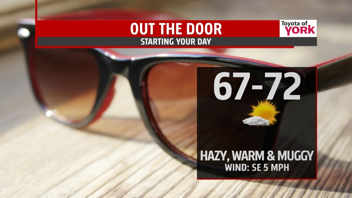
THIS EVENING: A warm evening under way with temps well into the 80s and dewpoints in the upper 60s to near 70. There is an isolated storm threat but most will remain dry. Temps will fall into the upper 70s by 10pm.
OVERNIGHT: Mostly clear skies, muggy and very warm with lows in the upper 60s to low 70s. Patchy fog is likely to develop by morning.

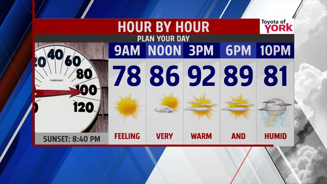
TOMORROW: Wind flow out of the south-southwest will help to pump more moisture into the area making it feel pretty nasty outside. Highs will be much warmer in the low 90s. When you factor the heat and humidity, heat indices will be running in the mid to upper 90s. That is what it will feel like outside. If you have to be outside make sure to drink plenty of water and wear light colored clothing. Take frequent breaks in the shade to give your body a chance to cool down. There is an isolated storm chance in the late afternoon and evening.

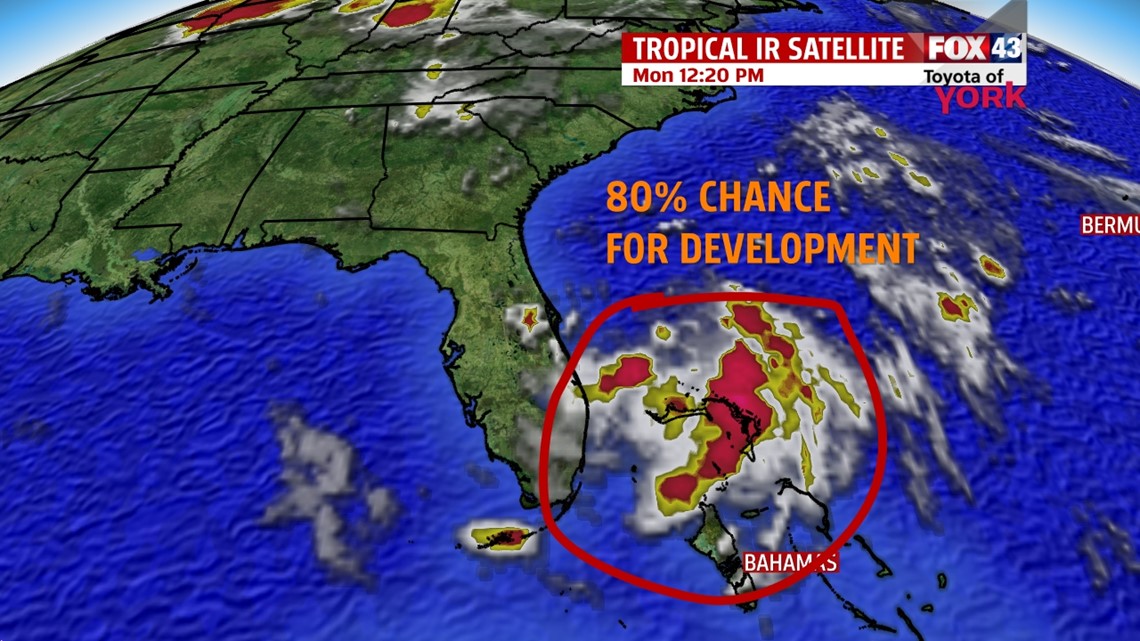
OUTLOOK: Cold front slowly advances towards us bringing a bigger threat for showers and storms by Wednesday and continuing into Thursday as it stalls. Some storms may be strong to severe so we’ll be watching for damaging winds, hail and heavy downpours. It will remain very warm in the upper 80s to low 90s. Upper level trough swings through by Thursday and Friday before flattening out over the weekend. Fourth of the July looks to be dry right now but we are watching for the possible development of our first tropical depression of the season off the southeast coast of Florida. As it moves up the coast, it will bring showers and storms along the east coast from VA on south. For us, it will create a easterly flow bringing in more in the way of clouds for the holiday but right now it looks dry. The upper level trough and cold front on Thursday should help to steer the low pressure system away from us by the end of the week. If it becomes a tropical system, it would be named Arthur. We’ll keep you posted!

MaryEllen Pann, Chief Meteorologist
Like me on Facebook: maryellenpannfox43
Follow me on Twitter: @MaryEllenFox43